

National Geographic – Spain and Portugal – Adventure Folding Travel Map
$14.95
National Geographic’s Spain and Portugal Adventure Map is designed to meet the unique needs of adventure travelers with its detailed and accurate information.
Publication: 2019 || Size: 25.5″ x 37.75″
Out of stock
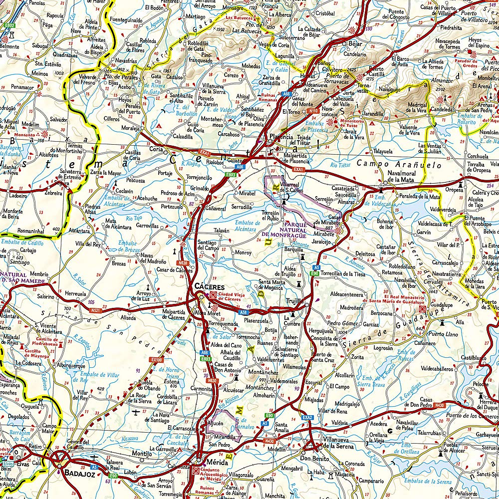
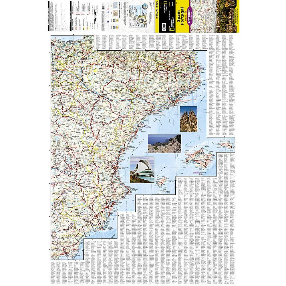
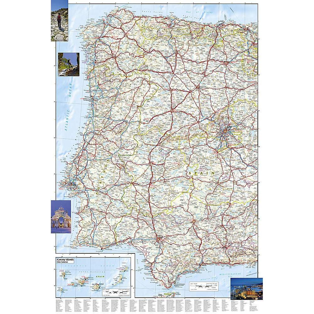
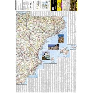
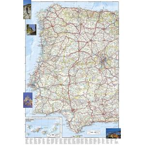
National Geographic’s Spain and Portugal Adventure Map is designed to meet the unique needs of adventure travelers with its detailed and accurate information. Cities and towns are clearly indicated and easy to find in the user-friendly index. A road network complete with distances and designations for motorways, expressways, and secondary routes will help you find the route that’s right for you. Specialty content to include hundreds of diverse and unique recreational, ecological, cultural, and historical destinations, make this map invaluable to travelers hoping to experience all the attractions the countries have to offer. The eastern half of the Spain/Portugal map shows the eastern half of Spain from its northern borders with France and Andorra south along its Mediterranean coastline to Almer�a. Portugal and the western half of Spain including the Canary Islands are covered on the other half of the map. The neighboring countries of Spain and Portugal were both powerful empires at one time whose discoveries, conquests, and cultures greatly influenced the course of world history. With the opening of trade routes and the colonization of the Americas, Spain and Portugal not only brought their languages, religion, art, literature, music, and architecture to regions across the globe, they introduced new agricultural products, spices, and knowledge of the geography and peoples of the world to Europe. Vacationers enjoy Spain and Portugal’s lovely islands and extensive coastal beaches, as well as the plethora of historical sites, museums, and striking architectural masterpieces found in their sunny cities. Every Adventure Map is printed on durable synthetic paper, making them waterproof, tear-resistant and tough — capable of withstanding the rigors of international travel.
We love technology and enjoy the convenience of GPS, but you can’t plan a trip on a phone screen and navigation doesn’t work where there’s no cell signal. Start your next trip on the right foot with a high-quality folding travel map. Make the most of your next adventure, even if you lose GPS or cell signals. You’ll always be on the correct route with our folding travel maps. Your adventure starts here!
What is an Adventure Map?
Adventure Maps are the most authoritative maps for touring international destinations. Each waterproof and tear-resistant map provides travelers with the perfect combination of detail and perspective, highlighting points of interest for those venturing outside city centers. From the plains of France to the top of Mt. Everest these maps cover the hottest adventure destinations.
About the Author
Founded in 1915 as the Map Department of the National Geographic Society, National Geographic Maps is responsible for illustrating the world around us through the art and science of mapmaking. Today, National Geographic Maps continues this mission by creating the world’s best wall maps, outdoor recreation maps, travel maps, atlases and globes that inspire people to care about and explore their world.
Back-Orders & Out-of-Stock Items
If an item is out of stock, it will ship as soon as it becomes available. The expected timeframe is shown in the “Normally Ships in” section below the Add to Cart button. If your order is on backorder, you will receive email updates as we get more information. Our goal is always to deliver your products as quickly as possible.
Returns
We accept free returns within 30 days of delivery. To start a return, please contact us within 30 days to receive a return authorization number. Once we receive the return, we will issue your refund within three business days. Please note: original shipping charges are non-refundable and return shipping costs are your responsibility unless the error was ours.
Returns are not accepted on clearance items. All clearance sales are final.
| Publisher | National Geographic |
|---|---|
| Language | English |
| Print Series | |
| Published | 2019 |