


What Are Scandinavian and Russian NGA Charts?
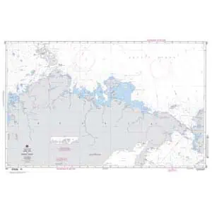
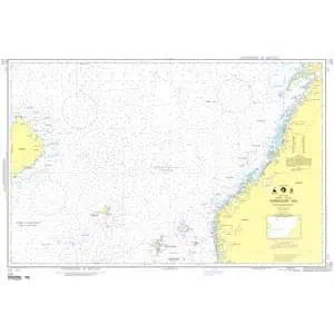
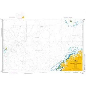
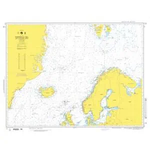
Scandinavian and Russian NGA charts are official maritime maps historically produced by the National Geospatial-Intelligence Agency to document the coastlines, ports, and shipping routes of Northern Europe and Russian waters. These charts provide detailed hydrographic data including depth soundings, fjord entrances, harbor layouts, and offshore navigational routes. While they are no longer updated for navigation, these charts remain valuable for reference and are popular as decorative pieces capturing the unique maritime geography of this region.
Scandinavian and Russian NGA charts are official maritime maps historically produced by the National Geospatial-Intelligence Agency to document the coastlines, ports, and shipping routes of Northern Europe and Russian waters. These charts provide detailed hydrographic data including depth soundings, fjord entrances, harbor layouts, and offshore navigational routes. While they are no longer updated for navigation, these charts remain valuable for reference and are popular as decorative pieces capturing the unique maritime geography of this region.
What Are the Different Types of Scandinavian and Russian NGA Charts?
Our NGA chart collection includes maps of Norway’s fjords, Denmark’s shipping lanes, Sweden’s Baltic coast, Finland’s archipelagos, and Iceland’s rugged shoreline. Russian coastal charts include the Baltic Sea ports of St. Petersburg and Kaliningrad, as well as Arctic regions along the Barents and Kara Seas. These charts are ideal for collectors, maritime historians, and as authentic wall décor for offices and homes.
Our NGA chart collection includes maps of Norway’s fjords, Denmark’s shipping lanes, Sweden’s Baltic coast, Finland’s archipelagos, and Iceland’s rugged shoreline. Russian coastal charts include the Baltic Sea ports of St. Petersburg and Kaliningrad, as well as Arctic regions along the Barents and Kara Seas. These charts are ideal for collectors, maritime historians, and as authentic wall décor for offices and homes.
Are Scandinavian and Russian NGA Charts Updated?
No. NGA printed charts are no longer updated for modern navigation. They are preserved for their historical and cartographic value. If you require a chart of these waters with current information, we can create a custom chart using the latest digital data. Create your custom chart here.
No. NGA printed charts are no longer updated for modern navigation. They are preserved for their historical and cartographic value. If you require a chart of these waters with current information, we can create a custom chart using the latest digital data. Create your custom chart here.
What Areas Do Scandinavian and Russian NGA Charts Cover?
These NGA charts cover the entire Nordic region and northern Russian coastlines. This includes Norwegian fjords, the North Sea, Danish Straits, Baltic Sea approaches, Gulf of Finland, Iceland’s Atlantic waters, and Russian Arctic routes. Major ports such as Copenhagen, Oslo, Stockholm, Helsinki, Murmansk, and St. Petersburg are detailed along with surrounding shipping lanes.
These NGA charts cover the entire Nordic region and northern Russian coastlines. This includes Norwegian fjords, the North Sea, Danish Straits, Baltic Sea approaches, Gulf of Finland, Iceland’s Atlantic waters, and Russian Arctic routes. Major ports such as Copenhagen, Oslo, Stockholm, Helsinki, Murmansk, and St. Petersburg are detailed along with surrounding shipping lanes.
Can I Order a Custom Scandinavian or Russian Chart?
Yes. We can create a custom NGA chart for any location within Scandinavia or along the Russian coast. Specify your desired port, region, or Arctic shipping route, and we will produce a printed chart tailored to your needs. Charts can be printed on paper or waterproof material and mounted or framed for display. Design your custom chart here.
Yes. We can create a custom NGA chart for any location within Scandinavia or along the Russian coast. Specify your desired port, region, or Arctic shipping route, and we will produce a printed chart tailored to your needs. Charts can be printed on paper or waterproof material and mounted or framed for display. Design your custom chart here.
What Finishing Options Are Available?
Scandinavian and Russian NGA charts can be printed on standard bond paper or waterproof synthetic material. We offer mounting on foam board and professional framing options to transform these charts into durable, ready-to-hang artwork. Mounted charts are ideal for pin tracking, while framed charts create a polished, decorative look. Explore finishing options here.
Scandinavian and Russian NGA charts can be printed on standard bond paper or waterproof synthetic material. We offer mounting on foam board and professional framing options to transform these charts into durable, ready-to-hang artwork. Mounted charts are ideal for pin tracking, while framed charts create a polished, decorative look. Explore finishing options here.
Can I Find a Specific NGA Chart by Number?
Yes. Enter the chart number in the search bar at the top-right of our website to locate it quickly. Alternatively, you can browse this category to visually explore all available Scandinavian and Russian NGA charts.
Yes. Enter the chart number in the search bar at the top-right of our website to locate it quickly. Alternatively, you can browse this category to visually explore all available Scandinavian and Russian NGA charts.
What Makes Scandinavian and Russian NGA Charts Ideal for Decorative Use?
These charts highlight the unique geography of the Nordic countries and Russian northern waters, featuring fjords, archipelagos, and Arctic passages. Their detailed cartography makes them excellent for framing and displaying in coastal homes, offices, or shipping company headquarters. A chart of a meaningful location or Arctic route adds a personalized, conversation-worthy piece of wall art.
These charts highlight the unique geography of the Nordic countries and Russian northern waters, featuring fjords, archipelagos, and Arctic passages. Their detailed cartography makes them excellent for framing and displaying in coastal homes, offices, or shipping company headquarters. A chart of a meaningful location or Arctic route adds a personalized, conversation-worthy piece of wall art.
Why Buy Scandinavian and Russian NGA Charts from The Map Shop?
With over 30 years of experience, The Map Shop is a trusted provider of printed maritime charts. We produce every NGA chart in-house in Charlotte, NC using high-quality materials and expert finishing techniques. Thousands of charts are available for quick printing, mounting, and framing, ensuring reliable service and premium results. Read reviews here or learn about our company history here.
With over 30 years of experience, The Map Shop is a trusted provider of printed maritime charts. We produce every NGA chart in-house in Charlotte, NC using high-quality materials and expert finishing techniques. Thousands of charts are available for quick printing, mounting, and framing, ensuring reliable service and premium results. Read reviews here or learn about our company history here.