

ITMB – Boston and USA NE – Folding Travel Map
$10.95
The durable and convenient ITMB maps will take all the wear and tear your journey can dish out.
Publication: October 2019 || Size: 27″ x 39″
In stock
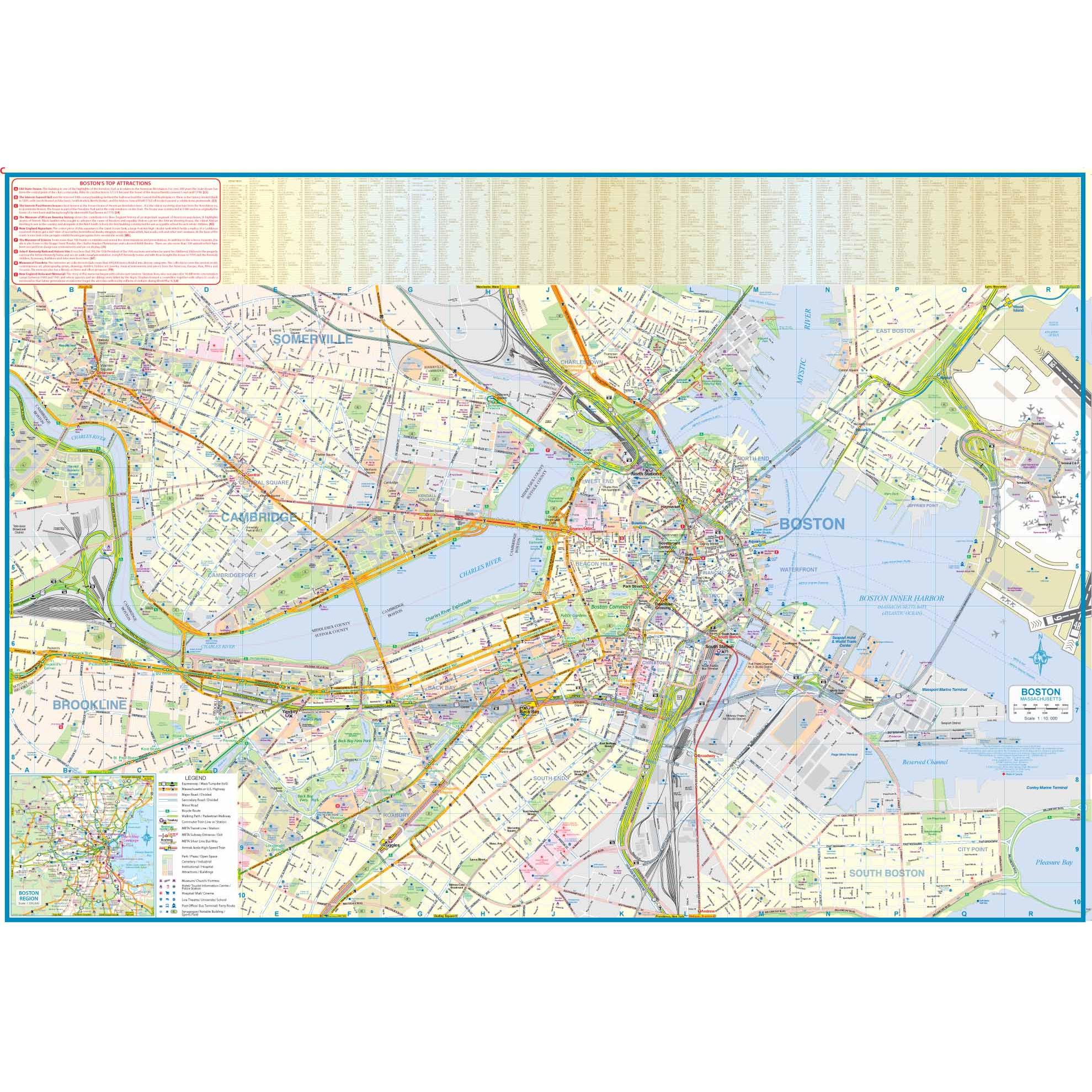
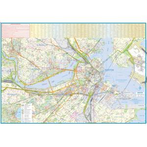
Boston is, of course, a very important and scenic city, and well worth a visit. The city graces the south shore of the Charles River, with Cambridge on the north side; both cities being shown. Boston Common is the focal point of the city, adjacent to historic Beacon hill and Chinatown. Being in the state capital, the Massachusetts state legislature is also nearby, as is the theater district. Not to be outdone, Cambridge has MIT, one of the great educational institutes of America. It is best visited by teking the subway to Kendall Square station, as parking is limited on campus. The harbour is also an exciting aspect of life in a major urban area. How many cities have ferry service to their international airport?
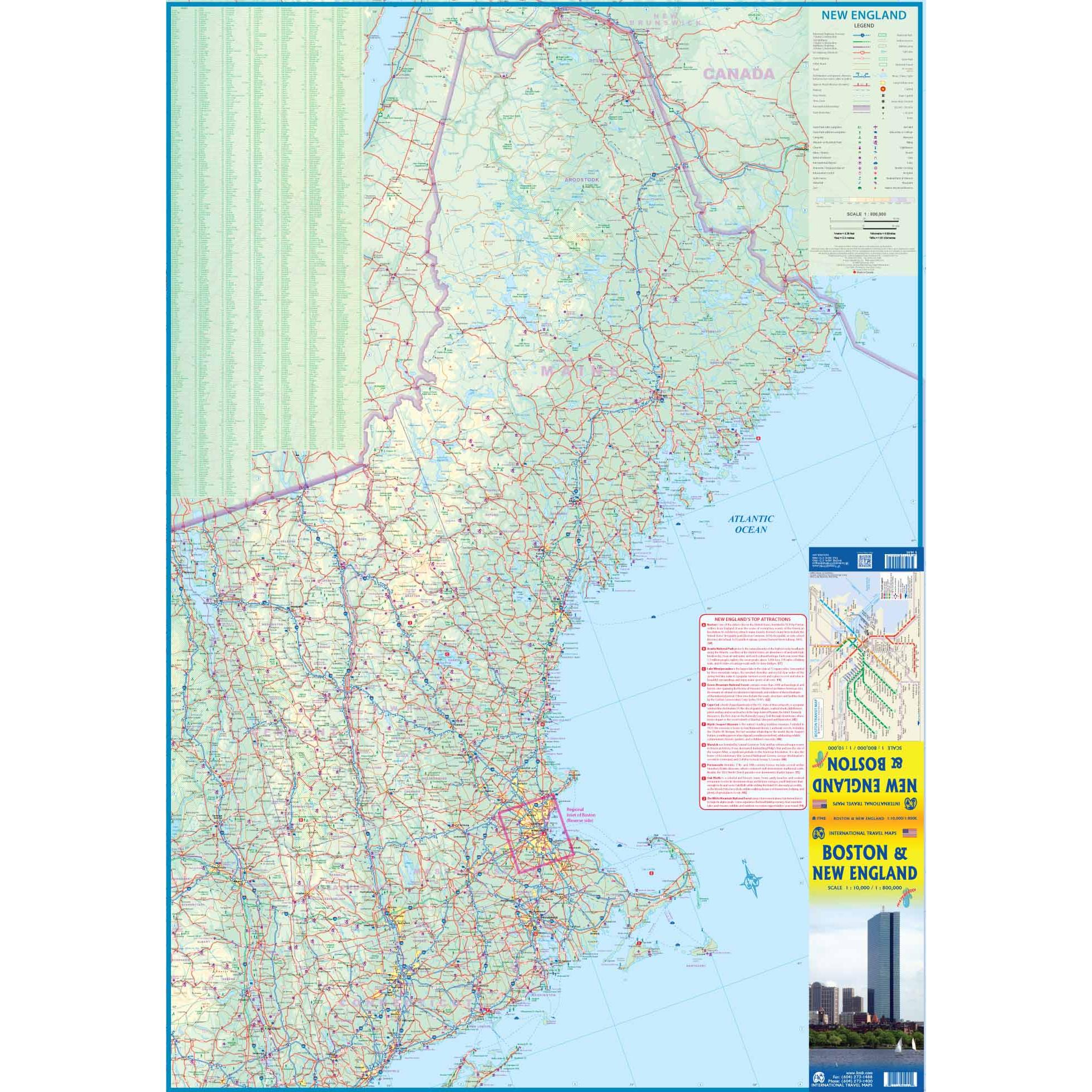
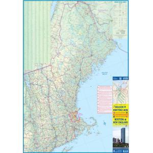
The other side of the sheet is this massive undertaking, showing all of the five US states collectively known as New England-maine, in the north, then Vermont and New Hampshire, and Connecticut, Massachusetts, and tiny Rhode Island in the south. A tiny bit of New York State, along the Hudson River, is also included, as well as brief potions of Quebec and New Brunswick. These states are made for driving, although the closer one is to New York City, the more likely one is to travel by train. This is a very densely-populated part of the USA, and part of the original 17 colonies that made up British America. It is a region rich in history and loaded with attractions, some of which are noted in our Top Attractions text block.
We love technology and enjoy the convenience of GPS, but you can’t plan a trip on a phone screen and navigation doesn’t work where there’s no cell signal. Start your next trip on the right foot with a high-quality folding travel map. Make the most of your next adventure, even if you lose GPS or cell signals. You’ll always be on the correct route with our folding travel maps. Your adventure starts here!
About the Author
ITMB Publishing (International Travel Maps and Books) prepares detailed travel maps and atlases of countries and regions around the world, specializing in Africa, Asia, Canada, the Caribbean, Europe, the Middle East, and Latin America. As a publisher, ITMB has released more than 425 titles to date and is adding about 30 new titles each year.
Back-Orders & Out of Stock Items
If the item is currently out of stock it will ship as soon as we can get it. This will be shown in the “Normally Ships in” section above. If the item is on backorder you will recieve an email with updates as we recieve them. Our goal is to get your products to you a quickly as possible!
Returns
We offer free returns within 30 days for this product. Contact us within 30 days of receiving your product to receive a return authorization number, which you can write on the box and ship back to us. We will issue your return within three days of receiving the product back. **We do not refund the initial shipping charges and you’re responsible for shipping charges to get the product back to us unless we made a mistake in the order.
Whether you are getting a map as a piece of art or getting something to fit a business need, we can make it. A custom decorative map can tell a story of where you have been or where you want to go. It can be a great gift for someone or a unique piece of art for yourself.
On the business side, we have been making custom maps for companies around the world since 1996. Our customer list includes a wide range of organizations like Hollywood Studios, Homeland Security, Jehovah’s Witnesses, Harris Teeter, and Domino’s Pizza. We provide a wide variety of maps to fit any need your business will need. From territory map to a delivery map and everything in between, we can make it.
To reach out about a custom map, click HERE!
