Topographic Maps

We offer two options for topographic maps. The first option is a USGS Topographic map that we can print and ship for you. USGS Topos are inexpensive but they have set coverage areas and styles that cannot be edited. The second option is a custom topographic map that we can generate for any areas you’d like. You’ll see descriptions of both options below with details on how to request your order. We look forward to working with you!

USGS Topographic Maps

What Are They?

If you’re looking for a topographic map of geography within the United States, the most cost-effective option is the US Topo series, produced by the National Geospatial Program of the U.S. Geological Survey (USGS).

  • 7.5-minute Topographic Map
  • Scale: 1:24,000
  • Overall Size: 21.5″ x 29″
  • Map Size: 18.5″ x 22.75″

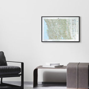
These are general-use maps that present elevation (contour lines), hydrography, geographic place names, and points of interests like hospitals, schools, and fire stations. Current-generation topographic maps are available as well as historic maps from 1884-on. 

USGS also offers maps in various scales, however those will be considered historic maps. The only maps that are updated consistently are the 7.5-minute topographic maps. 

Click the image for full-size PDF version that you can view at 100% to see the detail!

How Do I Find One?


Step 1

Click the link to go to the “Map Locator” page on the USGS Store site: USGS Map Locator

Step 2

In the box across the top of the screen, type in the location that you are looking for and search. This will automatically place a blue pin on that location. You can also double click any place on the map to drop a blue pin at that location.

Step 3

Click on the blue pin to view options for that print or zoom in to the area using the tools on the left of the screen. 

Step 4

Want us to print these for you? Fill out the form below to submit a request to our team. We will reach out with your options to move forward!


You can check out our finishing options, just CLICK HERE!

Request a USGS Topo Map

Custom Topographic Maps

United States Locations

If the standard USGS Topo maps are not a perfect fit, we can create custom topographic maps for you using our in-house map engine. These maps are derived from the modern USGS Topographic series updated on a 3-year cycle and allows for the creation of detailed modern topographic maps for anywhere in the USA. 

  • Scale: 1:13,000 – 1:40,000
  • Overall Size: 8.5″x11″ – 54″x68″

We offer seven set sizes that are available in a portrait or landscape composition. We can customize the title on your map that prints on the bottom near the legend!

Click the image for full-size PDF version that you can view at 100% to see the detail!

International Locations


In addition to locations in the United States, we can also create custom topographic maps for areas internationally. The features, scale, and pricing vary depending on which data set is available for your area. 

  • Scale: 1:13,000 – 1:40,000
  • Areas: Australia, Canada, France, Italy, Portugal, Spain, and the UK
  • Overall Size: 8.5″x11″ – 54″x68″

We offer seven set sizes that are available in a portrait or landscape composition. We can customize the title on your map that prints on the bottom near the legend!

Click the image for full-size PDF version that you can view at 100% to see the detail!

Request a Custom Topo Map