

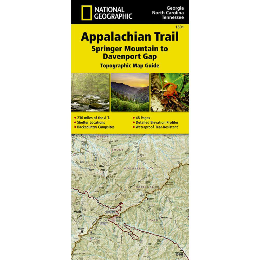


National Geographic – Appalachian Trail: Springer Mountain to Davenport Gap [GA,NC,TN] – Trails Illustrated Folding Travel Map
$14.95
Published: 2015
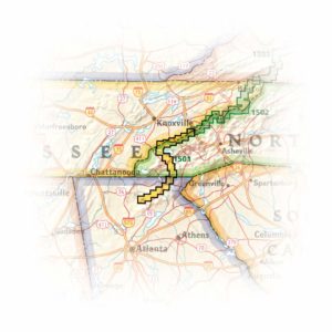
The Springer Mountain to Davenport Gap Topographic Map Guide makes a perfect traveling companion when traversing the Georgia, southeastern Tennessee and southwestern North Carolina, section of the Appalachian Trail (A.T.).
Published: 2015 || Size: 4.25″ x 9.25″ (Folded)
In stock
The Springer Mountain to Davenport Gap Topographic Map Guide makes a perfect traveling companion when traversing the Georgia, southeastern Tennessee and southwestern North Carolina, section of the Appalachian Trail (A.T.). The southern most section of the A.T. which starts at Georgia’s Springer Mountain and heads north into North Carolina and Tennessee, offers some of most physically challenging, but rewarding hiking along the entire trail. The A.T. through this area is located entirely within National Park and National Forest land, and follows the ridges and balds of the beautiful and biologically diverse Southern Appalachians.
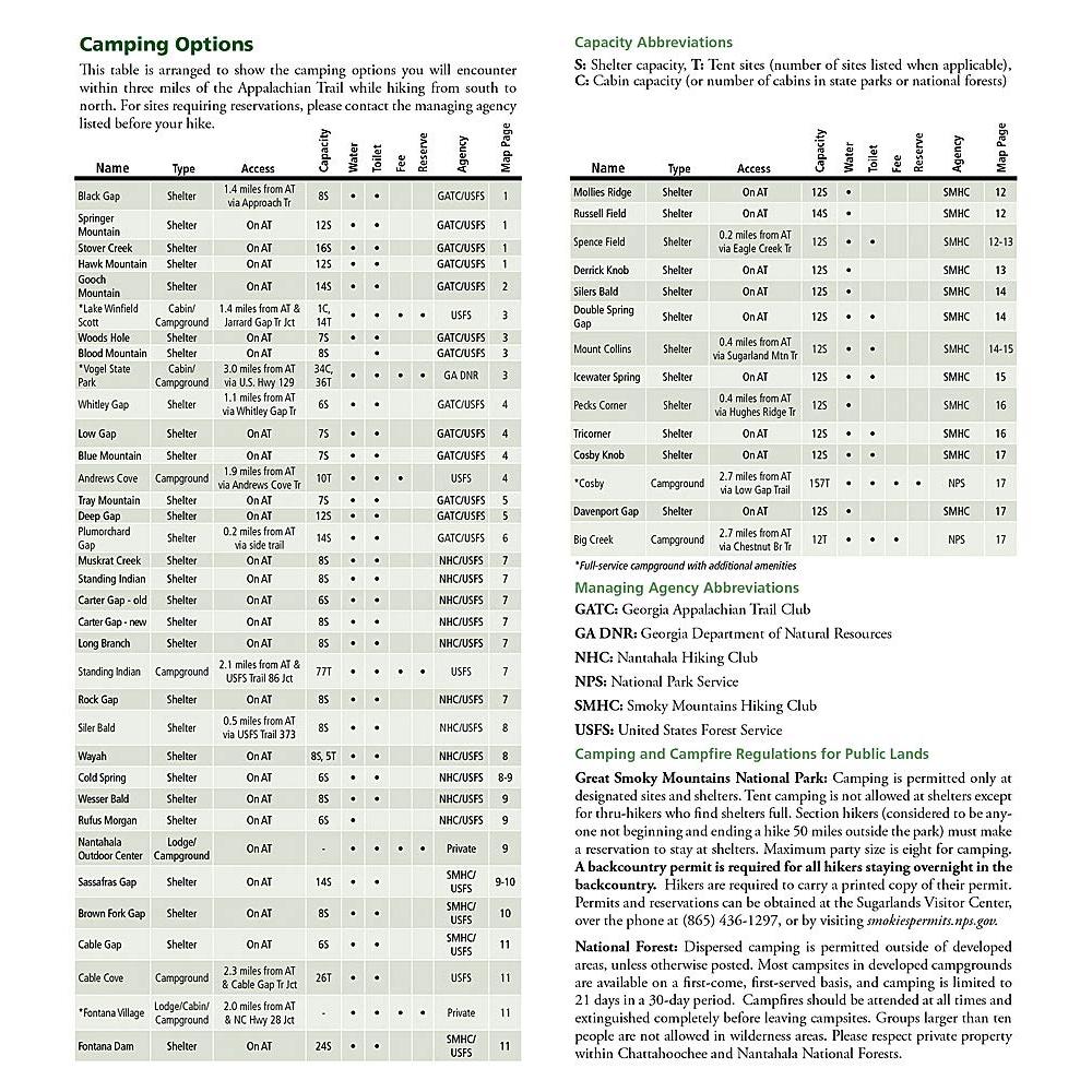
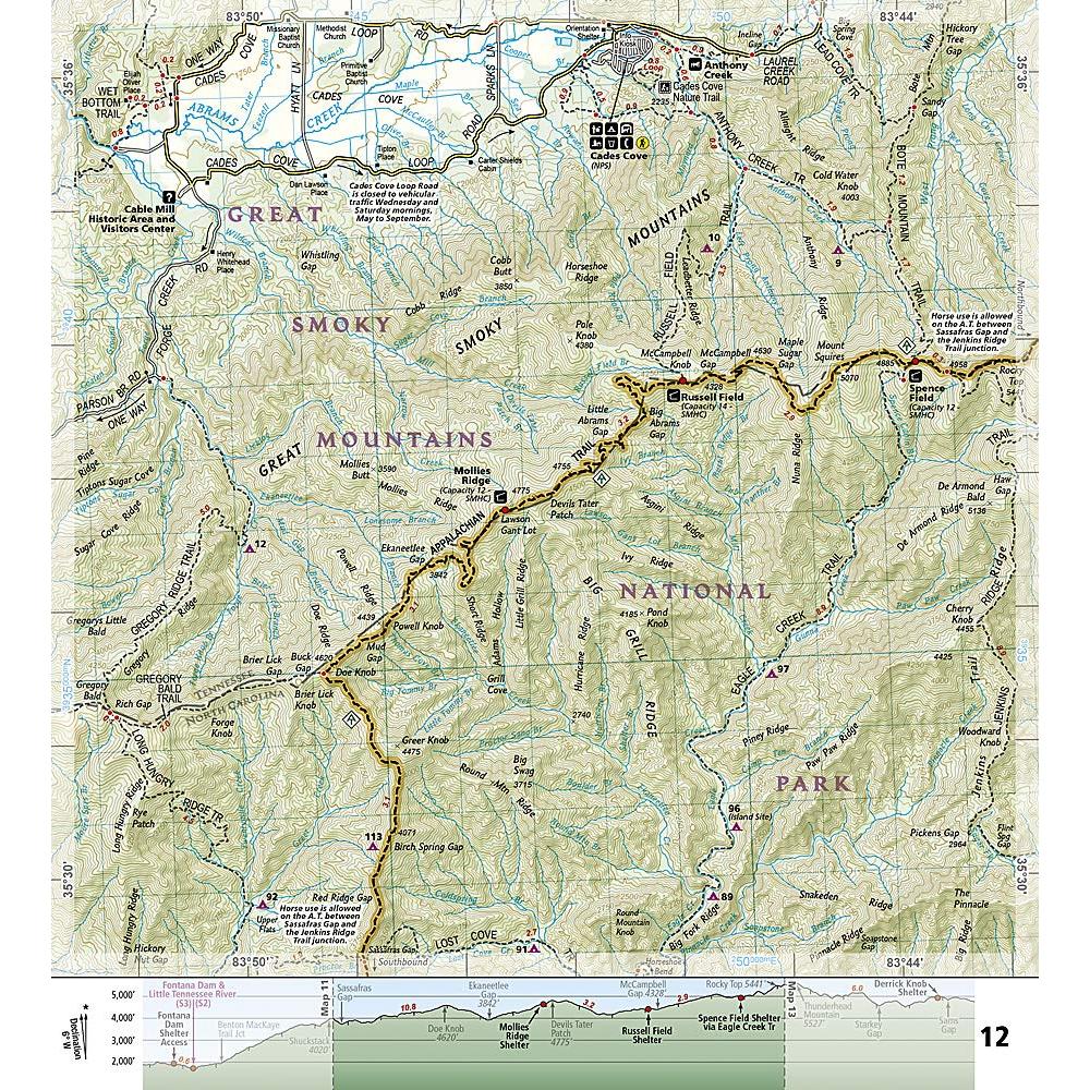
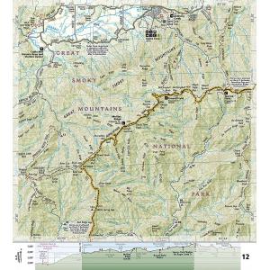
Each A.T. Topographic Map Guide includes detailed topographic maps at a detail of 1 inch = 1 mile. Each page is centered on the A.T. and overlaps with the adjacent pages so there is little chance of getting lost. Along the bottom of each page is a trail profile that shows the distance between shelters, camping areas, and trail access points. The map and trail profile provide a step by step visual guide to hiking the trail, mile by rugged mile. The Topographic Map Guide is built for all levels of hiking enthusiasts, from the day tripper to the multi month ‘thru-hiker’. The front pages of the printed Topographic Map Guide include resupply information, town inset maps, camping options, and much more.
Map Size: 4.25″ x 9.25″ (Folded)
Published: 2015
Every Topographic Map Guide is printed on “Backcountry Tough” waterproof, tear-resistant paper. A full UTM grid is printed on the map to aid with GPS navigation. We love technology and enjoy the convenience of GPS, but you can’t plan a trip on a phone screen and navigation doesn’t work where there’s no cell signal. Start your next trip on the right foot with a high-quality folding travel map. Make the most of your next adventure, even if you lose GPS or cell signals. You’ll always be on the correct route with our folding travel maps. Your adventure starts here!
Coverage Includes
A. Rufus Morgan Shelter, Blood Mountain, Blood Mountain Shelter, Blue Mountain Shelter, Bly Gap, Brown Fork Gap Shelter, Cable Gap Shelter, Carter Gap Shelter, Chattahoochee National Forest, Clayton, Clingmans Dome, Cold Spring Shelter, Cosby Knob Shelter, Davenport Gap Shelter, Deep Gap Shelter, Derrick Knob Shelter, Dicks Creek Gap, Double Spring Gap Shelter, Fontana Dam Shelter, Fontana Lake, Franklin, Gooch Mountain Shelter, Great Smoky Mountains National Park, Hawk Mountain Shelter, Helen, Icewater Spring Shelter, Long Branch Shelter, Low Gap Shelter, Mollies Ridge Shelter, Mount Collins Shelter, Mount Guyot, Muskrat Creek Shelter, Nantahala National Forest, Newfound Gap, Peck’s Corner Shelter, Plumorchard Gap Shelter, Rock Gap Shelter, Russell Field Shelter, Sassafras Gap Shelter, Siler Bald Shelter, Silers Bald Shelter, Spence Field Shelter, Springer Mountain, Springer Mountain Shelter, Standing Indian Shelter, Stover Creek Shelter, Suches, Tray Mountain Shelter, Tri-Corner Knob Shelter, Wayah Bald, Wayah Shelter, Wesser Bald Shelter, Whitley Gap Shelter, Woods Hole Shelter.
What is a Topographic Guide?
The Topographic Map Guides are user-friendly and light-weight small book format maps printed on rugged waterproof, tear-resistant paper. They are laser focused to provide the tools needed for trail navigation. Each page includes a detailed topographic map and is centered on the trail. Along the bottom of the page is a trail profile that shows the distance between shelters, camping areas, and trail access points. The map and trail profile provide a step by step visual guide to hiking the trail, mile by rugged mile. The front pages of the printed Topographic Map Guide include resupply locations, key points of interest, safety guidelines, history, and everything you need to plan a safe and memorable hiking trip.
About the Author
Founded in 1915 as the Map Department of the National Geographic Society, National Geographic Maps is responsible for illustrating the world around us through the art and science of mapmaking. Today, National Geographic Maps continues this mission by creating the world’s best wall maps, outdoor recreation maps, travel maps, atlases and globes that inspire people to care about and explore their world.
Back-Orders & Out of Stock Items
If the item is currently out of stock it will ship as soon as we can get it. This will be shown in the “Normally Ships in” section above. If the item is on backorder you will recieve an email with updates as we recieve them. Our goal is to get your products to you a quickly as possible!
Returns
We offer free returns within 30 days for this product. Contact us within 30 days of receiving your product to receive a return authorization number, which you can write on the box and ship back to us. We will issue your return within three days of receiving the product back. **We do not refund the initial shipping charges and you’re responsible for shipping charges to get the product back to us unless we made a mistake in the order.
| Publisher | National Geographic |
|---|---|
| Language | English |
| Published | 2015 |
| Map Scale | 1 : 63,360 |
Whether you are getting a map as a piece of art or getting something to fit a business need, we can make it. A custom decorative map can tell a story of where you have been or where you want to go. It can be a great gift for someone or a unique piece of art for yourself.
On the business side, we have been making custom maps for companies around the world since 1996. Our customer list includes a wide range of organizations like Hollywood Studios, Homeland Security, Jehovah’s Witnesses, Harris Teeter, and Domino’s Pizza. We provide a wide variety of maps to fit any need your business will need. From territory map to a delivery map and everything in between, we can make it.
To reach out about a custom map, click HERE!
