
United Kingdom Political Wall Map by MapSherpa
$129.99 – $819.99
Size: 24" x 31.5" | 32" x 42" | 40" x 52"
Publisher: MapSherpa
Published: 2023
Printed By: MapShop
Published: 2023
Printed By: MapShop
$129.99 – $819.99
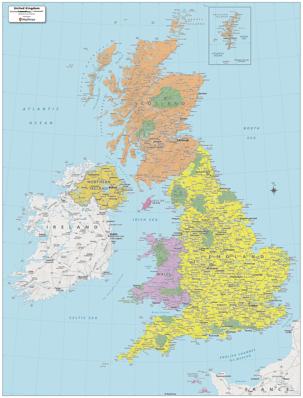
Created specifically for MapSherpa, this United Kingdom Political Map shows all the countries and island that make up the UK. The map shows the Shetland Islands in the extreme north, all the way to the Channel Islands in the south. All major cities are noted, as well as National Parks and primary physical features such as mountain ranges, rivers, and lakes. Note, the Republic of Ireland, is not part of the UK, but is fully featured on this map. With multiple sizes available, this is the perfect reference map for home, office, or school use.
| Size | 24" x 31.5", 32" x 42", 40" x 52" |
|---|---|
| Print Finishing Options | Paper, Laminated, Laminated with Rails – Black Molding, Laminated with Rails – Walnut Molding, Mounted to Foam Core, Foam Core with Rails – Black Molding, Foam Core with Rails – Walnut Molding, Framed – Black Molding, Framed – Walnut Molding |
| Publisher | MapSherpa |
| Map Type | Wall Map |
| Printed By | MapShop |
| Published | 2023 |

