
National Geographic – Southern France – Adventure Folding Travel Map
$14.95
National Geographic’s Adventure Map of Southern France is an invaluable tool for travelers seeking to explore the rich history, distinctive cuisine, and colorful landscapes of this remarkable region.
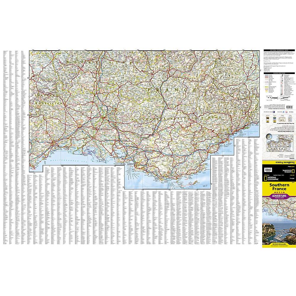
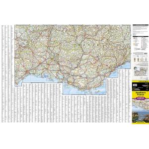
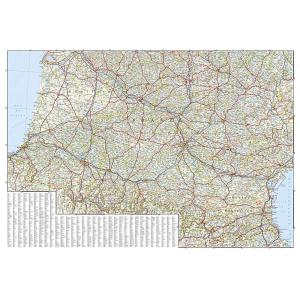
Publication: 2019 || Size: 37.75″ x 25.5″
In stock
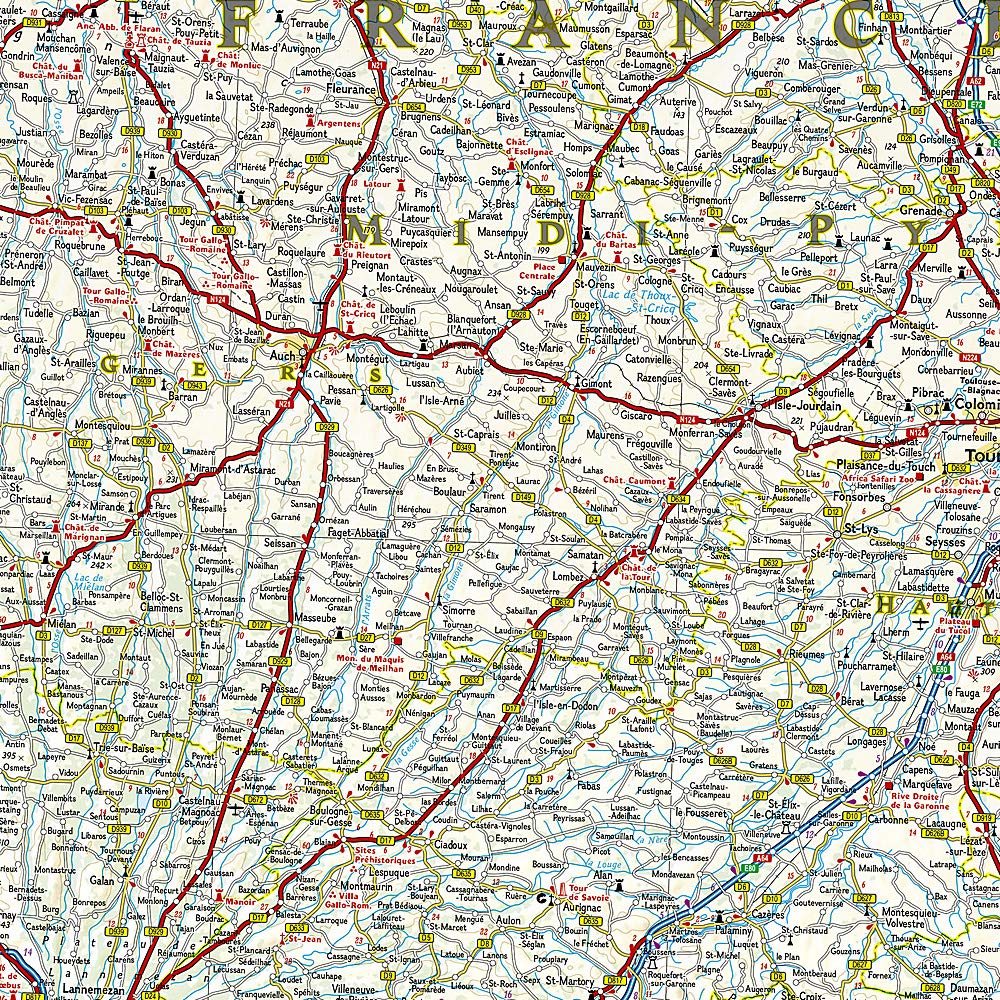
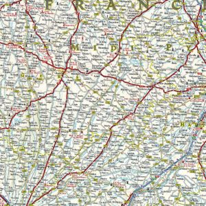
National Geographic’s Adventure Map of Southern France is an invaluable tool for travelers seeking to explore the rich history, distinctive cuisine, and colorful landscapes of this remarkable region. Designed to meet the needs of adventure travelers with its detailed, accurate information, this map includes the location of cities and towns with a user-friendly index and a clearly marked road network complete with distances and designations for roads/expressways, plus secondary routes for those seeking to explore off the beaten path. With specialty content to include hundreds of diverse and unique recreational, ecological, cultural, and historical destinations, this map is a perfect companion to a guidebook.
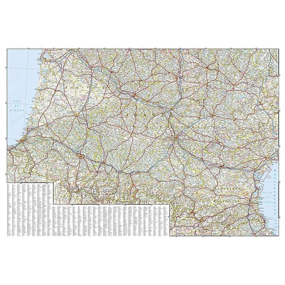
Among the many points of interest are national parks, campsites, beaches, ski resorts, golf courses, archeological sites, castles, churches, monuments, and more. The front side of the print map details the eastern region, from its border with Monaco and Italy to the east, and the Riviera (Cote d’ Azur), Mediterranean Sea and Golfe Du Lion to the south. The reverse side of the map details Southern France’s western region, extending from the Bay of Biscay to the west, Spain and Andorra to the south, and the Golfe du Lion to the east. Users will find a variety of helpful travel aids on this map as well, including the location of airports, railroads, and ferry routes. Every Adventure Map is printed on durable synthetic paper, making them waterproof, tear-resistant and tough — capable of withstanding the rigors of international travel.
We love technology and enjoy the convenience of GPS, but you can’t plan a trip on a phone screen and navigation doesn’t work where there’s no cell signal. Start your next trip on the right foot with a high-quality folding travel map. Make the most of your next adventure, even if you lose GPS or cell signals. You’ll always be on the correct route with our folding travel maps. Your adventure starts here!
What is an Adventure Map?
Adventure Maps are the most authoritative maps for touring international destinations. Each waterproof and tear-resistant map provides travelers with the perfect combination of detail and perspective, highlighting points of interest for those venturing outside city centers. From the plains of France to the top of Mt. Everest these maps cover the hottest adventure destinations.
About the Author
Founded in 1915 as the Map Department of the National Geographic Society, National Geographic Maps is responsible for illustrating the world around us through the art and science of mapmaking. Today, National Geographic Maps continues this mission by creating the world’s best wall maps, outdoor recreation maps, travel maps, atlases and globes that inspire people to care about and explore their world.
Back-Orders & Out-of-Stock Items
If an item is out of stock, it will ship as soon as it becomes available. The expected timeframe is shown in the “Normally Ships in” section below the Add to Cart button. If your order is on backorder, you will receive email updates as we get more information. Our goal is always to deliver your products as quickly as possible.
Returns
We accept free returns within 30 days of delivery. To start a return, please contact us within 30 days to receive a return authorization number. Once we receive the return, we will issue your refund within three business days. Please note: original shipping charges are non-refundable and return shipping costs are your responsibility unless the error was ours.
Returns are not accepted on clearance items. All clearance sales are final.
| Publisher | National Geographic |
|---|---|
| Language | English |
| Print Series | |
| Published | 2019 |