
Great Lakes (United States) Wall Map by The Times
$79.99 – $319.99
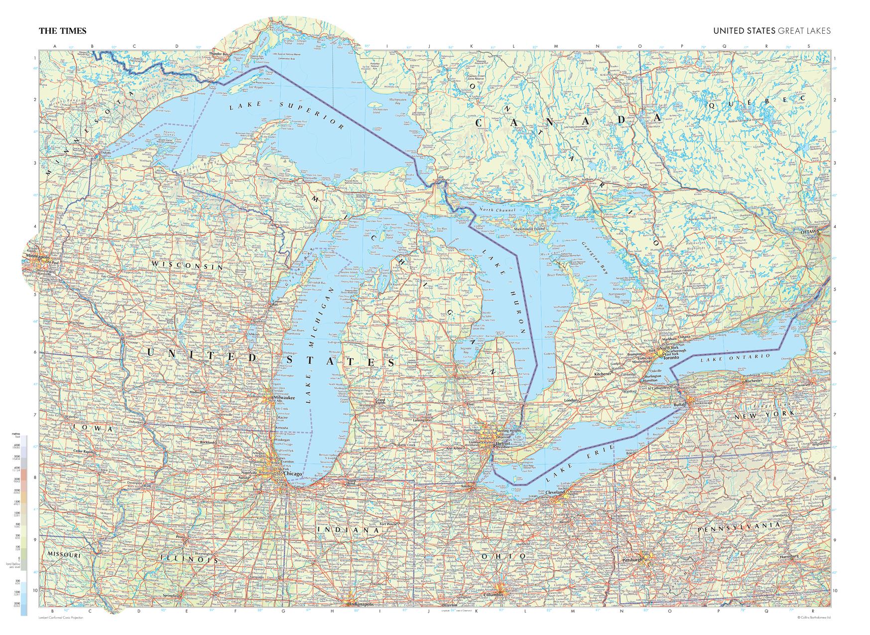
Size: 36.5" x 26.75"
Publisher: The Times
Published: 2025
Printed By: MapShop
Published: 2025
Printed By: MapShop
$79.99 – $319.99
This map of the US Great Lakes region stands as a benchmark of cartographic excellence, sourced from the industry-leading Times Comprehensive Atlas of the World. Published in full colour, this map offers a comprehensive and updated view of the landscapes found in this area. Encompassing states such as Michigan, Wisconsin, Ohio, and more, this map includes many of the majestic Great Lakes: Michigan, Superior, Erie, Ontario, and Huron. With meticulous attention to detail, this map is an indispensable guide to the geographic intricacies of the US Great Lakes region.
| Publisher | The Times |
|---|---|
| Map Type | Wall Map |
| Printed By | MapShop |
| Published | 2025 |
| Size | 36.5" x 26.75" |
| Packaging | Flat & Crated, Rolled |

