
Canada Political Wall Map by MapSherpa
$149.99 – $859.99
Size: 39" x 27" | 48" x 33.5" | 60" x 42"
Publisher: MapSherpa
Published: 2023
Printed By: MapShop
Published: 2023
Printed By: MapShop
$149.99 – $859.99
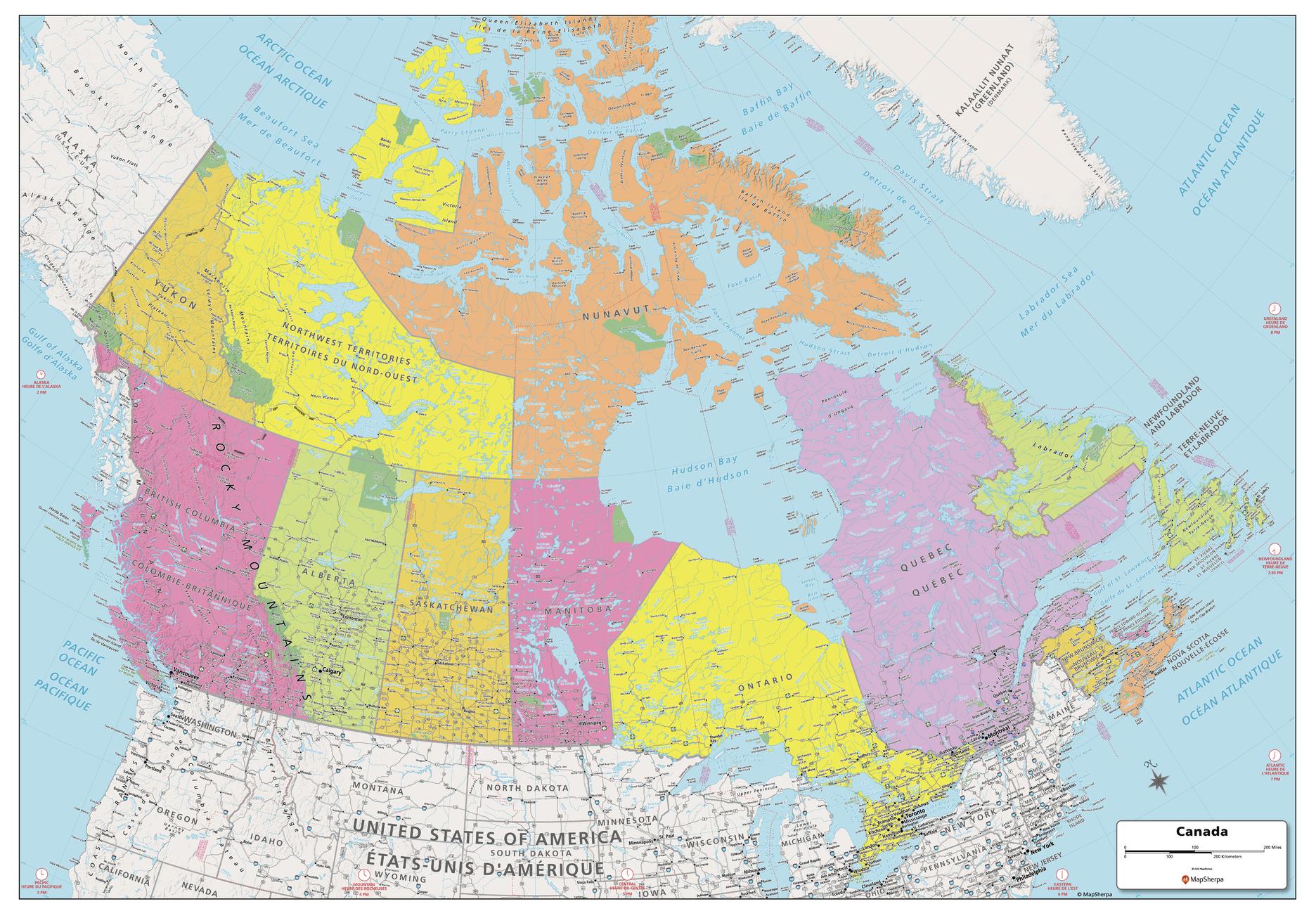
Explore the vastness of Canada with this map created specifically for MapSherpa. From sea to sea, this Canadian Political Map displays the ten provinces and three territories that make up the country. Stretching from the Arctic in the north to both the Atlantic and Pacific Oceans, this map prominently shows; Province capitals, primary cities & towns, major national parks, primary water features, mountain ranges and all time zones. With multiple sizes available, this is the perfect reference map for home, office, or school use.
| Size | 39" x 27", 48" x 33.5", 60" x 42" |
|---|---|
| Print Finishing Options | Paper, Laminated, Laminated with Rails – Black Molding, Laminated with Rails – Walnut Molding, Mounted to Foam Core, Foam Core with Rails – Black Molding, Foam Core with Rails – Walnut Molding, Framed – Black Molding, Framed – Walnut Molding |
| Publisher | MapSherpa |
| Map Type | Wall Map |
| Printed By | MapShop |
| Published | 2023 |

