

National Geographic – New River Gorge National River – Trails Illustrated Folding Travel Map
$14.95
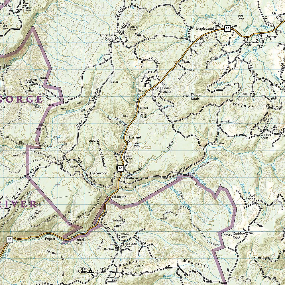
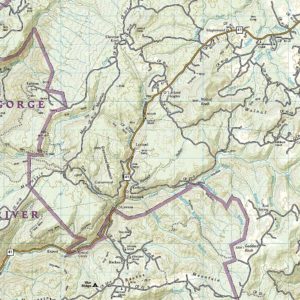
Fifty-three miles of West Virginia’s New River and its gorge, and forty miles of its tributaries, are preserved as New River Gorge National River, Gauley River National Recreation Area, and Bluestone National Scenic River.
Publication: 2019 || Size: 25.5″ x 37.75″
In stock
Fifty-three miles of West Virginia’s New River and its gorge, and forty miles of its tributaries, are preserved as New River Gorge National River, Gauley River National Recreation Area, and Bluestone National Scenic River. Expertly researched and created in partnership with local land management agencies, National Geographic’s Trails Illustrated map of New River Gorge National River offers an unparalleled tool for exploring this beautiful riparian region. Key areas of interest featured on this map include Summerville Lake and Babcock, Little Beaver, Pipestem, Carnifex Ferry Battlefield, and Hawks Nest state parks.
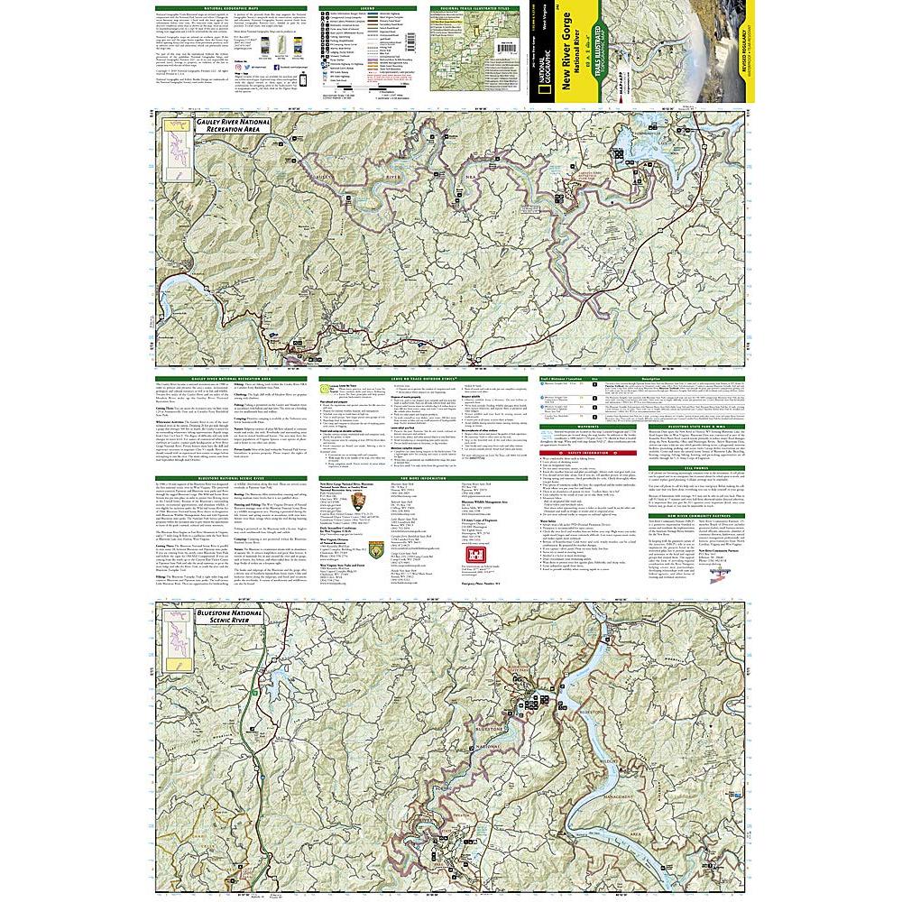
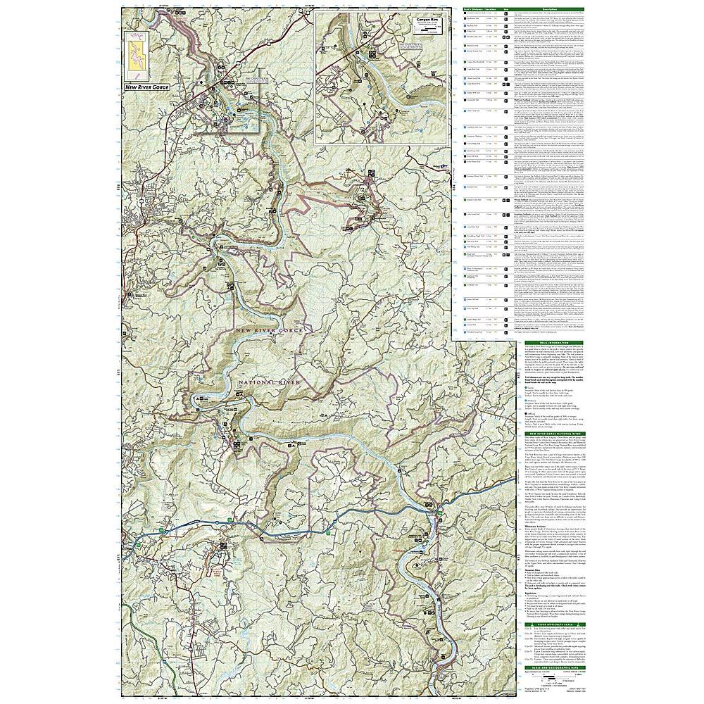
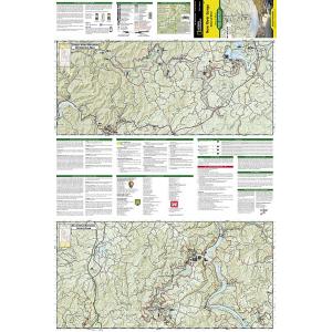
A detailed inset of Canyon Rim is provided in the print version of this map. Extensive trail summaries with location, distance, and use will help you choose the path that’s right for you. River mileage is noted for those exploring by boat. Recreation features are clearly marked, including campgrounds, trailheads, picnic areas, boat launches, whitewater access, fishing and swimming areas, marinas, and boat rental locations. Helpful agency contact information and safety tips are included as well. The map base includes contour lines, shaded relief, and elevations for summits and passes.
Every Trails Illustrated map is printed on “Backcountry Tough” waterproof, tear-resistant paper. A full UTM grid is printed on the map to aid with GPS navigation. We love technology and enjoy the convenience of GPS, but you can’t plan a trip on a phone screen and navigation doesn’t work where there’s no cell signal. Start your next trip on the right foot with a high-quality folding travel map. Make the most of your next adventure, even if you lose GPS or cell signals. You’ll always be on the correct route with our folding travel maps. Your adventure starts here!
Coverage Includes
Bluestone Lake, Flat Top Mountain, Gauley River, Greenbrier River, New River Gorge.
What is a Trails Illustrated Map?
With more than 250 titles available for America’s favorite outdoor destinations, Trails Illustrated maps are the most trusted and popular recreation maps available. Continually setting the standard for accuracy, each map is crafted in conjunction with local land managers and undergoes rigorous review and enhancement before being printed on waterproof, tear-resistant material. Each Trails Illustrated map contains detailed topographic information, clearly marked trails, recreational points of interest, and navigational aids.
About the Author
Founded in 1915 as the Map Department of the National Geographic Society, National Geographic Maps is responsible for illustrating the world around us through the art and science of mapmaking. Today, National Geographic Maps continues this mission by creating the world’s best wall maps, outdoor recreation maps, travel maps, atlases and globes that inspire people to care about and explore their world.
Back-Orders & Out-of-Stock Items
If an item is out of stock, it will ship as soon as it becomes available. The expected timeframe is shown in the “Normally Ships in” section below the Add to Cart button. If your order is on backorder, you will receive email updates as we get more information. Our goal is always to deliver your products as quickly as possible.
Returns
We accept free returns within 30 days of delivery. To start a return, please contact us within 30 days to receive a return authorization number. Once we receive the return, we will issue your refund within three business days. Please note: original shipping charges are non-refundable and return shipping costs are your responsibility unless the error was ours.
Returns are not accepted on clearance items. All clearance sales are final.
| Publisher | National Geographic |
|---|---|
| Language | English |
| Published | 2019 |
| Print Series | |
| Map Scale | 1 : 55,000 |