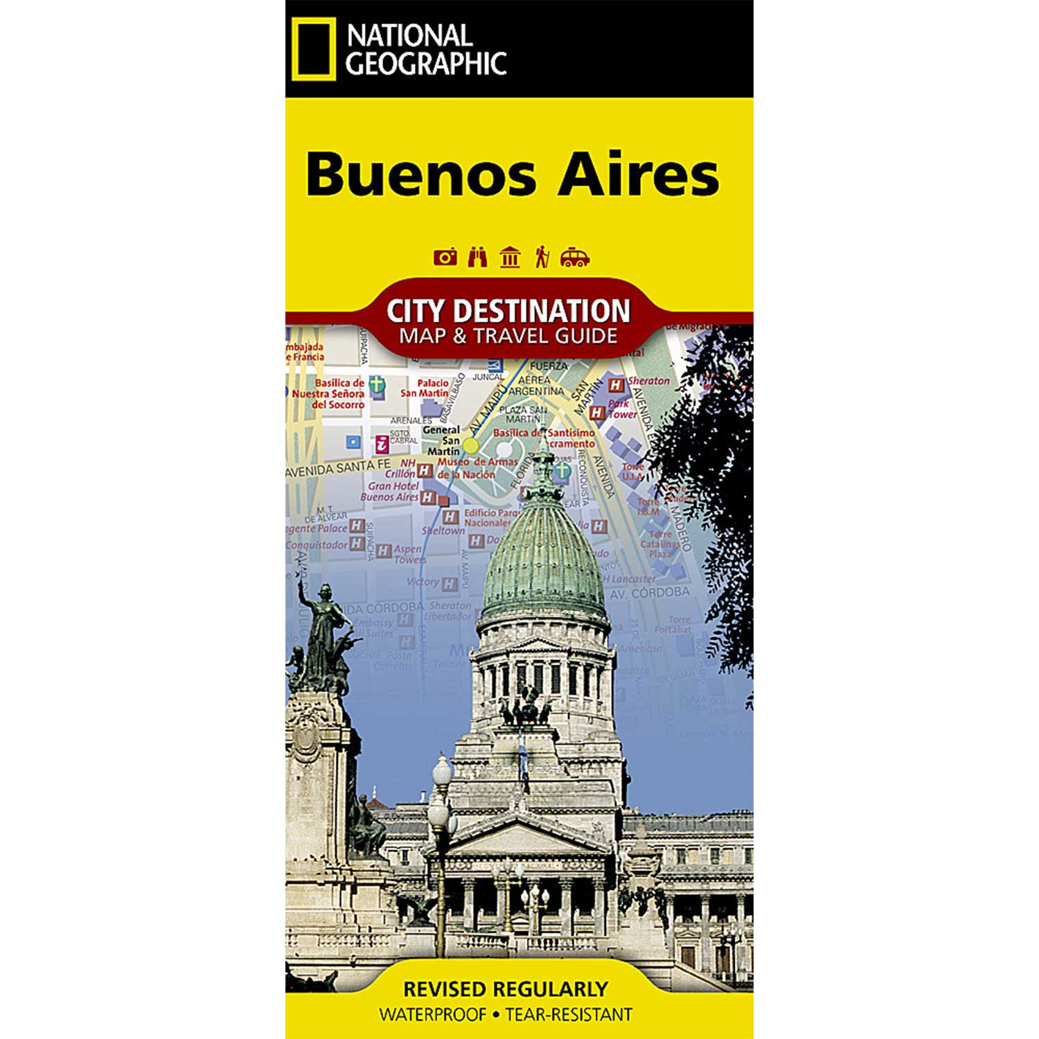

National Geographic – Buenos Aires – City Destination Folding Travel Map
$9.95
National Geographic’s City Destination map of Buenos Aires combines a city map and travel guide, making it the ultimate traveling companion to Argentina’s capital city.
Publication: 2018 || Size: 17.75″ x 24.75″
Out of stock
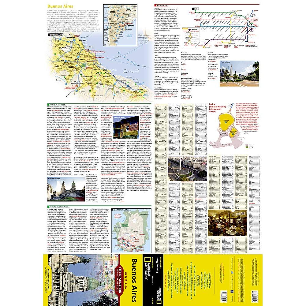
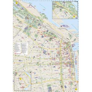
National Geographic’s City Destination map of Buenos Aires combines a city map and travel guide, making it the ultimate traveling companion to Argentina’s capital city. Featured on the front side are a regional map and inset map of Isla Martin Garcia. Maps of Ezeiza Airport and the subway (subte) along with an overview of the public transit system will help you travel around the city efficiently. Find your destination and plan your route using the user friendly index of streets, hotels, parks, metro stations, points of interest and public buildings. Information about the most popular points of interest in and around the city is also provided.
The main street map of the city is on the reverse side. In addition to road network designations for through routes, main and secondary roads, and one ways streets, the map also pinpoints hundreds of points of interest, public transit stations, monuments, theaters, places of worship, hotels, notable buildings and parks, along with a multi-language legend. Inset maps show the Belgrano and La Boca neighborhoods. Every Destination Map is printed on durable synthetic paper, making them waterproof, tear-resistant and tough — capable of withstanding the rigors of any kind of travel.
We love technology and enjoy the convenience of GPS, but you can’t plan a trip on a phone screen and navigation doesn’t work where there’s no cell signal. Start your next trip on the right foot with a high-quality folding travel map. Make the most of your next adventure, even if you lose GPS or cell signals. You’ll always be on the correct route with our folding travel maps. Your adventure starts here!
What is a City Destination Map?
Exploring and enjoying the world’s great cities is as easy as unfolding these waterproof, tear-resistant maps. City Destination Maps combine finely detailed maps with fascinating and practical travel information. Maps feature a large-scale city map, richly layered with tourist and business travel locations and information. 3-D styled drawings provide you with instant identification of famous buildings and landmarks, making orientation easy and creating a unique keepsake of the visit. The reverse side includes regional maps, top attractions, airport diagrams, travel tips, transit maps and an extensive index to streets, cities, neighborhoods, parks, points of interest, museums, monuments, government buildings, subway stations, hotels, and more. Multi-language legends are included on each map.
About the Author
Founded in 1915 as the Map Department of the National Geographic Society, National Geographic Maps is responsible for illustrating the world around us through the art and science of mapmaking. Today, National Geographic Maps continues this mission by creating the world’s best wall maps, outdoor recreation maps, travel maps, atlases and globes that inspire people to care about and explore their world.
Back-Orders & Out-of-Stock Items
If an item is out of stock, it will ship as soon as it becomes available. The expected timeframe is shown in the “Normally Ships in” section below the Add to Cart button. If your order is on backorder, you will receive email updates as we get more information. Our goal is always to deliver your products as quickly as possible.
Returns
We accept free returns within 30 days of delivery. To start a return, please contact us within 30 days to receive a return authorization number. Once we receive the return, we will issue your refund within three business days. Please note: original shipping charges are non-refundable and return shipping costs are your responsibility unless the error was ours.
Returns are not accepted on clearance items. All clearance sales are final.
| Publisher | National Geographic |
|---|---|
| Language | English |
| Published | 2018 |