

There is nothing ‘fishy’ about a map having scales!
Here at the Map Shop, we are not quiet about our love of all things maps. They make: excellent educational tools, handy travel guides, aesthetic art, and even playful decor — and we are eager to use them for all of the above.
All our maps may be different, but we love them all the same. Some map’s are more about serving up good vibes than navigational or referential assistance. And some maps are all business. If you come across a map that forgoes the use of a scale? Well, that definitely puts it in the “good vibe” camp – because a scale is essential for any map if you want to utilize it!
Ok, so you have a map with a scale on it. Sure it looks cool, but why are they so important and how do you use it?
Let's Explore the Purpose
For those of us who failed to pay attention in high school social studies, our working knowledge about map scales might be a little rusty -Fortunately, the basics are pretty straightforward and easy to understand. A map scale is a small unit of measurement intended to correspond to a larger one. The scale will denote the ratio that explains the relationship between the larger, “in real life” , distances to the distances on the map.
In more simplistic terms, it’s basically a stand-in, a more accurate representation of distance that wouldn’t otherwise be possible due to the inherent issues of translating large swaths of space onto a far smaller 2D document.
For example, you may run into a map that translates 200 kilometers into 5 centimeters. You can then use this measurement and some basic math to calculate real-world distance between various points on your map. You can also use these scales to better understand geographic details when looking at raised reliefs.
It wouldn’t be a stretch to claim that any map intended for practical use would be pointless without a clearly designated and labeled scale. This is why you’ll rarely see any maps that lack this basic yet essential feature. But there is one critical thing to note: just because most usable maps have a scale, doesn’t mean they are all the same.
3 Types of Representation
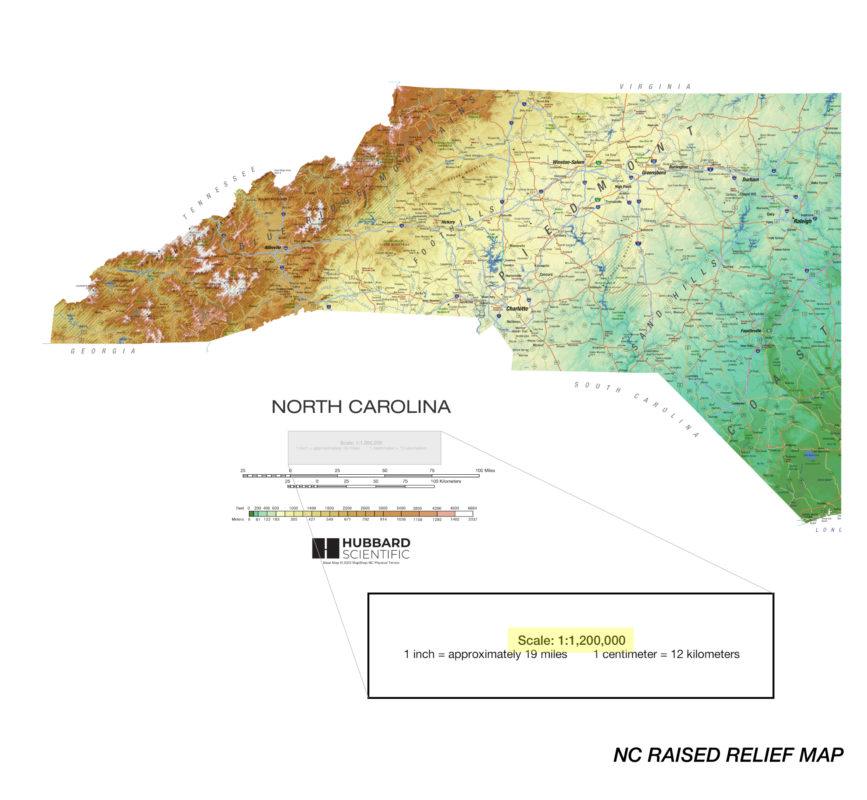
Lexical / Verbal Scale
Perhaps the simplest form of scale representation and the easiest for most folks to understand is the lexical or verbal scale. These don’t use visual representations of distance. Instead, they merely state corresponding measurements in plain English-unless your map is in some other language…then of course it will be in “plain (fill in the name of that language”) .
While the lexical scale is the most straightforward, this type of scale does have one downside. It generally necessitates the use of a ruler for you to make any meaningful distance calculations. So unless your finger is exactly one inch or centimeter thick you’ll need a way to accurately transfer the measurement mentioned in the scale onto the map.
For example: “One inch equals 10 miles.”

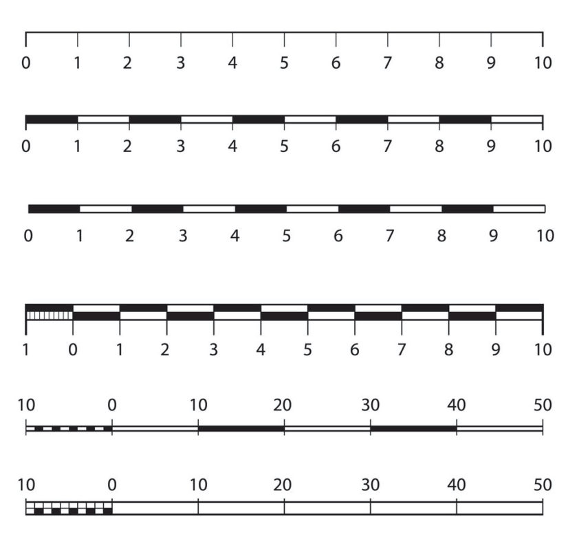
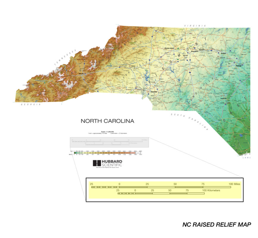
Linear / Bar Scale
Maybe lexical/ verbal isn’t your map’s thing – maybe your map likes to hang out near the bar. A Linear or Bar scale is a scale that represents distance through the use of a straight line.
The actual size of this line can occasionally differ, but we find that many maps tend to utilize one about six inches long line- and divide that line into several increments that show smaller units in a way that makes for easy to measure. Because this shows off distance in an actual, visual way, linear/bar scales are far better for visualizing distance than other scale forms.
Representative Fraction Scales
Apologies in advance to all of the anti-math folks in our midst, some number-crunching will have to happen here. This is because representative fraction scales display distance equivalencies through ratios rather than a visual representation or written statement. The benefit to this type of scale is that the map’s user can apply ANY unit of measurement to the ratio.
Do you like to measure distance in furlongs, light years, or Decimeters? Not a problem! The Fractional scale has got you covered. While this may be the most versatile scale, users may struggle to understand fractional scales when compared to the lexical or linear alternatives.
For example: this can be shown as 1:50,000 or 1/50,000.
Calculating Distance
There’s no doubt that maps are amazing things to have on hand when you’re trying to traverse a new area or if you find yourself on a road trip that goes a little sideways. As long as you have your trusty map, and some basic information about your surroundings, you can always find your way home.
But in those instances when you need your map to tell you about distance rather than “just” location. You will need to know how to read your map’s scale.
See how to utilize a map’s scale by following the steps:
- Grab a ruler (or an object with a known length) and use it to measure the distance between two points on your map. Take care to keep things as straight as possible to reduce the possibility of improper measurements
- Locate your map’s scale. There’s no one standard place that they live on every map, but you’ll often find this information in a lower or upper righthand corner.
-
- For lexical/verbal scales: simply take your measurements and follow the scale’s instructions to discover your literal distance.
- For linear/bar scales: compare your scale’s line against the two points you’re looking at on your map to find out real world distance.
- For representative fraction scales: multiply the distance you found with your ruler by the fraction’s denominator/ratio’s second number and consult your scale for the appropriate unit.
