What Are State Raised Relief Maps?
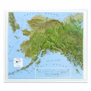
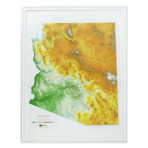
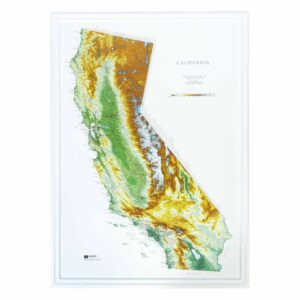
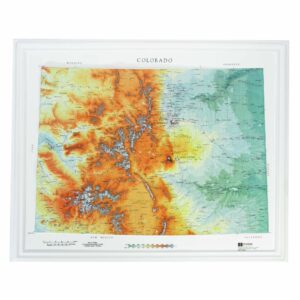
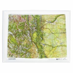
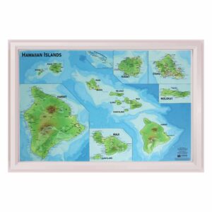
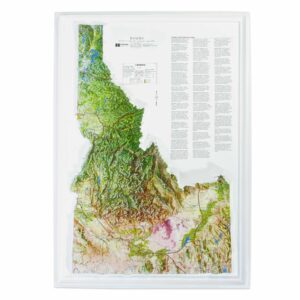
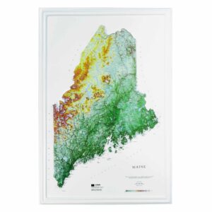
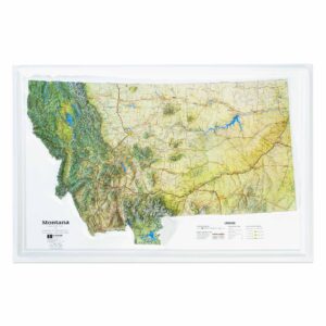
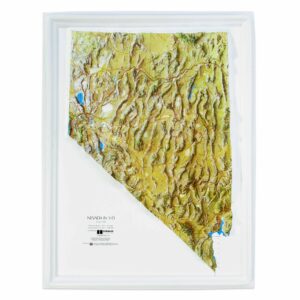
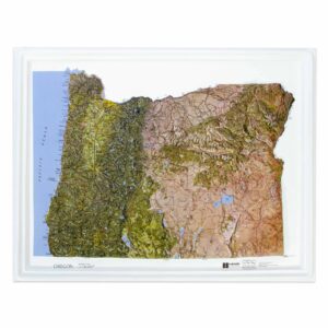
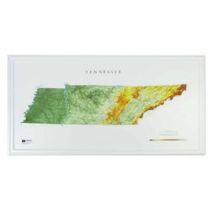
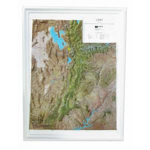
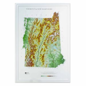
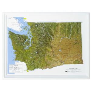
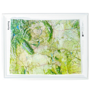
State raised relief maps are three-dimensional representations of individual U.S. states. Each map is molded using elevation data and designed to reflect the topographic details of a specific state. These maps show mountains, valleys, plains, rivers, and other landforms unique to the area. Made from durable vinyl and molded over a carved form, they offer both visual detail and physical depth.
State raised relief maps are three-dimensional representations of individual U.S. states. Each map is molded using elevation data and designed to reflect the topographic details of a specific state. These maps show mountains, valleys, plains, rivers, and other landforms unique to the area. Made from durable vinyl and molded over a carved form, they offer both visual detail and physical depth.
What States Are Available?
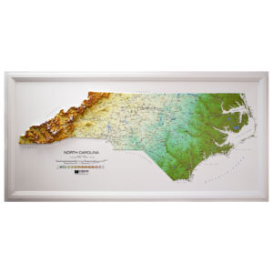
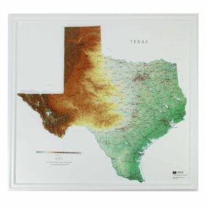
We carry a wide selection of raised relief maps for individual U.S. states, including popular options like California, Colorado, Texas, North Carolina, and more. These maps vary in size and labeling, but each one highlights the defining landforms of the region. Browse the collection to find your state or contact us if you’re looking for a specific area.
We carry a wide selection of raised relief maps for individual U.S. states, including popular options like California, Colorado, Texas, North Carolina, and more. These maps vary in size and labeling, but each one highlights the defining landforms of the region. Browse the collection to find your state or contact us if you’re looking for a specific area.
Why Choose a State-Specific 3D Map?
A state-focused raised relief map gives you a much more detailed look at a single region. These maps are perfect for state history or geography classes, local government buildings, or anyone with a strong connection to their home state. They also make thoughtful gifts for students, educators, or out-of-state family members.
A state-focused raised relief map gives you a much more detailed look at a single region. These maps are perfect for state history or geography classes, local government buildings, or anyone with a strong connection to their home state. They also make thoughtful gifts for students, educators, or out-of-state family members.
Are These Maps Accurate?
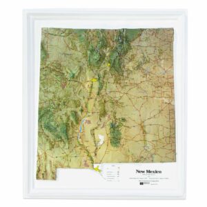
Yes. All state raised relief maps are created using precise elevation data and scaled to the dimensions of the map. Some models use vertical exaggeration to help features like mountain ranges or river basins stand out. The terrain modeling is reviewed for accuracy, and many maps include cities, rivers, and labeled geographic features.
Yes. All state raised relief maps are created using precise elevation data and scaled to the dimensions of the map. Some models use vertical exaggeration to help features like mountain ranges or river basins stand out. The terrain modeling is reviewed for accuracy, and many maps include cities, rivers, and labeled geographic features.
Can You Frame a State Raised Relief Map?
Yes. These maps can be mounted in open-style frames or shadowboxes to enhance their appearance without flattening the 3D surface. Framing adds visual impact and is a great option for display in schools, offices, and government buildings. Some maps also include a molded border that adds structural support and makes framing easier.
Yes. These maps can be mounted in open-style frames or shadowboxes to enhance their appearance without flattening the 3D surface. Framing adds visual impact and is a great option for display in schools, offices, and government buildings. Some maps also include a molded border that adds structural support and makes framing easier.
Are These Maps Good for Education?
Definitely. State raised relief maps are a powerful tool for teaching localized geography and topographic concepts. They help students identify landforms, elevation patterns, and how physical geography influences settlement and land use. They are especially helpful for tactile learners and are commonly used in elementary, middle, and high school classrooms.
Definitely. State raised relief maps are a powerful tool for teaching localized geography and topographic concepts. They help students identify landforms, elevation patterns, and how physical geography influences settlement and land use. They are especially helpful for tactile learners and are commonly used in elementary, middle, and high school classrooms.
What Size Are State Relief Maps?
Sizes vary by state and manufacturer, but most range from 15 to 30 inches wide. These maps are small enough to fit in a classroom or office, but detailed enough to highlight topography clearly. Each product page includes exact dimensions.
Sizes vary by state and manufacturer, but most range from 15 to 30 inches wide. These maps are small enough to fit in a classroom or office, but detailed enough to highlight topography clearly. Each product page includes exact dimensions.
What Is the Hubbard Scientific Brand?
Hubbard Scientific has been producing state raised relief maps for over 60 years, providing educators with durable, accurate, and clearly labeled tools for teaching geography. These maps are made in the United States and designed for classroom durability and clarity. The Map Shop is proud to be the exclusive manufacturer of all Hubbard Scientific raised relief maps. Learn more about the Hubbard Scientific brand and history here.
Hubbard Scientific has been producing state raised relief maps for over 60 years, providing educators with durable, accurate, and clearly labeled tools for teaching geography. These maps are made in the United States and designed for classroom durability and clarity. The Map Shop is proud to be the exclusive manufacturer of all Hubbard Scientific raised relief maps. Learn more about the Hubbard Scientific brand and history here.
Why Buy State Raised Relief Maps from The Map Shop?
We are the exclusive manufacturer of all Hubbard Scientific state raised relief maps and have been making maps in Charlotte, NC since 1990. Our collection is carefully curated for quality, clarity, and durability. Whether you’re outfitting a school, decorating a local office, or buying a gift, we offer expert guidance and a wide selection of maps to choose from.
We are the exclusive manufacturer of all Hubbard Scientific state raised relief maps and have been making maps in Charlotte, NC since 1990. Our collection is carefully curated for quality, clarity, and durability. Whether you’re outfitting a school, decorating a local office, or buying a gift, we offer expert guidance and a wide selection of maps to choose from.