You got it right. It may become a collectors item if geographically named places keep changing.
 World Voyager Wall Map by South of Kings


Price range: $39.99 through $809.99
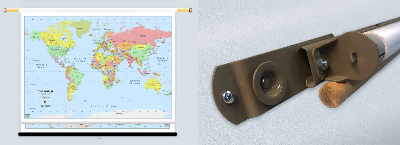
Features a bright blue marine color (oceans, lakes, and rivers) and a pleasingly saturated color scheme for the countries.
Also available as a Classroom Pull Down map! Click here to purchase
World Voyager Wall Map
Oceans, lakes, and rivers carry a bright marine blue, while the countries use a saturated palette that stays easy on the eyes from across a room.
Developed in-house by a team of cartographers and designers under the South of Kings name, keeping type, color, and label placement under one roof. Labeling covers continents, countries, US states and Canadian provinces, cities, rivers, lakes, shaded relief, the largest mountain ranges, highest peaks, marine areas, and minor islands. Label count runs higher and type runs larger than most world maps of the same footprint, so it reads from a few steps back. No scale bar is printed — this is a display and reference piece rather than a measuring tool.
Finishing choices include:
| Map Scale | No Scale |
|---|---|
| Publisher | The MapShop |
You got it right. It may become a collectors item if geographically named places keep changing.
World Voyager Wall Map by South of Kings
Great on all accounts. Make yourself a wonderful day!!
World Voyager Wall Map by South of Kings
You did great! We love our new map! We are very happy that you stayed true and kept the name “Gulf of Mexico.” Thank you for doing a great job.
World Voyager Wall Map by South of Kings
Delivered as promised--packaged properly, map is superior quality and met all of my expectations.
World Voyager Wall Map by South of Kings
I am very pleased with my map that I ordered. The quality is excellent and shipping was fast. I was really impressed with the communication during the whole process, it was very informative and professional. I would definitely recommend your company to anyone interested in purchasing one of your maps!
World Voyager Wall Map by South of Kings
The map you made for me is awesome!!! I travel quite a bit and needed the map to help with logistics/planning. I would highly recommend The Map Shop since the quality of the product and the customer service is top-notch.
World Voyager Wall Map by South of Kings
The maps are beautiful and of such a high quality. Worth the expense. Will expand on, and send pictures, regarding my purchase after finishing my move in July. The maps are already up in my new apartment and I am enjoying them immensely.
World Voyager Wall Map by South of Kings
The map i ordered was a gift for my husband. It arrived on time in good condition. I appreciate the care taken to produce and deliver our map. Thank you and take care!
World Voyager Wall Map by South of Kings
The two maps I ordered were for my grandchildren, for Christmas presents, so they haven't been in their new home yet. However, I had a good look at them when Santa sent them to my house for safekeeping until the big day, and they are both lovely. Perfect as visual aids for answering the childrens' myriad questions about where everything is in the world, and how far away do the cousins live? I'm sure the maps will get plenty of use.
Thanks for your whole site! I will be back again. Have a wonderful holiday!
World Voyager Wall Map by South of Kings
We want you to love your map. If you aren't satisfied, returns are accepted within 30 days for unfinished products.* Please contact us within 30 days of receiving your product to receive a return authorization number. Please note that shipping costs are non-refundable unless we made a mistake with your order.
*Finished products such as railed, mounted, and framed maps are not returnable because we make these on-demand just for you and do not stock them. If you have any questions about whether your order qualifies for a return, please contact us.
Transform your wall map into a ready-to-hang centerpiece! Our professional framing and railing services often cost less than visiting a local framer. Choose your finishing option during checkout and receive your map ready to display immediately and hassle-free.

Paper finishing is the most economical option. Most maps are printed on premium 36lb paper. Waterproof paper is also available for functional maps that may be used outdoors.

Maps are printed, then run through our laminator that applies 1.7mil-thick satin-gloss lamination to the front and back. You can use map stickers and wet-erase markers.

Maps are printed, then laminated with 1.7mil-thick satin lamination onto 1/4″-thick foam core. You can use map pins, stickers, or wet-erase markers with our mounted maps.

First, we laminate the map, then mount wood rails at the top and bottom. The front side of each rail features a black or walnut finish, while the sides and back are unfinished wood. Sawtooth hardware is attached to the back of the top rail so it's ready to hang. You can use stickers or wet-erase markers on your laminated map. We recommend a mounted or framed option if you'd like to use map pins to mark locations.


First, we laminate the map onto foam core, then mount wood rails at the top and bottom. The front side of each rail features a black or walnut finish, while the sides and back are unfinished wood. Sawtooth hardware is attached to the back of the top rail so it's ready to hang. You can use map pins, stickers, or wet-erase markers on your map. This option will lay clean and flat against the wall, unlike the laminated with rails option.
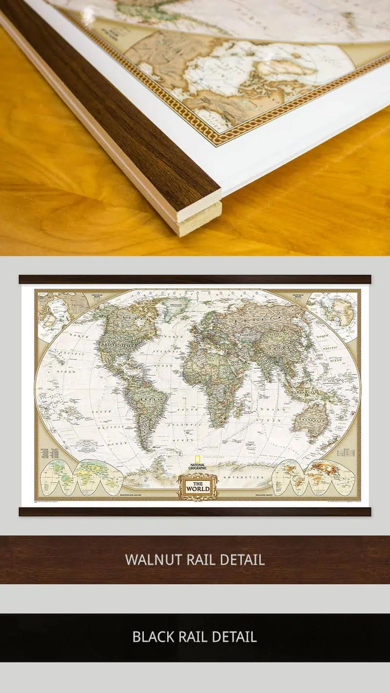

Maps are laminated onto foam core, then secured into the frame. The engineered molding is made from recycled wood in either a black or walnut finish that wraps around the entire map. Most moldings are 2″ wide by 3/4″ deep, but maps 24″ x 36″ and smaller use a 1.25″ wide molding. You can use map pins, stickers, or wet-erase markers on all our framed maps. Ready-to-hang sawtooth hardware or wire hanging loops are included.