


What Are High School and College Continent Maps?
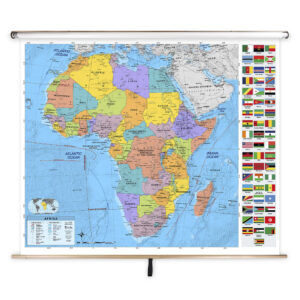
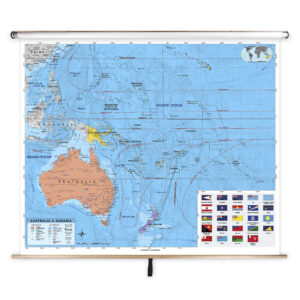
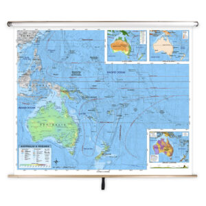
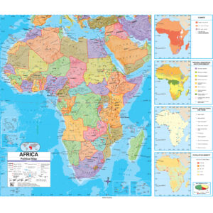
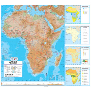
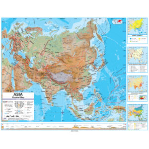
High school and college continent maps are educational wall maps mounted on spring rollers that focus on the geography of individual continents. These maps provide detailed political boundaries, major cities, and physical features such as mountain ranges, rivers, and deserts. Many include thematic information such as climate, population density, and economic data, making them ideal for advanced instruction in geography, history, and environmental studies.
High school and college continent maps are educational wall maps mounted on spring rollers that focus on the geography of individual continents. These maps provide detailed political boundaries, major cities, and physical features such as mountain ranges, rivers, and deserts. Many include thematic information such as climate, population density, and economic data, making them ideal for advanced instruction in geography, history, and environmental studies.
What Are the Different Types of High School and College Continent Maps?
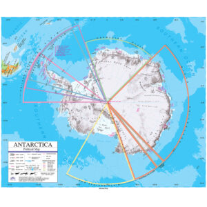
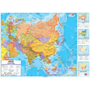
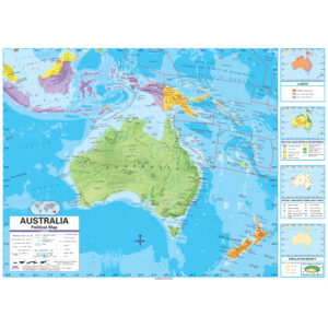
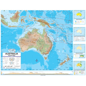
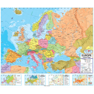
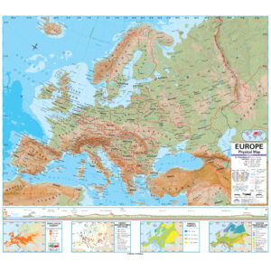
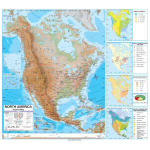
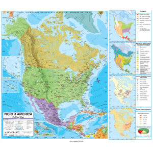
This category offers a variety of continent-specific maps for advanced classrooms. Teachers can select political maps for studying borders and capitals, physical maps for exploring terrain and natural features, or thematic maps that address environmental, cultural, or economic factors. Each map is designed to provide detailed, accurate information for grades 9–12 and higher education.
This category offers a variety of continent-specific maps for advanced classrooms. Teachers can select political maps for studying borders and capitals, physical maps for exploring terrain and natural features, or thematic maps that address environmental, cultural, or economic factors. Each map is designed to provide detailed, accurate information for grades 9–12 and higher education.
What Are the Benefits of Using Continent Maps in Advanced Classrooms?
Continent maps allow students to focus on detailed regional studies, exploring political, cultural, and environmental factors unique to each continent. Teachers can guide lessons on historical events, trade networks, migration patterns, and natural resources using these maps. Laminated, markable surfaces enable interactive lessons that enhance understanding and support advanced research.
Continent maps allow students to focus on detailed regional studies, exploring political, cultural, and environmental factors unique to each continent. Teachers can guide lessons on historical events, trade networks, migration patterns, and natural resources using these maps. Laminated, markable surfaces enable interactive lessons that enhance understanding and support advanced research.
Are High School and College Continent Maps Good for Classrooms, Offices, and Homes?
Yes. While primarily designed for academic classrooms, these maps are also suitable for research facilities, tutoring centers, and professional offices. Families with older students can use them to support advanced geography and history education at home. Built with durable materials and easy-to-clean laminated finishes, these maps are ideal for long-term, high-traffic educational settings.
Yes. While primarily designed for academic classrooms, these maps are also suitable for research facilities, tutoring centers, and professional offices. Families with older students can use them to support advanced geography and history education at home. Built with durable materials and easy-to-clean laminated finishes, these maps are ideal for long-term, high-traffic educational settings.
What Grade Levels Are High School and College Continent Maps Designed For?
These maps are specifically created for grades 9–12 and higher education. They provide more comprehensive geographic and thematic detail than elementary or middle school maps, preparing students for college-level coursework and research.
These maps are specifically created for grades 9–12 and higher education. They provide more comprehensive geographic and thematic detail than elementary or middle school maps, preparing students for college-level coursework and research.
How Do I Decorate with High School and College Continent Maps?
Continent maps enhance advanced classrooms with detailed visuals that double as academic décor. When stored, they retract neatly above whiteboards or chalkboards. When displayed, they provide an engaging and informative focal point that supports in-depth lessons. In study areas or offices, these maps add a professional and educational touch.
Continent maps enhance advanced classrooms with detailed visuals that double as academic décor. When stored, they retract neatly above whiteboards or chalkboards. When displayed, they provide an engaging and informative focal point that supports in-depth lessons. In study areas or offices, these maps add a professional and educational touch.
Can I Create a Custom High School or College Continent Map for My Classroom?
Yes. We specialize in creating custom continent maps tailored to high school and college classrooms. Options include combining multiple continent maps on a single roller, adding branded or district-specific features, or customizing thematic content to align with specific coursework. Each custom map is produced in-house with premium materials for accuracy and durability. Learn more about custom solutions at this page.
Yes. We specialize in creating custom continent maps tailored to high school and college classrooms. Options include combining multiple continent maps on a single roller, adding branded or district-specific features, or customizing thematic content to align with specific coursework. Each custom map is produced in-house with premium materials for accuracy and durability. Learn more about custom solutions at this page.
How Do I Install High School and College Continent Maps?
Installation is straightforward. These maps are designed to mount above whiteboards or on flat walls, with both wall and ceiling mounting options available. Orders with backboards arrive pre-attached for easy setup. Proper installation ensures secure mounting and smooth roller operation. Detailed instructions are available at this link.
Installation is straightforward. These maps are designed to mount above whiteboards or on flat walls, with both wall and ceiling mounting options available. Orders with backboards arrive pre-attached for easy setup. Proper installation ensures secure mounting and smooth roller operation. Detailed instructions are available at this link.
Do You Sell Mounting Hardware for High School and College Continent Maps?
Yes. We offer a complete range of mounting hardware, including brackets, backboards, and accessories designed for high school and college continent maps. Each order includes backboards and wall brackets, but screws and anchors must be chosen based on wall type. Browse available hardware options at this page.
Yes. We offer a complete range of mounting hardware, including brackets, backboards, and accessories designed for high school and college continent maps. Each order includes backboards and wall brackets, but screws and anchors must be chosen based on wall type. Browse available hardware options at this page.
What Materials Are Used for High School and College Continent Maps?
Each map is printed on heavyweight paper and laminated for durability and frequent academic use. The laminated surface supports both dry-erase and wet-erase markers, making lessons interactive and engaging. Powder-coated steel backboards provide stability, ensuring these maps last for years in high school and college classrooms.
Each map is printed on heavyweight paper and laminated for durability and frequent academic use. The laminated surface supports both dry-erase and wet-erase markers, making lessons interactive and engaging. Powder-coated steel backboards provide stability, ensuring these maps last for years in high school and college classrooms.
What Do Maps Teach High School and College Students?
Continent maps help advanced students analyze political and physical geography, study regional development, and understand environmental and cultural factors unique to each continent. Teachers can use these maps to explain global trade patterns, geopolitical conflicts, and regional climate impacts, promoting critical thinking and analytical skills.
Continent maps help advanced students analyze political and physical geography, study regional development, and understand environmental and cultural factors unique to each continent. Teachers can use these maps to explain global trade patterns, geopolitical conflicts, and regional climate impacts, promoting critical thinking and analytical skills.
What Are the Available Sizes of High School and College Continent Maps?
These maps are available in multiple sizes to accommodate different classroom or research settings. Large-format maps are ideal for group instruction and lectures, while smaller maps suit compact academic spaces. Detailed dimensions for each product are provided on individual product pages within this category.
These maps are available in multiple sizes to accommodate different classroom or research settings. Large-format maps are ideal for group instruction and lectures, while smaller maps suit compact academic spaces. Detailed dimensions for each product are provided on individual product pages within this category.
What is BrightWay Educational?
BrightWay Educational is our exclusive line of classroom maps, including continent maps designed for high school and college instruction. Updated regularly with the latest geopolitical and environmental data, BrightWay maps feature precise cartography and professional labeling suited for advanced courses. Learn more about BrightWay Educational maps here.
BrightWay Educational is our exclusive line of classroom maps, including continent maps designed for high school and college instruction. Updated regularly with the latest geopolitical and environmental data, BrightWay maps feature precise cartography and professional labeling suited for advanced courses. Learn more about BrightWay Educational maps here.
Why Choose The Map Shop for High School and College Continent Maps?
Since 1990, The Map Shop has been a trusted provider of high-quality educational maps for advanced classrooms nationwide. Each continent map is hand-finished in our Charlotte, NC facility using premium materials and expert craftsmanship. We prioritize accuracy, durability, and academic value, ensuring our maps serve as reliable resources for teaching and research. Read customer reviews here or learn more about our story here.
Since 1990, The Map Shop has been a trusted provider of high-quality educational maps for advanced classrooms nationwide. Each continent map is hand-finished in our Charlotte, NC facility using premium materials and expert craftsmanship. We prioritize accuracy, durability, and academic value, ensuring our maps serve as reliable resources for teaching and research. Read customer reviews here or learn more about our story here.