What Are Middle School Continent Maps?
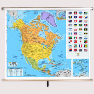
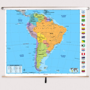
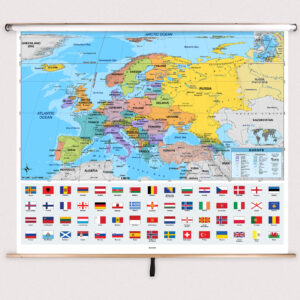
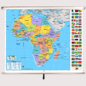
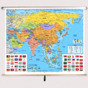
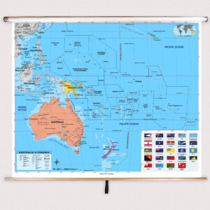
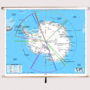
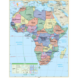
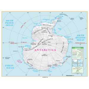
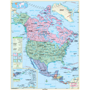
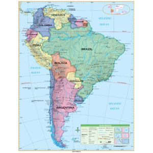
Middle school continent maps are educational wall maps mounted on spring rollers that focus on the geography of individual continents. Designed for grades 6–8, these maps include detailed political boundaries, country names, major cities, and significant physical features such as mountain ranges, rivers, and deserts. Some maps also provide thematic information, including climate or population density, supporting comprehensive geographic instruction.
Middle school continent maps are educational wall maps mounted on spring rollers that focus on the geography of individual continents. Designed for grades 6–8, these maps include detailed political boundaries, country names, major cities, and significant physical features such as mountain ranges, rivers, and deserts. Some maps also provide thematic information, including climate or population density, supporting comprehensive geographic instruction.
What Are the Different Types of Middle School Continent Maps?
This category features a range of continent-focused maps designed for middle school classrooms. Teachers can choose from political maps that highlight countries and boundaries, physical maps that emphasize terrain and natural features, and thematic maps that explore topics like ecosystems or economic activity. Each map is tailored for interactive lessons that help students understand the complexity of each continent.
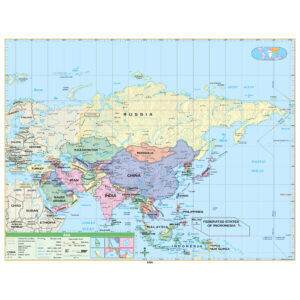
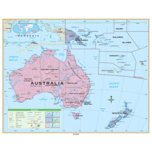
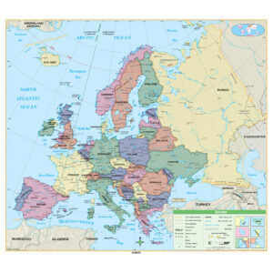
This category features a range of continent-focused maps designed for middle school classrooms. Teachers can choose from political maps that highlight countries and boundaries, physical maps that emphasize terrain and natural features, and thematic maps that explore topics like ecosystems or economic activity. Each map is tailored for interactive lessons that help students understand the complexity of each continent.
What Are the Benefits of Using Continent Maps in Middle School Classrooms?
Continent maps provide students with a deeper understanding of regional geography by focusing on specific continents. Teachers can use these maps to discuss cultural diversity, environmental factors, and historical events tied to different regions. Pull-down maps allow for hands-on instruction, enabling teachers to highlight key features and trace routes during lessons, fostering spatial reasoning and critical thinking skills.
Continent maps provide students with a deeper understanding of regional geography by focusing on specific continents. Teachers can use these maps to discuss cultural diversity, environmental factors, and historical events tied to different regions. Pull-down maps allow for hands-on instruction, enabling teachers to highlight key features and trace routes during lessons, fostering spatial reasoning and critical thinking skills.
Are Middle School Continent Maps Good for Classrooms, Offices, and Homes?
Yes. While primarily designed for middle school classrooms, these continent maps are also valuable for homeschooling, tutoring centers, and educational offices. Families use them to teach children about continents and their unique characteristics. The laminated finish ensures durability and easy cleaning, making them practical for long-term educational use.
Yes. While primarily designed for middle school classrooms, these continent maps are also valuable for homeschooling, tutoring centers, and educational offices. Families use them to teach children about continents and their unique characteristics. The laminated finish ensures durability and easy cleaning, making them practical for long-term educational use.
What Grade Levels Are Middle School Continent Maps Designed For?
Middle school continent maps are specifically tailored for students in grades 6–8. They provide more geographic detail than elementary maps while remaining accessible for younger learners. High school maps offer even greater complexity for advanced students, making middle school maps an ideal bridge between simplified and highly detailed cartography.
Middle school continent maps are specifically tailored for students in grades 6–8. They provide more geographic detail than elementary maps while remaining accessible for younger learners. High school maps offer even greater complexity for advanced students, making middle school maps an ideal bridge between simplified and highly detailed cartography.
How Do I Decorate with Middle School Continent Maps?
Middle school continent maps enhance classroom environments by adding visually engaging and informative resources. When stored, they retract neatly above whiteboards or chalkboards, conserving wall space. When displayed, they create a detailed focal point that sparks curiosity and promotes discussion. At home, these maps can be mounted in study areas to support educational activities and add informative décor.
Middle school continent maps enhance classroom environments by adding visually engaging and informative resources. When stored, they retract neatly above whiteboards or chalkboards, conserving wall space. When displayed, they create a detailed focal point that sparks curiosity and promotes discussion. At home, these maps can be mounted in study areas to support educational activities and add informative décor.
Can I Create a Custom Middle School Continent Map for My Classroom?
Yes. Custom continent maps can be designed to meet specific middle school curriculum needs. Teachers can combine multiple continents on one roller, request branded district-specific designs, or choose thematic focuses tailored to lessons. Each custom map is produced in-house using high-quality materials to ensure clarity and durability. Learn more about custom solutions at this page.
Yes. Custom continent maps can be designed to meet specific middle school curriculum needs. Teachers can combine multiple continents on one roller, request branded district-specific designs, or choose thematic focuses tailored to lessons. Each custom map is produced in-house using high-quality materials to ensure clarity and durability. Learn more about custom solutions at this page.
How Do I Install Middle School Continent Maps?
Installation is simple. Middle school continent maps are designed to mount above whiteboards or on flat walls, with wall and ceiling mounting options available. Units with backboards arrive pre-attached for easy setup. Proper installation ensures secure mounting and smooth spring roller function. Detailed instructions are available at this link.
Installation is simple. Middle school continent maps are designed to mount above whiteboards or on flat walls, with wall and ceiling mounting options available. Units with backboards arrive pre-attached for easy setup. Proper installation ensures secure mounting and smooth spring roller function. Detailed instructions are available at this link.
Do You Sell Mounting Hardware for Middle School Continent Maps?
Yes. We offer mounting hardware, including brackets, backboards, and accessories specifically for middle school continent maps. Each order includes backboards and wall brackets, but screws and anchors must be selected based on your wall type. Browse available hardware at this page.
Yes. We offer mounting hardware, including brackets, backboards, and accessories specifically for middle school continent maps. Each order includes backboards and wall brackets, but screws and anchors must be selected based on your wall type. Browse available hardware at this page.
What Materials Are Used for Middle School Continent Maps?
Each map is printed on heavyweight paper, laminated for durability, and mounted on a spring roller. The laminated surface is compatible with dry-erase and wet-erase markers, allowing teachers to annotate lessons easily. Powder-coated steel backboards provide stability, ensuring long-lasting use in active classrooms.
Each map is printed on heavyweight paper, laminated for durability, and mounted on a spring roller. The laminated surface is compatible with dry-erase and wet-erase markers, allowing teachers to annotate lessons easily. Powder-coated steel backboards provide stability, ensuring long-lasting use in active classrooms.
What Do Maps Teach Middle School Students?
Continent maps teach students about the political, physical, and cultural features of specific regions. Teachers can use these maps to explain regional climates, ecosystems, and economic patterns. Pull-down continent maps support interactive lessons that help students connect geographic knowledge with historical and social studies topics.
Continent maps teach students about the political, physical, and cultural features of specific regions. Teachers can use these maps to explain regional climates, ecosystems, and economic patterns. Pull-down continent maps support interactive lessons that help students connect geographic knowledge with historical and social studies topics.
What Are the Available Sizes of Middle School Continent Maps?
Middle school continent maps are available in multiple sizes to suit different classroom needs. Larger maps are ideal for group instruction, while smaller versions fit compact spaces. Exact dimensions for each map are listed on individual product pages in this category.
Middle school continent maps are available in multiple sizes to suit different classroom needs. Larger maps are ideal for group instruction, while smaller versions fit compact spaces. Exact dimensions for each map are listed on individual product pages in this category.
What is BrightWay Educational?
BrightWay Educational is our exclusive brand of classroom maps, including middle school continent maps. Updated frequently with the latest geographic and political data, BrightWay maps are designed by educators and cartographers to provide accurate, detailed, and visually engaging resources for grades 6–8. Learn more about BrightWay Educational maps here.
BrightWay Educational is our exclusive brand of classroom maps, including middle school continent maps. Updated frequently with the latest geographic and political data, BrightWay maps are designed by educators and cartographers to provide accurate, detailed, and visually engaging resources for grades 6–8. Learn more about BrightWay Educational maps here.
Why Choose The Map Shop for Middle School Continent Maps?
For over 30 years, The Map Shop has been providing educational maps to schools nationwide. Each middle school continent map is hand-finished in our Charlotte, NC facility with premium materials and professional assembly. Our focus on durability, accuracy, and instructional value ensures that educators receive reliable tools for teaching. Read reviews here or learn more about our history here.
For over 30 years, The Map Shop has been providing educational maps to schools nationwide. Each middle school continent map is hand-finished in our Charlotte, NC facility with premium materials and professional assembly. Our focus on durability, accuracy, and instructional value ensures that educators receive reliable tools for teaching. Read reviews here or learn more about our history here.