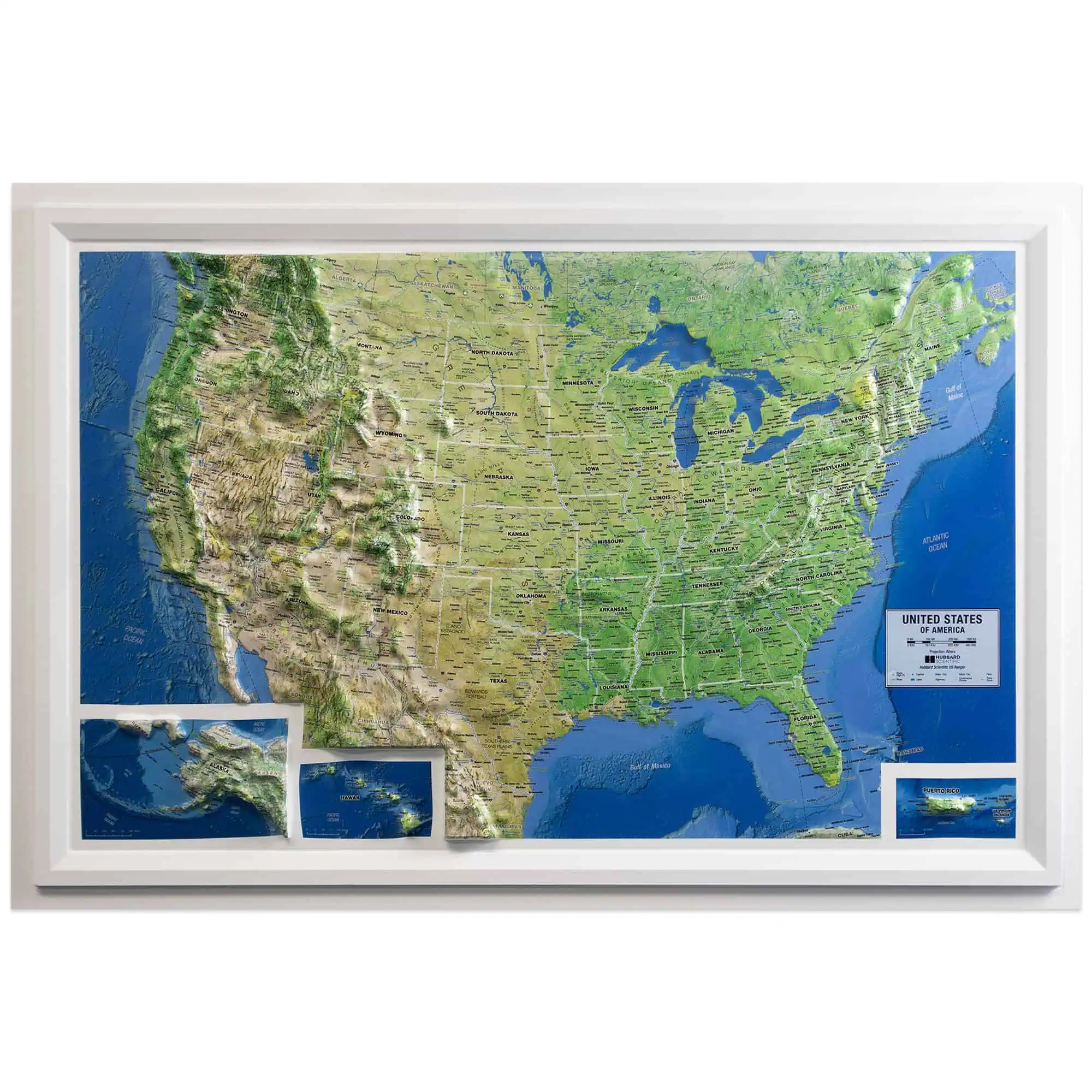

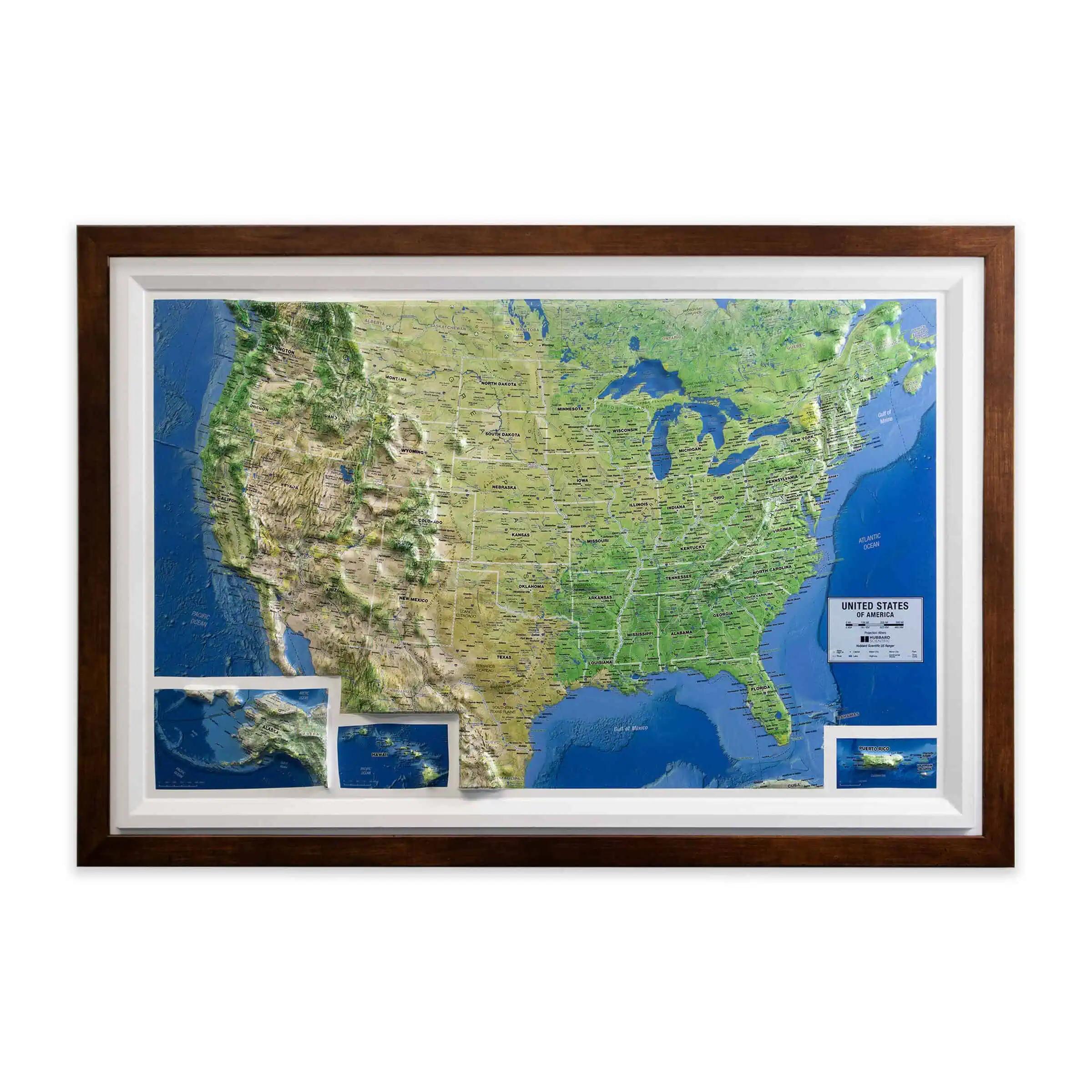


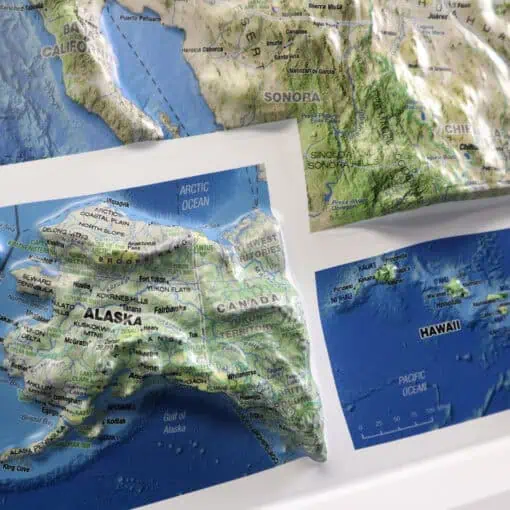


US Ranger Raised Relief Map
Price range: $99.99 through $324.99
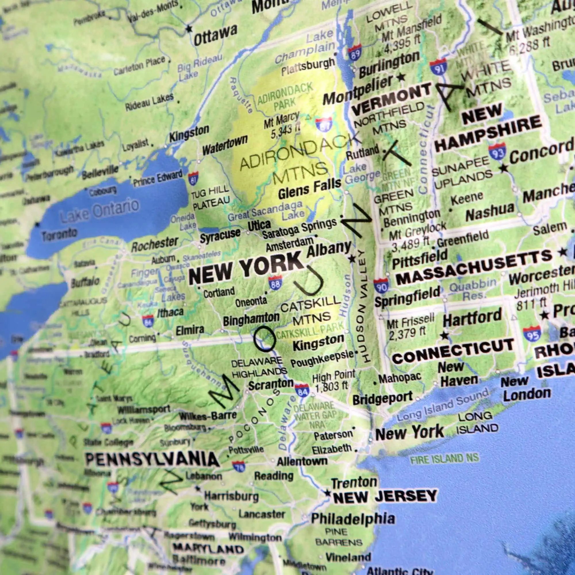
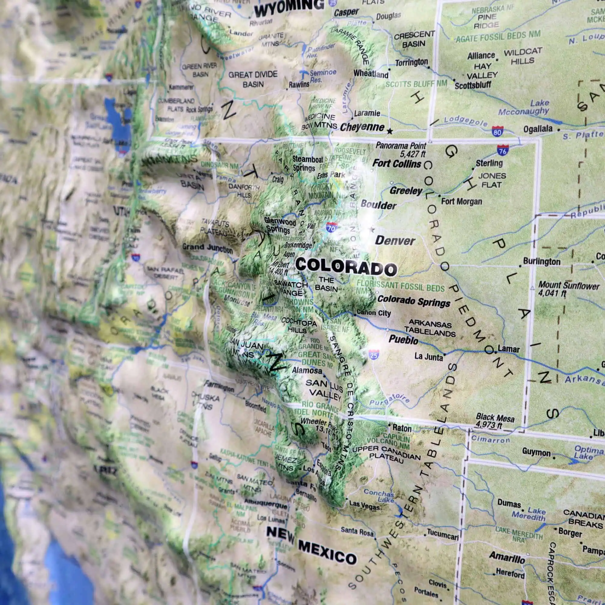
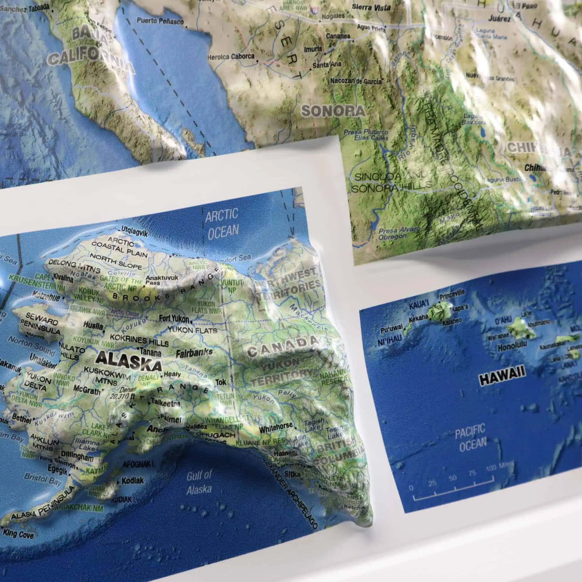
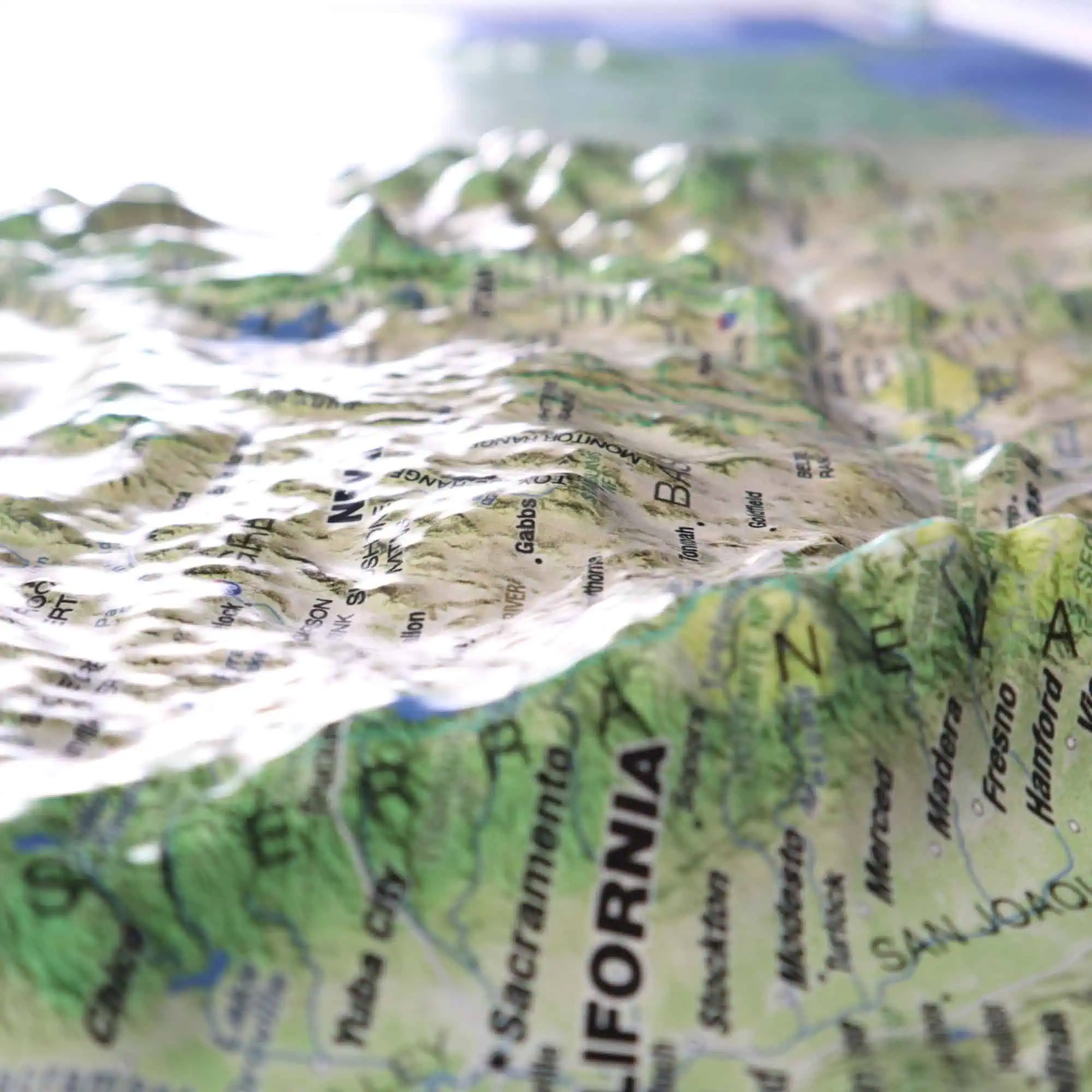
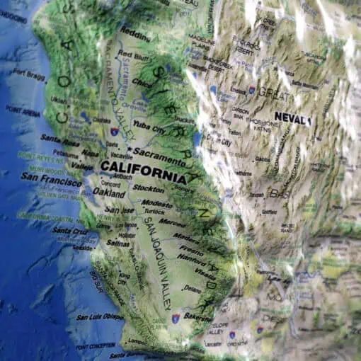
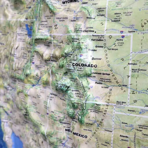
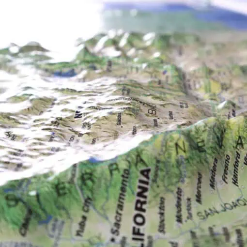
This is a true 3D raised relief map – a superior visual reference.
More About 3D Raised Relief Maps
Raised Relief Maps are superior visual references that give a new perspective. Not only do these maps show you the beauty of the land but they also allow you to touch a scaled representation of the mountains and valleys. Fully three-dimensional, these vacuum-formed vinyl maps use color and shading to represent elevation changes so you get a better understanding of the terrain and landforms. These maps are unique wall decor for homes or offices. The perfect gift for anyone who likes to travel to this region and a wonderfully decorative and informative item for natives and newcomers alike. Click here to learn more about 3D Raised Relief maps and how they are made.
The Map Shop is the largest manufacturer of 3D raised relief maps, under the Hubbard Scientific brand. Click here to learn more about the history of Hubbard Scientific, which spans over 60 years. We begin with a flat map printed on sturdy vinyl. A corresponding custom terrain model mold is carved, using digital elevation data. The vinyl map is carefully registered on the terrain mold, then heated and vacuum-formed over the terrain model. The result is a truly exceptional visual and tactile reference. You will be proud to display one of these raised relief maps in any setting.
Returns
We want you to love your map. If you aren't satisfied, returns are accepted within 30 days for unfinished products.* Please contact us within 30 days of receiving your product to receive a return authorization number. Please note that shipping costs are non-refundable unless we made a mistake with your order.
*Finished products such as railed, mounted, and framed maps are not returnable because we make these on-demand just for you and do not stock them. If you have any questions about whether your order qualifies for a return, please contact us.
Raised Relief Finishing Options

Unframed
Maps are printed on 15-mil vinyl and heat-formed over a mold to create the 3D relief effect. All Raised Relief maps ship flat in protective boxes to preserve the 3D details. Please note that these maps are not standard frame sizes, so our custom framing option is often more cost-effective than local framing.

Mounted
Maps are printed on 15-mil vinyl and heat-formed over a mold to create the 3D relief effect. Maps are then affixed with adhesive onto 1/4″-thick foam core. Mounting offers additional protection by keeping the map flat and rigid. All Raised Relief maps ship flat in protective boxes to preserve the 3D details. Please note that these maps are not standard frame sizes, so our custom framing option is often more cost-effective than local framing.

Framed
Maps are printed on 15-mil vinyl and heat-formed over a mold to create the 3D relief effect. We then mount the map into recycled wood molding with pre-installed hanging hardware, so it arrives ready to hang. Glass is not included, allowing you to touch and feel the relief. Please avoid direct sunlight, as extreme heat can cause the dimensional features to flatten over time. Smaller maps are framed with 1.25"-wide molding and larger maps over 36" x 24" are framed with 2"-wide molding.