What Are Elementary World Maps?
Elementary world maps are educational wall maps mounted on spring rollers, designed to teach young learners the basics of global geography. Featuring simplified labeling, vibrant colors, and intuitive layouts, these maps help students in grades K–5 identify continents, oceans, and countries. Built for daily classroom use, they serve as essential teaching tools for introducing world geography, history, and cultural awareness in an engaging and accessible way.
Elementary world maps are educational wall maps mounted on spring rollers, designed to teach young learners the basics of global geography. Featuring simplified labeling, vibrant colors, and intuitive layouts, these maps help students in grades K–5 identify continents, oceans, and countries. Built for daily classroom use, they serve as essential teaching tools for introducing world geography, history, and cultural awareness in an engaging and accessible way.
What Are the Different Types of Elementary World Maps?
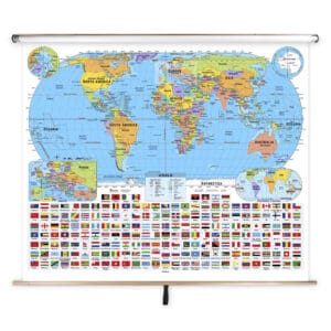
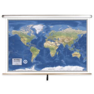
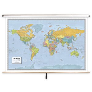
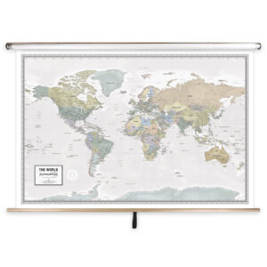
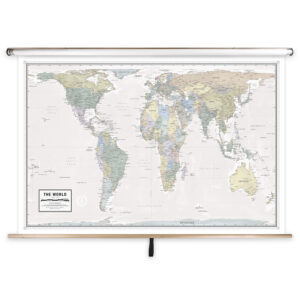
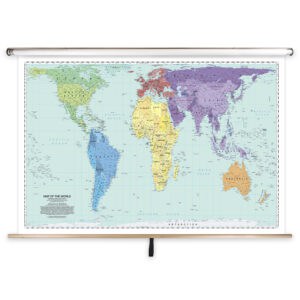
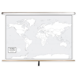
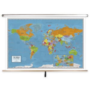
The Elementary World Maps category includes a variety of world maps designed specifically for early learners. Options include simplified political maps with bold country boundaries, physical maps highlighting major landforms, and thematic maps focusing on cultural or environmental topics. Each product is tailored to young students, making it easier for teachers to adapt lessons to their specific curriculum needs while keeping learning interactive and visually engaging.
The Elementary World Maps category includes a variety of world maps designed specifically for early learners. Options include simplified political maps with bold country boundaries, physical maps highlighting major landforms, and thematic maps focusing on cultural or environmental topics. Each product is tailored to young students, making it easier for teachers to adapt lessons to their specific curriculum needs while keeping learning interactive and visually engaging.
What Are the Benefits of Using World Maps in Elementary Classrooms?
Using world maps in elementary classrooms helps students develop foundational geographic knowledge and spatial reasoning skills. By visually representing continents, countries, and oceans, these maps make abstract concepts more concrete and understandable. Teachers can guide discussions on global cultures, environmental features, and historical events, fostering curiosity and building a base for future studies in geography and social sciences.
Using world maps in elementary classrooms helps students develop foundational geographic knowledge and spatial reasoning skills. By visually representing continents, countries, and oceans, these maps make abstract concepts more concrete and understandable. Teachers can guide discussions on global cultures, environmental features, and historical events, fostering curiosity and building a base for future studies in geography and social sciences.
Are Elementary World Maps Good for Classrooms, Offices, and Homes?
Yes. While specifically designed for elementary classrooms, these maps are also ideal for homeschooling, daycare centers, and educational offices. Families use them to teach children about world geography and to explore global travel destinations. The laminated, markable surface makes them practical for frequent handling, allowing lessons to be interactive while keeping the maps clean and long-lasting.
Yes. While specifically designed for elementary classrooms, these maps are also ideal for homeschooling, daycare centers, and educational offices. Families use them to teach children about world geography and to explore global travel destinations. The laminated, markable surface makes them practical for frequent handling, allowing lessons to be interactive while keeping the maps clean and long-lasting.
What Grade Levels Are Elementary World Maps Designed For?
These maps are tailored for grades K–5, with simplified geographic information and clear visuals suitable for younger learners. The maps avoid overwhelming detail, focusing instead on essential information that supports early education. For older students, middle school and high school maps provide more advanced political and physical details to match higher curriculum levels.
These maps are tailored for grades K–5, with simplified geographic information and clear visuals suitable for younger learners. The maps avoid overwhelming detail, focusing instead on essential information that supports early education. For older students, middle school and high school maps provide more advanced political and physical details to match higher curriculum levels.
How Do I Decorate with Elementary World Maps?
Elementary world maps are both functional teaching tools and visually appealing classroom decorations. When retracted, they store neatly above whiteboards or chalkboards, preserving wall space. When pulled down, the bright colors and simplified design create an engaging focal point that draws student interest. At home, these maps can be mounted in learning areas or playrooms as both educational décor and conversation starters.
Elementary world maps are both functional teaching tools and visually appealing classroom decorations. When retracted, they store neatly above whiteboards or chalkboards, preserving wall space. When pulled down, the bright colors and simplified design create an engaging focal point that draws student interest. At home, these maps can be mounted in learning areas or playrooms as both educational décor and conversation starters.
Can I Create a Custom Elementary World Map for My Classroom?
Yes. Custom elementary world maps can be created to match your specific teaching needs. Options include combining multiple maps on one roller, adding branded or district-specific features, or creating simplified regional views for younger learners. Each custom map is produced in-house with high-quality materials and assembled to withstand daily classroom use. Learn more at this page.
Yes. Custom elementary world maps can be created to match your specific teaching needs. Options include combining multiple maps on one roller, adding branded or district-specific features, or creating simplified regional views for younger learners. Each custom map is produced in-house with high-quality materials and assembled to withstand daily classroom use. Learn more at this page.
How Do I Install Elementary World Maps?
Installation is quick and easy. The maps are designed to be mounted above whiteboards or on flat walls, with wall or ceiling mount options available. Units ordered with backboards come pre-attached for hassle-free installation. Proper installation ensures a secure fit and smooth operation. Step-by-step instructions can be found at this link.
Installation is quick and easy. The maps are designed to be mounted above whiteboards or on flat walls, with wall or ceiling mount options available. Units ordered with backboards come pre-attached for hassle-free installation. Proper installation ensures a secure fit and smooth operation. Step-by-step instructions can be found at this link.
Do You Sell Mounting Hardware for Elementary World Maps?
Yes, we provide brackets, backboards, and accessories for securely installing elementary pull down maps. Each order includes backboards and wall brackets, but screws and anchors must be chosen based on the wall material. Visit this page to browse available hardware options.
Yes, we provide brackets, backboards, and accessories for securely installing elementary pull down maps. Each order includes backboards and wall brackets, but screws and anchors must be chosen based on the wall material. Visit this page to browse available hardware options.
What Materials Are Used for Elementary World Maps?
Each map is printed on heavyweight paper, laminated for durability, and mounted on a spring roller for convenient classroom use. The laminated surface works with dry-erase and wet-erase markers, making lessons interactive and easy to update. Backboards are made of powder-coated steel to ensure long-lasting support, and each product is assembled for smooth, reliable use in elementary classrooms.
Each map is printed on heavyweight paper, laminated for durability, and mounted on a spring roller for convenient classroom use. The laminated surface works with dry-erase and wet-erase markers, making lessons interactive and easy to update. Backboards are made of powder-coated steel to ensure long-lasting support, and each product is assembled for smooth, reliable use in elementary classrooms.
What Do Maps Teach Elementary Students?
World maps teach children essential geographic concepts, including the locations of continents, oceans, and countries. They help young learners understand cultural diversity, environmental features, and global relationships. Pull down maps make these lessons visual and interactive, encouraging exploration and discussion while supporting early spatial reasoning skills.
World maps teach children essential geographic concepts, including the locations of continents, oceans, and countries. They help young learners understand cultural diversity, environmental features, and global relationships. Pull down maps make these lessons visual and interactive, encouraging exploration and discussion while supporting early spatial reasoning skills.
What Are the Available Sizes of Elementary World Maps?
Elementary world maps are available in different sizes to suit various classroom needs. Large-format maps are ideal for group instruction, while smaller formats work well in compact learning areas. Exact dimensions for each product are available on the individual product pages within this category.
Elementary world maps are available in different sizes to suit various classroom needs. Large-format maps are ideal for group instruction, while smaller formats work well in compact learning areas. Exact dimensions for each product are available on the individual product pages within this category.
What is BrightWay Educational?
BrightWay Educational is our exclusive brand of classroom maps, including elementary world maps. Updated frequently to reflect the latest geographic and political data, BrightWay maps are designed by cartographers and educators to provide accurate, simplified, and visually engaging resources for early learners. Learn more about BrightWay Educational maps here.
BrightWay Educational is our exclusive brand of classroom maps, including elementary world maps. Updated frequently to reflect the latest geographic and political data, BrightWay maps are designed by cartographers and educators to provide accurate, simplified, and visually engaging resources for early learners. Learn more about BrightWay Educational maps here.
Why Choose The Map Shop for Elementary World Maps?
For over 30 years, The Map Shop has been a trusted provider of educational maps for schools nationwide. Each elementary world map is hand-finished in our Charlotte, NC facility with premium materials and professional assembly techniques. We are dedicated to producing durable, accurate, and visually appealing maps that enhance classroom learning. Read customer reviews here or learn more about our history here.
For over 30 years, The Map Shop has been a trusted provider of educational maps for schools nationwide. Each elementary world map is hand-finished in our Charlotte, NC facility with premium materials and professional assembly techniques. We are dedicated to producing durable, accurate, and visually appealing maps that enhance classroom learning. Read customer reviews here or learn more about our history here.