


National Geographic – Argentina – Adventure Folding Travel Map
$14.95
National Geographic’s Adventure Map of Argentina is an invaluable tool for travelers seeking to explore the diverse landscapes, rich history, and stately architecture of South America’s second largest nation.
Publication: 2022 || Size: 25.5″ x 37.75″
In stock
National Geographic’s Adventure Map of Argentina is an invaluable tool for travelers seeking to explore the diverse landscapes, rich history, and stately architecture of South America’s second largest nation. This expertly crafted map provides global travelers with the perfect combination of detail and perspective, highlighting hundreds of points of interest including archaeological sites, camping areas, museums, beaches, protected areas, World Heritage sites, and more. Cities and towns are clearly indicated and easy to find in the user-friendly index. A road network complete with distances and designations for highways, major routes, roads, unpaved tracks, and more will help you find the route that’s right for you. Every Adventure Map is printed on durable synthetic paper, making them waterproof, tear-resistant and tough — capable of withstanding the rigors of international travel. We love technology and enjoy the convenience of GPS, but you can’t plan a trip on a phone screen and navigation doesn’t work where there’s no cell signal. Start your next trip on the right foot with a high-quality folding travel map. Make the most of your next adventure, even if you lose GPS or cell signals. You’ll always be on the correct route with our folding travel maps. Your adventure starts here!
Coverage Includes
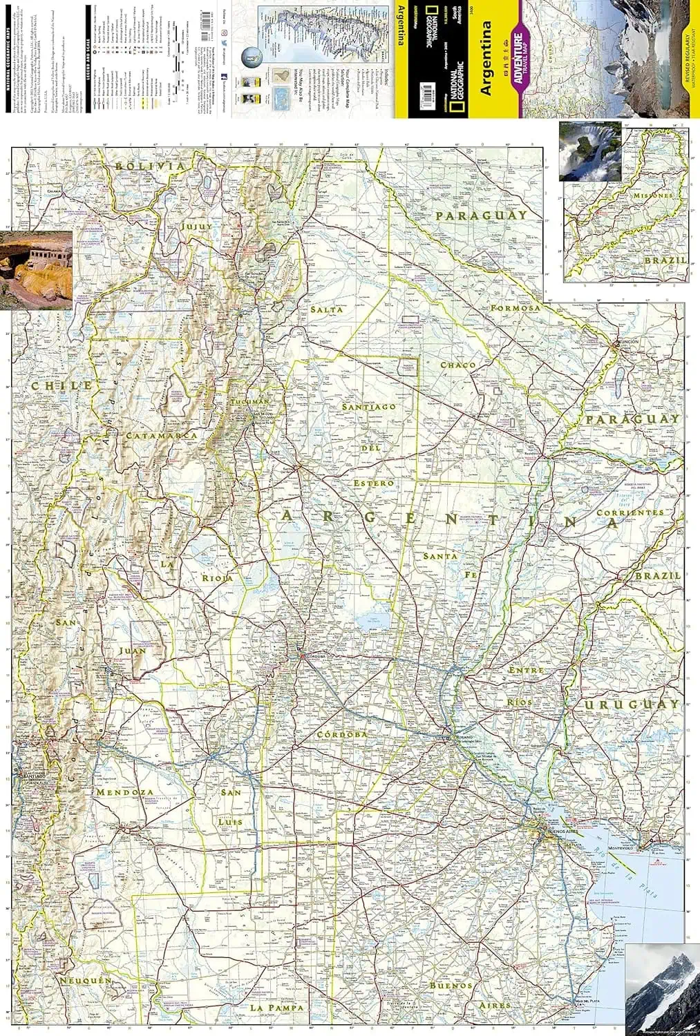
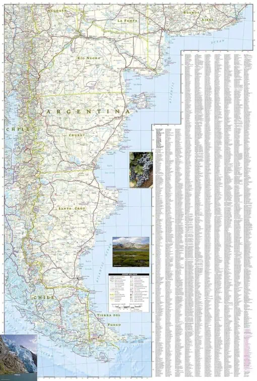
The north side of the print map details the most highly populated areas of the country including the provinces of Buenos Aires, Córdoba, and Santa Fe, as well as the impressive landscape of the Cordillera de los Andes bordering Chile on the northwest. Vineyards in Mendoza, Argentina’s world-renowned wine producing province are included, as are ski areas in this popular tourist region. An inset map shows the small province of Misiones that juts into the neighboring countries of Brazil and Paraguay. The south side of the map details Argentina’s extensive coastline from Mar Del Plata to Tierra Del Fuego highlighting beaches, preserves, and areas noted for fishing and surfing.
What is an Adventure Map?
Adventure Maps are the most authoritative maps for touring international destinations. Each waterproof and tear-resistant map provides travelers with the perfect combination of detail and perspective, highlighting points of interest for those venturing outside city centers. From the plains of France to the top of Mt. Everest these maps cover the hottest adventure destinations.
About the Author
Founded in 1915 as the Map Department of the National Geographic Society, National Geographic Maps is responsible for illustrating the world around us through the art and science of mapmaking. Today, National Geographic Maps continues this mission by creating the world’s best wall maps, outdoor recreation maps, travel maps, atlases and globes that inspire people to care about and explore their world.
Back-Orders & Out-of-Stock Items
If an item is out of stock, it will ship as soon as it becomes available. The expected timeframe is shown in the “Normally Ships in” section below the Add to Cart button. If your order is on backorder, you will receive email updates as we get more information. Our goal is always to deliver your products as quickly as possible.
Returns
We accept free returns within 30 days of delivery. To start a return, please contact us within 30 days to receive a return authorization number. Once we receive the return, we will issue your refund within three business days. Please note: original shipping charges are non-refundable and return shipping costs are your responsibility unless the error was ours.
Returns are not accepted on clearance items. All clearance sales are final.
| Publisher | National Geographic |
|---|---|
| Language | English |
| Print Series |