Raleigh 25-Mile Radius Wall Map
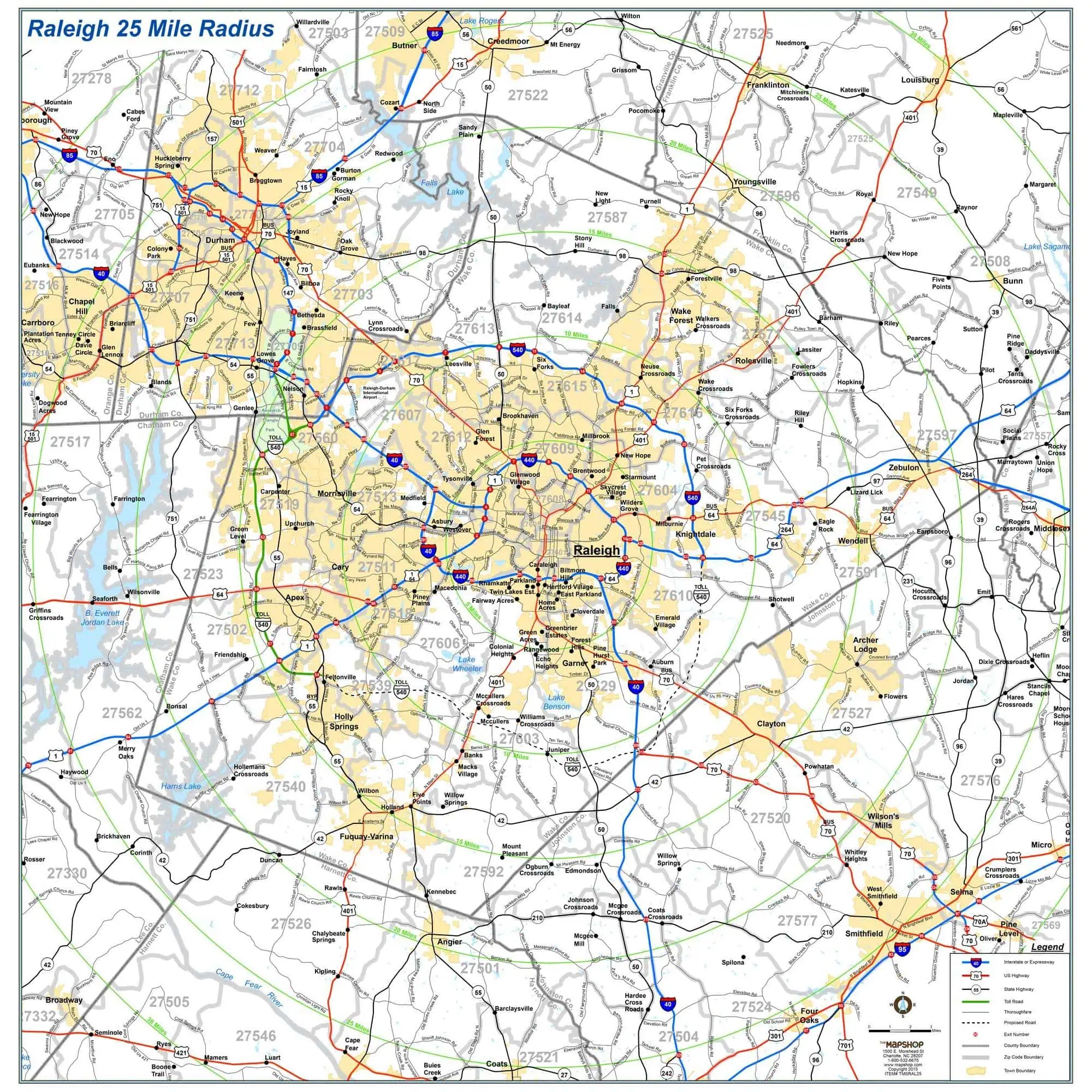
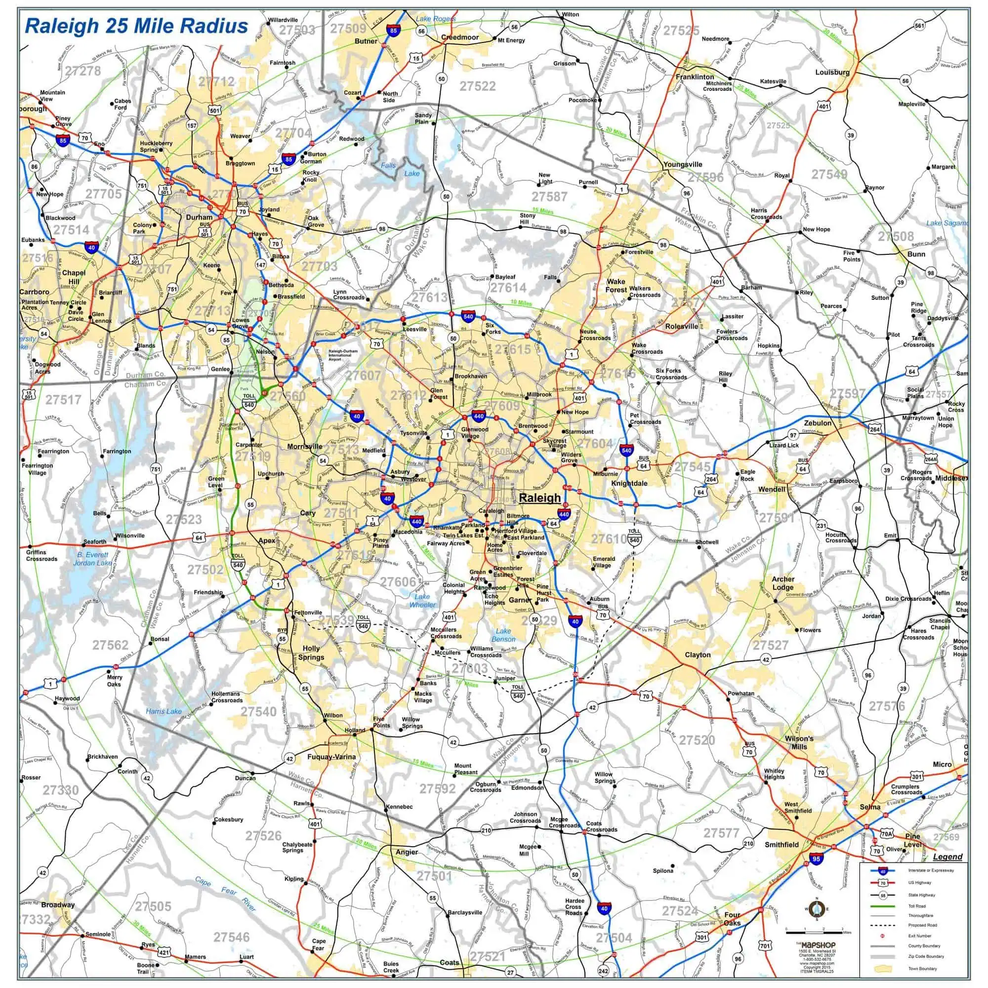
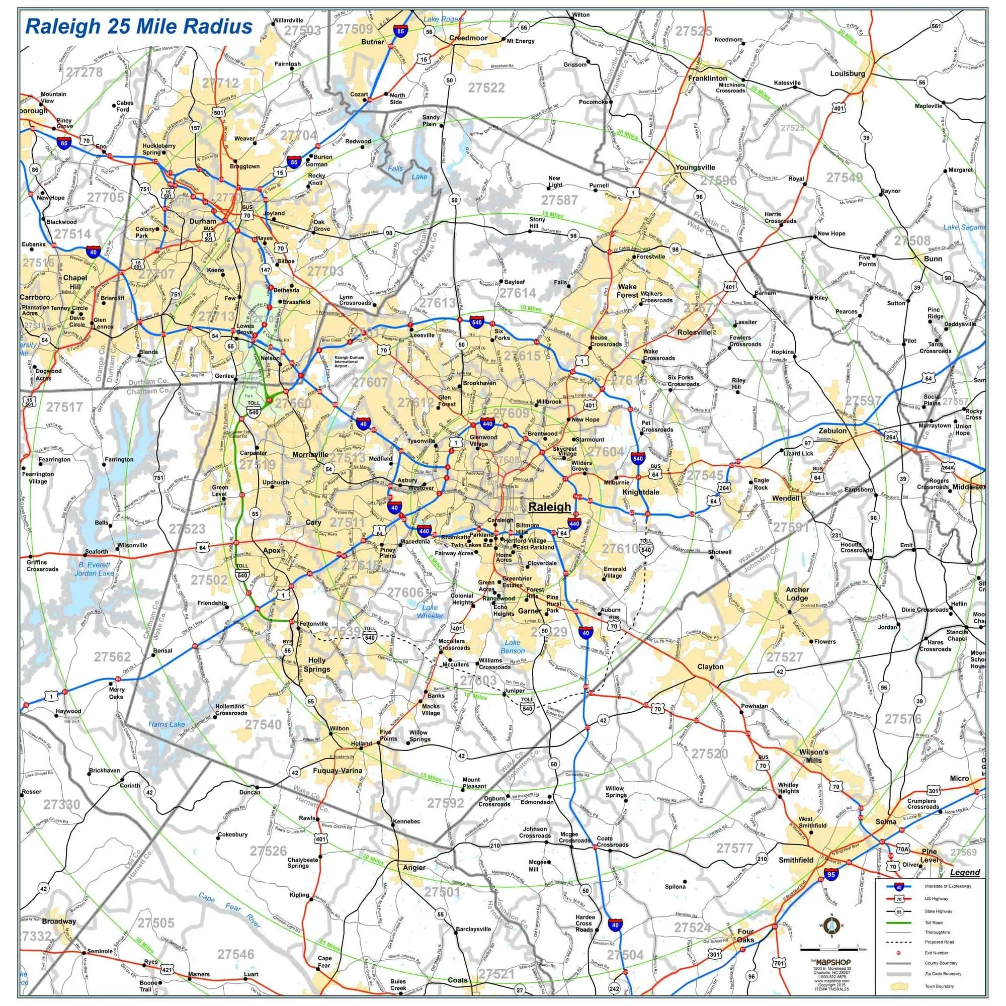
This Map Shop wall map puts downtown Raleigh at the center and spreads out across the Research Triangle, giving territory planners, real estate offices, and dispatch teams a full view of the metro on one wall.
- Coverage spans a circle reaching 25 miles in every direction from Raleigh
- Takes in Wake County plus parts of Durham, Johnston, Franklin, and Chatham counties
- Cities and towns labeled, including Cary, Durham, Apex, Garner, Wake Forest, Clayton, and Morrisville
- Highways and major roads shown, from I-40 and I-440 to US 1, US 64, and US 70
- County boundaries drawn across the full radius
- ZIP codes marked, useful for mailing zones and service areas
- Common uses include sales territory planning, real estate market areas, delivery routing, and service-area reference in a conference room or dispatch office


