Argentina Adventure Map
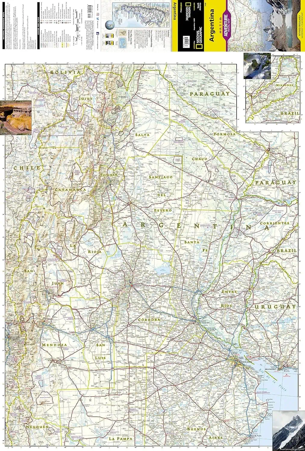
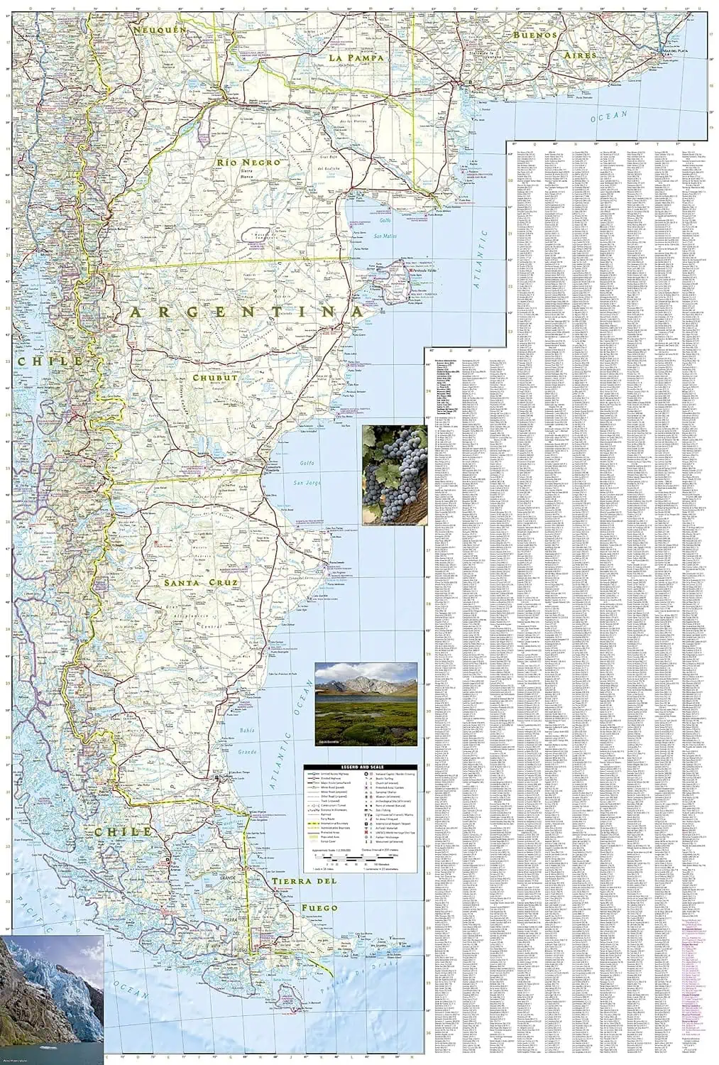
A two-sided map from National Geographic’s Adventure Map series covering Argentina from the Misiones rainforest corner down to Tierra del Fuego. The two printed sides split the country so the central provinces and the long Atlantic coast each have room.
- North side: Buenos Aires, Córdoba and Santa Fe provinces, the most populated part of the country
- Cordillera de los Andes along the border with Chile
- Mendoza wine country, with vineyards and ski areas marked
- Inset of Misiones Province, which juts between Brazil and Paraguay
- South side: the Atlantic coastline from Mar del Plata to Tierra del Fuego, with beaches, preserves, and fishing and surfing areas
- Hundreds of points of interest, including archaeological sites, museums, camping areas, protected areas and World Heritage sites
- Road network with distances, classed from highways and major routes down to unpaved roads
- Index of cities and towns
- Waterproof, tear-resistant synthetic paper
Useful for route planning and as a backup where GPS and cell signal drop out.


