


What Are Combo Pull Down Maps?
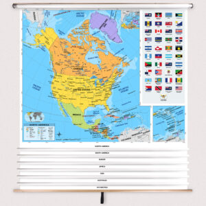
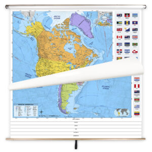
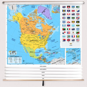
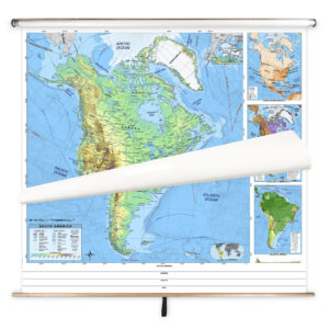
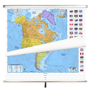
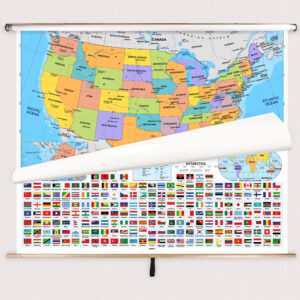
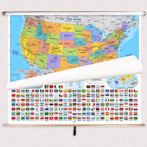
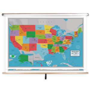
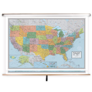
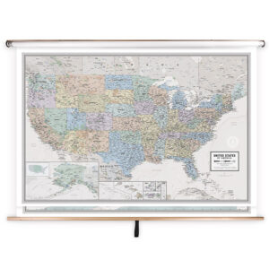
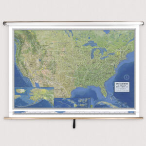
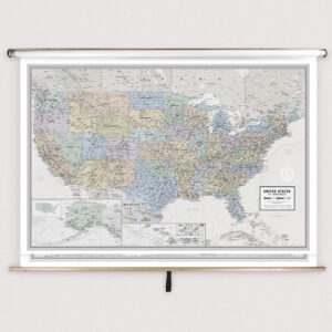
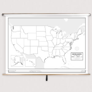
Combo pull down maps are large-format educational maps mounted together on a single spring roller to create a versatile classroom teaching tool. Similar to traditional pull-down charts often found above whiteboards or chalkboards, combo sets allow teachers to access multiple maps from the same mount. A common configuration includes a U.S. map, a world map, and an additional state or continent map. This design saves wall space, streamlines lessons, and supports frequent reference in social studies, geography, and history classrooms. Combo maps are built for daily use in schools, making them a long-term solution for interactive instruction.
Combo pull down maps are large-format educational maps mounted together on a single spring roller to create a versatile classroom teaching tool. Similar to traditional pull-down charts often found above whiteboards or chalkboards, combo sets allow teachers to access multiple maps from the same mount. A common configuration includes a U.S. map, a world map, and an additional state or continent map. This design saves wall space, streamlines lessons, and supports frequent reference in social studies, geography, and history classrooms. Combo maps are built for daily use in schools, making them a long-term solution for interactive instruction.
What Are the Different Types of Combo Maps?
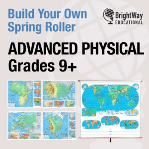
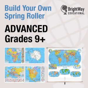
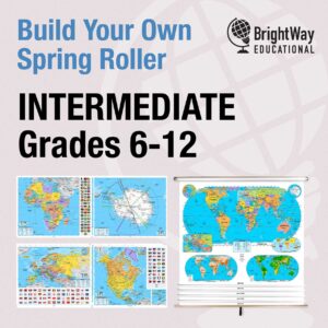
Our Best Selling Combo Maps include a wide range of configurations to meet the needs of different classrooms. Two-map sets are a popular choice for educators who primarily teach U.S. and world geography, while three-map sets often add a state or thematic map to cover more specific regional content. Full five and seven map sets provide the broadest coverage, making them perfect for schools that want access to multiple geographic perspectives without additional hardware. Each set is designed to be age-appropriate, with clear labeling and color schemes that suit elementary, middle, and high school students. These sets allow teachers to cover multiple subjects in a single space-efficient installation.
Our Best Selling Combo Maps include a wide range of configurations to meet the needs of different classrooms. Two-map sets are a popular choice for educators who primarily teach U.S. and world geography, while three-map sets often add a state or thematic map to cover more specific regional content. Full five and seven map sets provide the broadest coverage, making them perfect for schools that want access to multiple geographic perspectives without additional hardware. Each set is designed to be age-appropriate, with clear labeling and color schemes that suit elementary, middle, and high school students. These sets allow teachers to cover multiple subjects in a single space-efficient installation.
What Are the Benefits of Using Combo Maps in the Classroom?
Using combo pull down maps provides several advantages for teachers and students. Having multiple maps mounted together saves space in the classroom and eliminates the need for multiple spring rollers. This setup makes it easy for teachers to transition between different geographic perspectives during lessons, enhancing engagement and supporting comprehensive learning. Students benefit from seeing related maps in one place, which helps them understand how U.S., world, and regional geographies are interconnected. The laminated, markable surface of each map allows teachers to highlight locations, trace routes, and annotate lessons directly on the map for interactive instruction.
Using combo pull down maps provides several advantages for teachers and students. Having multiple maps mounted together saves space in the classroom and eliminates the need for multiple spring rollers. This setup makes it easy for teachers to transition between different geographic perspectives during lessons, enhancing engagement and supporting comprehensive learning. Students benefit from seeing related maps in one place, which helps them understand how U.S., world, and regional geographies are interconnected. The laminated, markable surface of each map allows teachers to highlight locations, trace routes, and annotate lessons directly on the map for interactive instruction.
Are the Maps Good for Classrooms, Offices, and Homes?
Yes. While these combo sets are specifically designed for classrooms, they are also highly effective in offices and homes. Businesses use them to support strategic planning and visualize regional operations, while families often use them as educational décor or to track travel history. The laminated finish of each map ensures durability and easy cleaning, making them practical for high-traffic environments. Combo pull down maps are versatile enough to be used in teaching environments, professional spaces, and even as a stylish, informative addition to a home office or family room.
Yes. While these combo sets are specifically designed for classrooms, they are also highly effective in offices and homes. Businesses use them to support strategic planning and visualize regional operations, while families often use them as educational décor or to track travel history. The laminated finish of each map ensures durability and easy cleaning, making them practical for high-traffic environments. Combo pull down maps are versatile enough to be used in teaching environments, professional spaces, and even as a stylish, informative addition to a home office or family room.
What Grade Levels Are Combo Maps Designed For?
Best Selling Combo Maps are designed for flexibility and can be used across multiple grade levels. Elementary-level sets feature simplified labels and bright colors to support early learners, middle school sets introduce additional geographic detail to develop spatial awareness, and high school or college-level sets incorporate advanced political, physical, and thematic information. Each map is tailored to meet curriculum standards and comprehension levels, ensuring that educators can effectively teach geography and history at every stage of learning.
Best Selling Combo Maps are designed for flexibility and can be used across multiple grade levels. Elementary-level sets feature simplified labels and bright colors to support early learners, middle school sets introduce additional geographic detail to develop spatial awareness, and high school or college-level sets incorporate advanced political, physical, and thematic information. Each map is tailored to meet curriculum standards and comprehension levels, ensuring that educators can effectively teach geography and history at every stage of learning.
How Do I Decorate with Combo Maps?
Combo pull down maps are not only functional teaching tools but can also enhance classroom aesthetics. When rolled up, they store neatly above chalkboards or whiteboards, keeping the space organized. When pulled down, they create a visually engaging focal point that sparks curiosity and discussion among students. In offices or homes, multi-map sets can be mounted as part of a professional display or framed to serve as decorative wall art. The detailed cartography and vibrant colors of these maps make them an attractive addition to any educational or professional environment.
Combo pull down maps are not only functional teaching tools but can also enhance classroom aesthetics. When rolled up, they store neatly above chalkboards or whiteboards, keeping the space organized. When pulled down, they create a visually engaging focal point that sparks curiosity and discussion among students. In offices or homes, multi-map sets can be mounted as part of a professional display or framed to serve as decorative wall art. The detailed cartography and vibrant colors of these maps make them an attractive addition to any educational or professional environment.
Can I Create a Custom Combo Map for My Classroom?
Yes. We specialize in designing custom combo map sets for schools and organizations. Custom solutions allow you to combine any selection of maps—such as U.S., world, state, or continent maps—onto a single roller to match your specific curriculum needs. Options include district-specific boundaries, branded maps, unique thematic content, and private-label maps for resellers. All custom sets are assembled in-house using high-quality hardware and premium materials. Learn more about custom options at this page.
Yes. We specialize in designing custom combo map sets for schools and organizations. Custom solutions allow you to combine any selection of maps—such as U.S., world, state, or continent maps—onto a single roller to match your specific curriculum needs. Options include district-specific boundaries, branded maps, unique thematic content, and private-label maps for resellers. All custom sets are assembled in-house using high-quality hardware and premium materials. Learn more about custom options at this page.
How Do I Install Combo Pull Down Maps?
Installation is straightforward. Our combo map sets are designed to be mounted above whiteboards or on flat walls, with options for both wall and ceiling mounting. Orders with backboards come pre-attached and ready to hang. For multi-map installations or replacements, following proper installation instructions ensures secure and long-lasting mounting. Detailed instructions can be found at this link.
Installation is straightforward. Our combo map sets are designed to be mounted above whiteboards or on flat walls, with options for both wall and ceiling mounting. Orders with backboards come pre-attached and ready to hang. For multi-map installations or replacements, following proper installation instructions ensures secure and long-lasting mounting. Detailed instructions can be found at this link.
Do You Sell Mounting Hardware for Combo Maps?
Yes, we provide a full range of mounting hardware specifically designed for combo pull down maps. This includes brackets, backboards, and accessories that ensure secure, stable installations. Each combo map order includes the necessary backboards and wall brackets, but screws and anchors must be selected based on your wall material. To see available hardware options, visit this page.
Yes, we provide a full range of mounting hardware specifically designed for combo pull down maps. This includes brackets, backboards, and accessories that ensure secure, stable installations. Each combo map order includes the necessary backboards and wall brackets, but screws and anchors must be selected based on your wall material. To see available hardware options, visit this page.
What Materials Are Used for Combo Maps?
Each map in our combo sets is printed on heavyweight paper, laminated to provide a markable and easy-to-clean surface, and mounted together on a durable spring roller. The laminated finish is compatible with both dry-erase and wet-erase markers, allowing for interactive teaching. Backboards are constructed from powder-coated steel for strength and longevity, ensuring that these maps withstand years of daily use in classrooms. Multi-map sets are carefully assembled to provide smooth, reliable operation.
Each map in our combo sets is printed on heavyweight paper, laminated to provide a markable and easy-to-clean surface, and mounted together on a durable spring roller. The laminated finish is compatible with both dry-erase and wet-erase markers, allowing for interactive teaching. Backboards are constructed from powder-coated steel for strength and longevity, ensuring that these maps withstand years of daily use in classrooms. Multi-map sets are carefully assembled to provide smooth, reliable operation.
What Do Maps Teach Students?
Maps are powerful teaching tools that foster interactive and engaging lessons. They help students develop spatial reasoning, understand geographic relationships, and connect historical events to physical locations. Combo maps make it possible to switch between perspectives quickly, helping students see how local, national, and global geographies relate to one another. This versatility supports a deeper understanding of complex subjects and enhances visual learning in the classroom.
Maps are powerful teaching tools that foster interactive and engaging lessons. They help students develop spatial reasoning, understand geographic relationships, and connect historical events to physical locations. Combo maps make it possible to switch between perspectives quickly, helping students see how local, national, and global geographies relate to one another. This versatility supports a deeper understanding of complex subjects and enhances visual learning in the classroom.
What Are the Available Sizes of Combo Maps?
Combo map sets come in various sizes depending on the included maps and their intended use. Large-format maps are ideal for elementary classrooms where students need bold, clear visuals, while more compact sets suit older students and college environments. Because sizes vary based on the combination of maps, detailed dimensions are provided on individual product pages within the Best Selling Combo Maps category.
Combo map sets come in various sizes depending on the included maps and their intended use. Large-format maps are ideal for elementary classrooms where students need bold, clear visuals, while more compact sets suit older students and college environments. Because sizes vary based on the combination of maps, detailed dimensions are provided on individual product pages within the Best Selling Combo Maps category.
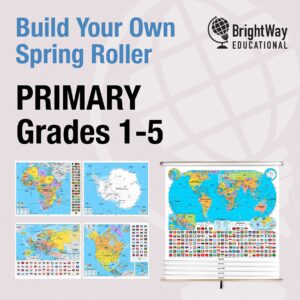
What is BrightWay Educational?
BrightWay Educational is our exclusive line of classroom pull down maps, including many popular combo sets, developed for maximum clarity, accuracy, and instructional value. BrightWay maps are frequently updated to reflect the latest geographic and political information and feature enhanced labeling, vivid colors, and thorough coverage of key features. Designed in collaboration with educators and cartographers, BrightWay combo maps set the standard for quality educational maps. Learn more about BrightWay Educational maps here.
BrightWay Educational is our exclusive line of classroom pull down maps, including many popular combo sets, developed for maximum clarity, accuracy, and instructional value. BrightWay maps are frequently updated to reflect the latest geographic and political information and feature enhanced labeling, vivid colors, and thorough coverage of key features. Designed in collaboration with educators and cartographers, BrightWay combo maps set the standard for quality educational maps. Learn more about BrightWay Educational maps here.
Why Choose The Map Shop for Combo Maps?
Since 1990, The Map Shop has been a trusted provider of high-quality educational maps to schools across the United States. Each combo set is hand-finished at our Charlotte, NC facility using premium materials and professional mounting techniques. Our expertise in cartography and commitment to customer satisfaction ensure that you receive durable, accurate maps designed to enhance learning for years to come. Read customer reviews here or learn more about our history here.
Since 1990, The Map Shop has been a trusted provider of high-quality educational maps to schools across the United States. Each combo set is hand-finished at our Charlotte, NC facility using premium materials and professional mounting techniques. Our expertise in cartography and commitment to customer satisfaction ensure that you receive durable, accurate maps designed to enhance learning for years to come. Read customer reviews here or learn more about our history here.