

What Are Folding Travel Maps for the United States?
United States folding travel maps are designed for on-the-go navigation, offering a compact yet detailed look at states, regions, and cities across the country. Unlike digital GPS, these maps don’t rely on signal coverage or battery life, making them ideal for long road trips, rural exploration, and scenic drives. They feature clear road networks, distances, and points of interest, ensuring you can plan and navigate your route confidently.
United States folding travel maps are designed for on-the-go navigation, offering a compact yet detailed look at states, regions, and cities across the country. Unlike digital GPS, these maps don’t rely on signal coverage or battery life, making them ideal for long road trips, rural exploration, and scenic drives. They feature clear road networks, distances, and points of interest, ensuring you can plan and navigate your route confidently.
Why Use a Paper Map Instead of GPS for U.S. Travel?
GPS is useful but can fail when traveling through remote areas or when digital data is outdated. Folding travel maps provide a full visual overview of your route, allow you to plan detours, and highlight scenic drives, rest stops, and attractions that GPS might overlook. They also let you mark your route and make notes during the trip, making them a practical and reliable backup or primary navigation tool.
GPS is useful but can fail when traveling through remote areas or when digital data is outdated. Folding travel maps provide a full visual overview of your route, allow you to plan detours, and highlight scenic drives, rest stops, and attractions that GPS might overlook. They also let you mark your route and make notes during the trip, making them a practical and reliable backup or primary navigation tool.
What Types of U.S. Folding Travel Maps Are Available?
We offer a wide range of folding travel maps for the United States, organized into helpful subcategories. Browse our U.S. Folding Travel Maps for nationwide coverage. For multi-state journeys, explore Regional United States Maps. If you need detailed navigation, our US Folding State Maps and US Folding City Maps provide in-depth road and street information for every state and major city. With these options, you can easily find the right map for your next trip.
We offer a wide range of folding travel maps for the United States, organized into helpful subcategories. Browse our U.S. Folding Travel Maps for nationwide coverage. For multi-state journeys, explore Regional United States Maps. If you need detailed navigation, our US Folding State Maps and US Folding City Maps provide in-depth road and street information for every state and major city. With these options, you can easily find the right map for your next trip.
What is the Difference Between Nationwide, Regional, State, and City Maps?
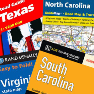
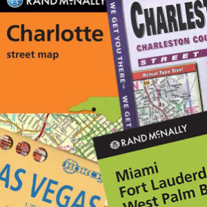
Nationwide folding travel maps cover the entire country in a single sheet, making them great for long cross-country trips. Regional maps focus on multi-state areas, ideal for road trips through specific sections of the U.S. State maps provide detailed coverage of road networks, highways, and local attractions for individual states, while city maps zoom in on urban areas, showing streets, landmarks, public transit, and points of interest. Choosing the right type depends on your destination and how much detail you need for your journey.
Nationwide folding travel maps cover the entire country in a single sheet, making them great for long cross-country trips. Regional maps focus on multi-state areas, ideal for road trips through specific sections of the U.S. State maps provide detailed coverage of road networks, highways, and local attractions for individual states, while city maps zoom in on urban areas, showing streets, landmarks, public transit, and points of interest. Choosing the right type depends on your destination and how much detail you need for your journey.
Are Folding U.S. Travel Maps Good for Road Trips?
Yes. Folding travel maps are designed for road trips across the U.S. They highlight interstates, scenic byways, rest areas, and attractions that enhance the travel experience. Because they don’t depend on batteries or reception, they’re a reliable companion for long drives through remote or rural areas. Whether you’re heading to national parks, coastal highways, or small towns, a paper map ensures you always know where you’re going.
Yes. Folding travel maps are designed for road trips across the U.S. They highlight interstates, scenic byways, rest areas, and attractions that enhance the travel experience. Because they don’t depend on batteries or reception, they’re a reliable companion for long drives through remote or rural areas. Whether you’re heading to national parks, coastal highways, or small towns, a paper map ensures you always know where you’re going.
Do Folding Travel Maps Show Points of Interest?
Most folding travel maps include more than just road layouts. They feature symbols for parks, campgrounds, gas stations, historical sites, and scenic routes. Some maps also include topographic shading, elevation markers, and travel guides to help you discover unique stops and experiences along your trip.
Most folding travel maps include more than just road layouts. They feature symbols for parks, campgrounds, gas stations, historical sites, and scenic routes. Some maps also include topographic shading, elevation markers, and travel guides to help you discover unique stops and experiences along your trip.
What Finishes Are Available for Folding Travel Maps?
Our folding travel maps come in several finishes, including standard paper, laminated versions for repeated use, and waterproof synthetic material for rugged outdoor trips. Spiral-bound options are available for certain atlases, making them easy to flip through during planning and travel. Product pages detail the finish and material for each map, allowing you to select the best option for your journey.
Our folding travel maps come in several finishes, including standard paper, laminated versions for repeated use, and waterproof synthetic material for rugged outdoor trips. Spiral-bound options are available for certain atlases, making them easy to flip through during planning and travel. Product pages detail the finish and material for each map, allowing you to select the best option for your journey.
How Often Are U.S. Folding Travel Maps Updated?
Many folding travel maps for the United States are updated every one to two years to reflect changes in highways, routes, and points of interest. This ensures that your printed map provides current information for safe and accurate navigation throughout your trip.
Many folding travel maps for the United States are updated every one to two years to reflect changes in highways, routes, and points of interest. This ensures that your printed map provides current information for safe and accurate navigation throughout your trip.
Why Buy Folding Travel Maps for the United States from The Map Shop?
The Map Shop has been helping travelers navigate the U.S. since 1990 with high-quality printed maps from trusted publishers like Rand McNally and National Geographic. Every map is inspected and shipped from our Charlotte, NC facility by a team passionate about maps. Whether you’re planning a cross-country drive, a regional road trip, or exploring a single city, we have the folding maps you need to travel confidently. Our staff provides personalized support to help you find the right map for your adventure.
The Map Shop has been helping travelers navigate the U.S. since 1990 with high-quality printed maps from trusted publishers like Rand McNally and National Geographic. Every map is inspected and shipped from our Charlotte, NC facility by a team passionate about maps. Whether you’re planning a cross-country drive, a regional road trip, or exploring a single city, we have the folding maps you need to travel confidently. Our staff provides personalized support to help you find the right map for your adventure.