
What Are National Park Raised Relief Maps?
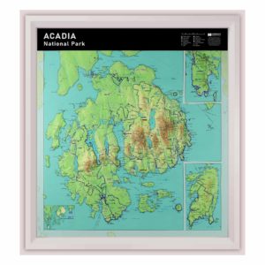
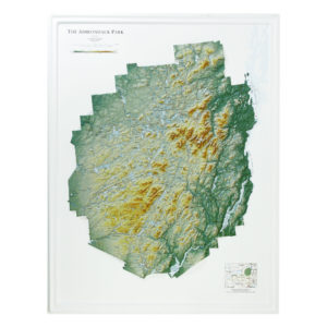
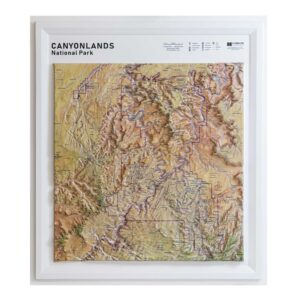
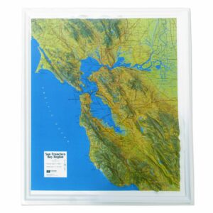
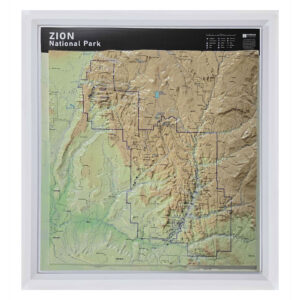
National park raised relief maps are three-dimensional representations of the terrain inside specific U.S. national parks. They are molded from elevation data to accurately show mountains, valleys, lakes, and ridges. These maps provide a detailed and physical sense of a park’s topography and are printed in full color for added clarity and beauty. They are ideal for trip planning, education, and display.
National park raised relief maps are three-dimensional representations of the terrain inside specific U.S. national parks. They are molded from elevation data to accurately show mountains, valleys, lakes, and ridges. These maps provide a detailed and physical sense of a park’s topography and are printed in full color for added clarity and beauty. They are ideal for trip planning, education, and display.
Which Parks Are Available as 3D Maps?
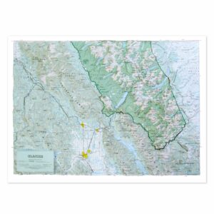
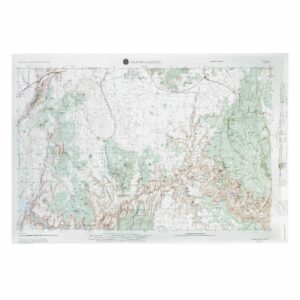
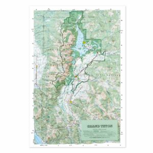
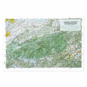
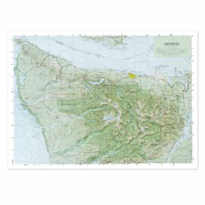
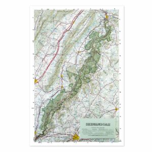
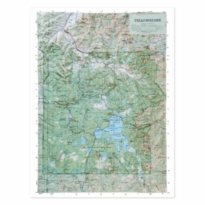
We offer raised relief maps of some of the most visited and topographically interesting national parks, including Grand Canyon, Yellowstone, Yosemite, Great Smoky Mountains, and more. These maps focus on natural features and elevation, rather than roads or visitor centers, which makes them excellent for hikers, educators, and collectors. Check each product page to explore what is available for your favorite park.
We offer raised relief maps of some of the most visited and topographically interesting national parks, including Grand Canyon, Yellowstone, Yosemite, Great Smoky Mountains, and more. These maps focus on natural features and elevation, rather than roads or visitor centers, which makes them excellent for hikers, educators, and collectors. Check each product page to explore what is available for your favorite park.
Why Choose a 3D Map for a National Park?
A raised relief map of a national park lets you see the park the way nature made it—through terrain. These maps bring the elevation and landforms to life in a way flat maps cannot. They’re perfect for visualizing hiking routes, understanding watershed boundaries, or just appreciating the complexity of the land. For park enthusiasts, a raised relief map also serves as a beautiful and meaningful keepsake.
A raised relief map of a national park lets you see the park the way nature made it—through terrain. These maps bring the elevation and landforms to life in a way flat maps cannot. They’re perfect for visualizing hiking routes, understanding watershed boundaries, or just appreciating the complexity of the land. For park enthusiasts, a raised relief map also serves as a beautiful and meaningful keepsake.
Are These Maps Accurate?
Yes. National park raised relief maps are created using official elevation data and scaled to the park’s layout. Vertical exaggeration is used to make terrain stand out more clearly, especially in smaller formats. Each map is labeled with key features and is crafted for both visual accuracy and physical durability.
Yes. National park raised relief maps are created using official elevation data and scaled to the park’s layout. Vertical exaggeration is used to make terrain stand out more clearly, especially in smaller formats. Each map is labeled with key features and is crafted for both visual accuracy and physical durability.
Can You Frame a National Park Relief Map?
Yes, and it’s a great way to turn your favorite park into wall art. These maps can be mounted in shadowbox or open-style frames to preserve their 3D shape. Framing adds impact and makes them ideal for cabins, living rooms, offices, or as a gift for national park lovers. Just be sure not to frame them under glass, since that would flatten the relief.
Yes, and it’s a great way to turn your favorite park into wall art. These maps can be mounted in shadowbox or open-style frames to preserve their 3D shape. Framing adds impact and makes them ideal for cabins, living rooms, offices, or as a gift for national park lovers. Just be sure not to frame them under glass, since that would flatten the relief.
Are These Maps Good for Trip Planning?
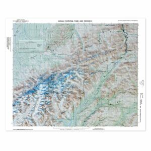
Definitely. While not a substitute for a trail map, raised relief maps give you a clear understanding of the park’s terrain before you visit. They help with route visualization, elevation awareness, and general topographic orientation. They are especially useful when teaching park geography or preparing students for outdoor exploration.
Definitely. While not a substitute for a trail map, raised relief maps give you a clear understanding of the park’s terrain before you visit. They help with route visualization, elevation awareness, and general topographic orientation. They are especially useful when teaching park geography or preparing students for outdoor exploration.
What Size Are National Park Relief Maps?
Most national park raised relief maps range in size from 18 to 30 inches wide. This makes them small enough to fit in an office or classroom, but large enough to show key features like canyons, ridgelines, and major landmarks. Exact dimensions are listed on each product page.
Most national park raised relief maps range in size from 18 to 30 inches wide. This makes them small enough to fit in an office or classroom, but large enough to show key features like canyons, ridgelines, and major landmarks. Exact dimensions are listed on each product page.
What Is the Hubbard Scientific Brand?
Hubbard Scientific is a trusted producer of educational raised relief maps, including several national park editions. These maps are known for their durability, clarity, and visual accuracy. All maps are made in the United States, and The Map Shop is the exclusive manufacturer. Learn more about the Hubbard Scientific brand and history here.
Hubbard Scientific is a trusted producer of educational raised relief maps, including several national park editions. These maps are known for their durability, clarity, and visual accuracy. All maps are made in the United States, and The Map Shop is the exclusive manufacturer. Learn more about the Hubbard Scientific brand and history here.
Why Buy National Park Relief Maps from The Map Shop?
The Map Shop is the exclusive manufacturer of all Hubbard Scientific raised relief maps, including our national park collection. We’ve been producing high-quality maps in Charlotte, NC for decades and are passionate about helping people connect with geography through tangible, visual tools. Whether you’re shopping for education, travel, or display, our team is here to help you find the perfect map.
The Map Shop is the exclusive manufacturer of all Hubbard Scientific raised relief maps, including our national park collection. We’ve been producing high-quality maps in Charlotte, NC for decades and are passionate about helping people connect with geography through tangible, visual tools. Whether you’re shopping for education, travel, or display, our team is here to help you find the perfect map.