


What Are Educational Wall Maps?
Educational maps are visual tools created to teach geographic, political, historical, or thematic information in a format that is easy for students to understand. They support a wide range of subjects including geography, history, social studies, and science by helping students connect abstract concepts to real-world locations. These maps are designed with clarity in mind, using large fonts, color coding, and details like flags, population data, and landforms. Unlike decorative maps, educational maps are built for comprehension, repeated use, and durability in classroom settings. They promote geographic literacy, spatial awareness, and hands-on learning through clear and accurate representations.
Educational maps are visual tools created to teach geographic, political, historical, or thematic information in a format that is easy for students to understand. They support a wide range of subjects including geography, history, social studies, and science by helping students connect abstract concepts to real-world locations. These maps are designed with clarity in mind, using large fonts, color coding, and details like flags, population data, and landforms. Unlike decorative maps, educational maps are built for comprehension, repeated use, and durability in classroom settings. They promote geographic literacy, spatial awareness, and hands-on learning through clear and accurate representations.
What Types of Classroom Maps Are Available?
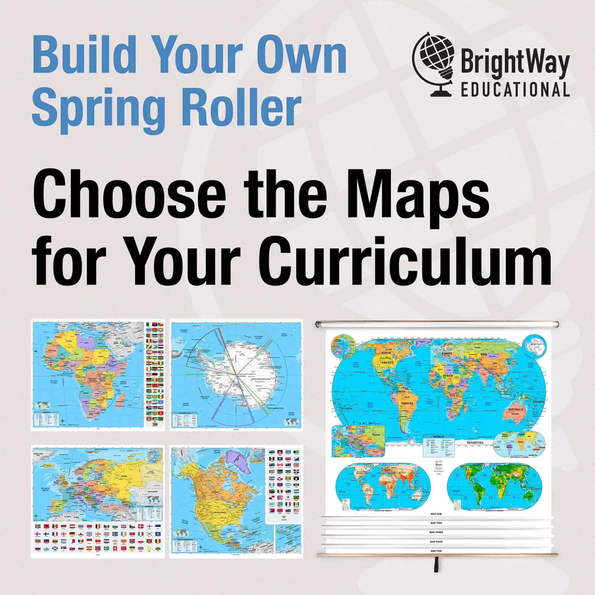
We offer a variety of classroom maps to match different teaching styles and environments. Our Best Selling Combo Maps combine U.S., world, and regional maps on a single spring roller, making it easy to switch topics without changing displays. Custom Spring Roller Maps let you create your own combinations based on your curriculum. The Classroom Pull Down Maps section includes all pull-down options for quick reference. Raised Relief Maps add a tactile layer to physical geography instruction. For state-specific lessons, our Maps by State focus on local geography and key features. Map Accessories like markers, pins, and stickers encourage interactive use and help students engage with the material directly.
We offer a variety of classroom maps to match different teaching styles and environments. Our Best Selling Combo Maps combine U.S., world, and regional maps on a single spring roller, making it easy to switch topics without changing displays. Custom Spring Roller Maps let you create your own combinations based on your curriculum. The Classroom Pull Down Maps section includes all pull-down options for quick reference. Raised Relief Maps add a tactile layer to physical geography instruction. For state-specific lessons, our Maps by State focus on local geography and key features. Map Accessories like markers, pins, and stickers encourage interactive use and help students engage with the material directly.
What Grade Levels Are These Maps Designed For?
Our maps are suitable for students of all ages, from elementary through high school and even college. Younger learners benefit from simplified visuals and bold labels that introduce basic geography and spatial awareness. As students progress, they work with more complex maps showing political boundaries, climate zones, and historical developments. Our maps are commonly used in K-12 schools, homeschool programs, and higher education. Each product page includes notes on appropriate grade levels, so you can select the right map based on your instructional goals. Click here to view the Classroom Map section, then select your grade level to view the available maps.
Our maps are suitable for students of all ages, from elementary through high school and even college. Younger learners benefit from simplified visuals and bold labels that introduce basic geography and spatial awareness. As students progress, they work with more complex maps showing political boundaries, climate zones, and historical developments. Our maps are commonly used in K-12 schools, homeschool programs, and higher education. Each product page includes notes on appropriate grade levels, so you can select the right map based on your instructional goals. Click here to view the Classroom Map section, then select your grade level to view the available maps.
Are These Maps Durable Enough for Classroom Use?
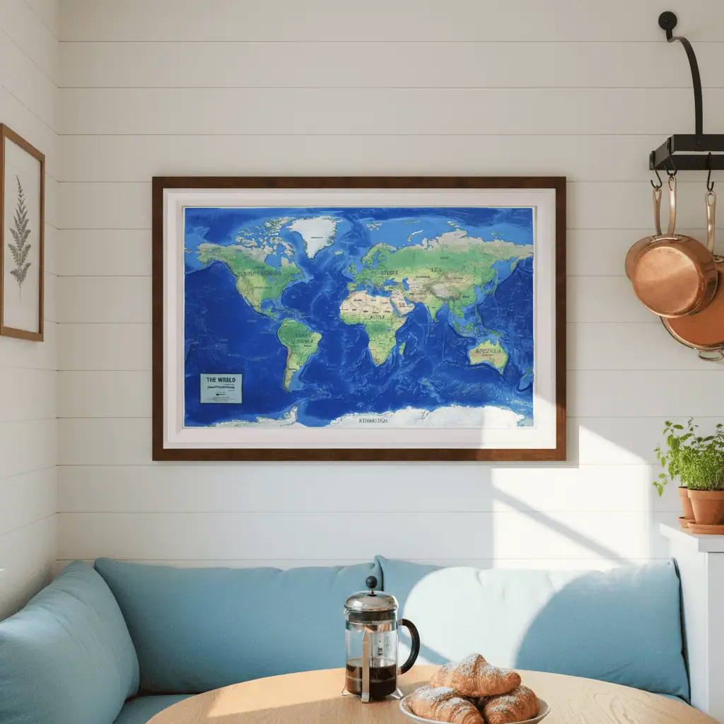
Yes. Every classroom map we offer is designed for regular use in active learning environments. Pull-down maps feature reliable spring roller systems for easy storage and quick access. Laminated wall maps are printed on strong paper stock that can withstand daily handling and repeated use with wet-erase markers. These materials are selected for durability and clarity, allowing educators to use the maps for many years without sacrificing visual quality or function.
Yes. Every classroom map we offer is designed for regular use in active learning environments. Pull-down maps feature reliable spring roller systems for easy storage and quick access. Laminated wall maps are printed on strong paper stock that can withstand daily handling and repeated use with wet-erase markers. These materials are selected for durability and clarity, allowing educators to use the maps for many years without sacrificing visual quality or function.
Why Choose Physical Maps Over Digital?
Digital maps offer flexibility, but physical maps remain essential in many classrooms. Wall maps, pull-down sets, and globes provide a shared visual anchor that supports discussion, exploration, and student participation. Physical maps stay in view throughout a lesson, reinforcing concepts and reducing distractions. Students can trace routes, compare regions, and grasp spatial relationships in a way that encourages tactile learning. While digital tools can provide added detail, physical maps offer a reliable, distraction-free format that helps students develop foundational geographic knowledge without relying on devices.
Digital maps offer flexibility, but physical maps remain essential in many classrooms. Wall maps, pull-down sets, and globes provide a shared visual anchor that supports discussion, exploration, and student participation. Physical maps stay in view throughout a lesson, reinforcing concepts and reducing distractions. Students can trace routes, compare regions, and grasp spatial relationships in a way that encourages tactile learning. While digital tools can provide added detail, physical maps offer a reliable, distraction-free format that helps students develop foundational geographic knowledge without relying on devices.
Can I Make My Maps Interactive for Students?
Absolutely. Map accessories like push pins, stickers, and wet-erase markers let students interact directly with the map. They can label regions, draw migration routes, or highlight areas connected to lessons. Teachers can also encourage students to create their own maps as part of projects or presentations. These interactive activities build map-reading skills, spatial reasoning, and engagement. Students retain more information when they actively participate in lessons, and physical maps make that possible in a hands-on format.
Absolutely. Map accessories like push pins, stickers, and wet-erase markers let students interact directly with the map. They can label regions, draw migration routes, or highlight areas connected to lessons. Teachers can also encourage students to create their own maps as part of projects or presentations. These interactive activities build map-reading skills, spatial reasoning, and engagement. Students retain more information when they actively participate in lessons, and physical maps make that possible in a hands-on format.
How Do I Choose the Right Map for My Classroom?
Start by thinking about how you will use the map. Pull-down maps on spring rollers are ideal for daily instruction and can hold multiple maps in one place. Laminated wall maps work well for permanent display and allow for repeated interaction. Globes are helpful for showing spatial relationships in three dimensions. Thematic maps that focus on population, climate, or history support cross-subject lessons. Choose a map size and scale that fits your room and is easy for students to read from a distance. Each product page offers guidance to help you select the best option for your teaching goals.
Start by thinking about how you will use the map. Pull-down maps on spring rollers are ideal for daily instruction and can hold multiple maps in one place. Laminated wall maps work well for permanent display and allow for repeated interaction. Globes are helpful for showing spatial relationships in three dimensions. Thematic maps that focus on population, climate, or history support cross-subject lessons. Choose a map size and scale that fits your room and is easy for students to read from a distance. Each product page offers guidance to help you select the best option for your teaching goals.
How Do I Build Map Skills in Students?
Teaching map skills builds a foundation for geographic literacy. Begin with key elements like legends, compasses, and scales. Then introduce more advanced topics like interpreting symbols, analyzing data layers, and drawing geographic conclusions. Encourage students to read, discuss, and create maps. These exercises improve visual thinking, communication, and research abilities. Using a combination of physical maps, digital tools, and student-made projects creates a strong learning framework that prepares students to think critically and globally.
Teaching map skills builds a foundation for geographic literacy. Begin with key elements like legends, compasses, and scales. Then introduce more advanced topics like interpreting symbols, analyzing data layers, and drawing geographic conclusions. Encourage students to read, discuss, and create maps. These exercises improve visual thinking, communication, and research abilities. Using a combination of physical maps, digital tools, and student-made projects creates a strong learning framework that prepares students to think critically and globally.
What Are Map-Based Learning Activities for the Classroom?
Map-based activities make geography and other subjects more engaging. In social studies, students can create migration maps, report on countries, or analyze conflict regions. In math, they might calculate scale or measure distances. Literature lessons can include tracking story settings across continents. Science classes can use maps to study biomes or track weather systems. These interdisciplinary uses show students how maps apply beyond geography and encourage them to connect what they learn in one subject to real-world information.
Map-based activities make geography and other subjects more engaging. In social studies, students can create migration maps, report on countries, or analyze conflict regions. In math, they might calculate scale or measure distances. Literature lessons can include tracking story settings across continents. Science classes can use maps to study biomes or track weather systems. These interdisciplinary uses show students how maps apply beyond geography and encourage them to connect what they learn in one subject to real-world information.
What Are the Benefits of Using Educational Maps?
Maps help students see the world clearly and think critically about how it works. They improve spatial awareness and allow learners to connect facts to places. Students gain insight into political boundaries, landforms, climate patterns, and human movement. Map-based learning encourages problem-solving, supports visual learners, and helps students retain information. Teachers can use maps to spark discussion, deepen understanding, and make abstract concepts more tangible and accessible.
Maps help students see the world clearly and think critically about how it works. They improve spatial awareness and allow learners to connect facts to places. Students gain insight into political boundaries, landforms, climate patterns, and human movement. Map-based learning encourages problem-solving, supports visual learners, and helps students retain information. Teachers can use maps to spark discussion, deepen understanding, and make abstract concepts more tangible and accessible.
Why Buy Educational Maps from The Map Shop?
Since 1990, The Map Shop has helped educators find maps that match their classroom goals. Our collection is chosen for clarity, durability, and alignment with K-12 and college-level instruction. We work with experienced publishers and ship all products from our facility in Charlotte, NC. Our team offers personalized service, and we support schools, homeschoolers, and districts with purchase order options. Want to know what customers are saying? Read reviews here. Curious about our story? Learn more about The Map Shop.
Since 1990, The Map Shop has helped educators find maps that match their classroom goals. Our collection is chosen for clarity, durability, and alignment with K-12 and college-level instruction. We work with experienced publishers and ship all products from our facility in Charlotte, NC. Our team offers personalized service, and we support schools, homeschoolers, and districts with purchase order options. Want to know what customers are saying? Read reviews here. Curious about our story? Learn more about The Map Shop.