What Are Far East NGA Charts?
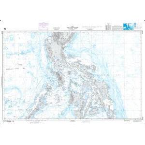
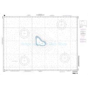
Far East NGA charts are official maritime maps historically produced by the National Geospatial-Intelligence Agency to document the waterways, ports, and shipping routes of East and Southeast Asia. They provide detailed hydrographic data including depth soundings, harbor layouts, shipping lanes, and navigational features essential to one of the world’s busiest maritime regions. While no longer updated for navigation, these charts remain valuable for reference, education, and decorative display.
Far East NGA charts are official maritime maps historically produced by the National Geospatial-Intelligence Agency to document the waterways, ports, and shipping routes of East and Southeast Asia. They provide detailed hydrographic data including depth soundings, harbor layouts, shipping lanes, and navigational features essential to one of the world’s busiest maritime regions. While no longer updated for navigation, these charts remain valuable for reference, education, and decorative display.
What Are the Different Types of Far East NGA Charts?
Our NGA chart collection covers major countries and regions of the Far East. This includes China’s eastern seaboard, Japan’s main islands, South Korea’s ports, the Philippines’ island chains, Vietnam’s coastal waters, Thailand’s Gulf regions, and Malaysia and Indonesia’s shipping lanes. These charts also document key maritime choke points like the Taiwan Strait, Strait of Malacca, and South China Sea trade routes. They are ideal for collectors, historians, and authentic wall décor.
Our NGA chart collection covers major countries and regions of the Far East. This includes China’s eastern seaboard, Japan’s main islands, South Korea’s ports, the Philippines’ island chains, Vietnam’s coastal waters, Thailand’s Gulf regions, and Malaysia and Indonesia’s shipping lanes. These charts also document key maritime choke points like the Taiwan Strait, Strait of Malacca, and South China Sea trade routes. They are ideal for collectors, historians, and authentic wall décor.
Are Far East NGA Charts Updated?
No. NGA printed charts are no longer updated for modern navigation. They are preserved for their historical and cartographic value. For customers who want a printed chart with current information, we can create custom charts using the latest digital maritime data. Create your custom chart here.
No. NGA printed charts are no longer updated for modern navigation. They are preserved for their historical and cartographic value. For customers who want a printed chart with current information, we can create custom charts using the latest digital maritime data. Create your custom chart here.
What Areas Do Far East NGA Charts Cover?
These NGA charts cover a wide range of East and Southeast Asian waters. Key areas include the eastern coast of China, Sea of Japan, Korean Peninsula, Japanese islands, the Philippines, South China Sea, Gulf of Thailand, Strait of Malacca, and Indonesian archipelagos. Major ports such as Shanghai, Tokyo, Manila, Ho Chi Minh City, and Jakarta are detailed.
These NGA charts cover a wide range of East and Southeast Asian waters. Key areas include the eastern coast of China, Sea of Japan, Korean Peninsula, Japanese islands, the Philippines, South China Sea, Gulf of Thailand, Strait of Malacca, and Indonesian archipelagos. Major ports such as Shanghai, Tokyo, Manila, Ho Chi Minh City, and Jakarta are detailed.
Can I Order a Custom Far East Chart?
Yes. We can create a custom NGA chart focused on any location in East or Southeast Asia. Specify your preferred coastline, port, or shipping route, and we will produce a printed chart tailored to your needs. Custom charts can be printed on standard or waterproof material and finished with mounting or framing for display. Design your custom chart here.
Yes. We can create a custom NGA chart focused on any location in East or Southeast Asia. Specify your preferred coastline, port, or shipping route, and we will produce a printed chart tailored to your needs. Custom charts can be printed on standard or waterproof material and finished with mounting or framing for display. Design your custom chart here.
What Finishing Options Are Available?
Far East NGA charts can be printed on standard bond paper or waterproof synthetic material. We offer mounting on foam board and professional framing services to transform these charts into ready-to-hang artwork. Mounted charts are ideal for pin tracking, while framed charts create a polished, decorative display. View finishing options here.
Far East NGA charts can be printed on standard bond paper or waterproof synthetic material. We offer mounting on foam board and professional framing services to transform these charts into ready-to-hang artwork. Mounted charts are ideal for pin tracking, while framed charts create a polished, decorative display. View finishing options here.
Can I Find a Specific NGA Chart by Number?
Yes. Enter the chart number in the search bar at the top-right corner of our website to quickly locate it. You can also browse this category to visually explore all available Far East NGA charts.
Yes. Enter the chart number in the search bar at the top-right corner of our website to quickly locate it. You can also browse this category to visually explore all available Far East NGA charts.
What Makes Far East NGA Charts Ideal for Decorative Use?
These charts capture the complex and historically rich maritime regions of East and Southeast Asia. Featuring detailed ports, archipelagos, and busy trade routes, their cartography makes them ideal for framing and displaying in offices, homes, or shipping company headquarters. A chart of a meaningful port or trade route creates a personalized, conversation-worthy piece of wall art.
These charts capture the complex and historically rich maritime regions of East and Southeast Asia. Featuring detailed ports, archipelagos, and busy trade routes, their cartography makes them ideal for framing and displaying in offices, homes, or shipping company headquarters. A chart of a meaningful port or trade route creates a personalized, conversation-worthy piece of wall art.
Why Buy Far East NGA Charts from The Map Shop?
With more than 30 years of experience, The Map Shop is a trusted source for printed maritime charts. We produce every NGA chart in-house in Charlotte, NC using high-quality materials and expert finishing techniques. Thousands of charts are available for quick production, mounting, and framing, ensuring reliable service and premium results. Read customer reviews here or learn more about our company history here.
With more than 30 years of experience, The Map Shop is a trusted source for printed maritime charts. We produce every NGA chart in-house in Charlotte, NC using high-quality materials and expert finishing techniques. Thousands of charts are available for quick production, mounting, and framing, ensuring reliable service and premium results. Read customer reviews here or learn more about our company history here.