


What Are NGA Charts?
NGA charts are official maritime maps produced by the National Geospatial-Intelligence Agency to document global oceans, coastlines, and ports. These charts were historically used for international shipping and defense purposes. They include detailed hydrographic information such as water depths, offshore features, channels, and port layouts. While they are no longer updated for navigation, NGA charts remain valuable for reference, education, and as decorative pieces for maritime enthusiasts and collectors.
NGA charts are official maritime maps produced by the National Geospatial-Intelligence Agency to document global oceans, coastlines, and ports. These charts were historically used for international shipping and defense purposes. They include detailed hydrographic information such as water depths, offshore features, channels, and port layouts. While they are no longer updated for navigation, NGA charts remain valuable for reference, education, and as decorative pieces for maritime enthusiasts and collectors.
What Are the Different Types of NGA Charts?
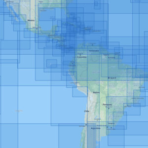
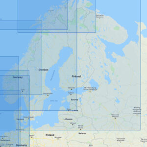
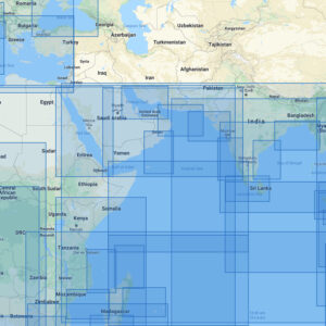
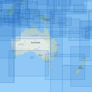
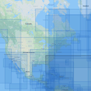
Our NGA chart collection covers a wide range of international maritime regions. You can browse categories including Caribbean, Central and South America, British Isles and France, Scandinavia and Russian Coast, Western Africa and Mediterranean, Eastern Africa, Middle East, and India, Far East, Australia, New Zealand, and Indonesia, North America and Atlantic Ocean, and North and South Pacific with Polynesia. Each chart captures a specific international region, showcasing coastlines, channels, and offshore features ideal for reference or display.
Our NGA chart collection covers a wide range of international maritime regions. You can browse categories including Caribbean, Central and South America, British Isles and France, Scandinavia and Russian Coast, Western Africa and Mediterranean, Eastern Africa, Middle East, and India, Far East, Australia, New Zealand, and Indonesia, North America and Atlantic Ocean, and North and South Pacific with Polynesia. Each chart captures a specific international region, showcasing coastlines, channels, and offshore features ideal for reference or display.
Are NGA Charts Updated?
No. These printed NGA charts are no longer updated for modern navigation. They are provided as preserved documents for their historical and cartographic value. Customers who want a paper chart with current information can request a custom international chart generated from the latest digital data.
No. These printed NGA charts are no longer updated for modern navigation. They are provided as preserved documents for their historical and cartographic value. Customers who want a paper chart with current information can request a custom international chart generated from the latest digital data.
What Areas Do NGA Charts Cover?
NGA charts cover nearly every major ocean and foreign coastline worldwide. This includes the Caribbean, Europe, Africa, Asia, Oceania, and polar regions. With thousands of charts available, you can find detailed representations of shipping routes, international ports, and strategic maritime regions for reference or decorative use.
NGA charts cover nearly every major ocean and foreign coastline worldwide. This includes the Caribbean, Europe, Africa, Asia, Oceania, and polar regions. With thousands of charts available, you can find detailed representations of shipping routes, international ports, and strategic maritime regions for reference or decorative use.
Can I Order a Custom International Chart?
Yes. We can create custom international charts using the most recent digital data for any global location. You can specify the region, scale, and layout to highlight areas of interest. Custom international charts can be printed on standard or waterproof paper and finished with mounting or framing to produce professional-quality displays. Create your custom chart here.
Yes. We can create custom international charts using the most recent digital data for any global location. You can specify the region, scale, and layout to highlight areas of interest. Custom international charts can be printed on standard or waterproof paper and finished with mounting or framing to produce professional-quality displays. Create your custom chart here.
What Finishing Options Are Available?
NGA charts can be printed on standard paper or waterproof synthetic material. For decorative use, we offer mounting on foam board for easy display and custom framing for a professional, ready-to-hang appearance. These options make NGA charts durable, attractive pieces of maritime wall art. Explore finishing options here.
NGA charts can be printed on standard paper or waterproof synthetic material. For decorative use, we offer mounting on foam board for easy display and custom framing for a professional, ready-to-hang appearance. These options make NGA charts durable, attractive pieces of maritime wall art. Explore finishing options here.
Can I Find a Specific NGA Chart by Number?
Yes. If you know the chart number, enter it into the search bar at the top-right of our website to quickly locate your specific NGA chart. Alternatively, you can navigate through the international chart categories to find your area of interest.
Yes. If you know the chart number, enter it into the search bar at the top-right of our website to quickly locate your specific NGA chart. Alternatively, you can navigate through the international chart categories to find your area of interest.
What Makes NGA Charts Ideal for Decorative Use?
NGA charts offer a technical, detailed representation of international maritime regions, making them excellent for wall décor. Their global coverage and cartographic precision make them ideal for international offices, shipping companies, and coastal residences. Displaying a framed NGA chart of a meaningful region creates a personalized, conversation-worthy decorative piece.
NGA charts offer a technical, detailed representation of international maritime regions, making them excellent for wall décor. Their global coverage and cartographic precision make them ideal for international offices, shipping companies, and coastal residences. Displaying a framed NGA chart of a meaningful region creates a personalized, conversation-worthy decorative piece.
Why Buy NGA Charts from The Map Shop?
For over 30 years, The Map Shop has been a trusted provider of printed maritime charts. We print every NGA chart in-house in Charlotte, NC using high-quality materials and expert finishing techniques. Our extensive catalog of international charts is available for fast printing, mounting, and framing. Customers choose us for accuracy, craftsmanship, and the ability to turn historical charts into timeless works of art. Read reviews here or learn about our history here.
For over 30 years, The Map Shop has been a trusted provider of printed maritime charts. We print every NGA chart in-house in Charlotte, NC using high-quality materials and expert finishing techniques. Our extensive catalog of international charts is available for fast printing, mounting, and framing. Customers choose us for accuracy, craftsmanship, and the ability to turn historical charts into timeless works of art. Read reviews here or learn about our history here.