What Are Middle School World Maps?
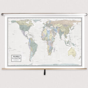
Middle school world maps are large-format wall maps mounted on spring rollers that provide a detailed view of global geography. Designed for grades 6–8, these maps include political boundaries, country names, capital cities, and physical landforms. Many also feature thematic data such as climate zones or population distribution. These maps are tailored for middle school instruction, offering more complexity than elementary-level maps while remaining clear and accessible for developing learners.
Middle school world maps are large-format wall maps mounted on spring rollers that provide a detailed view of global geography. Designed for grades 6–8, these maps include political boundaries, country names, capital cities, and physical landforms. Many also feature thematic data such as climate zones or population distribution. These maps are tailored for middle school instruction, offering more complexity than elementary-level maps while remaining clear and accessible for developing learners.
What Are the Different Types of Middle School World Maps?
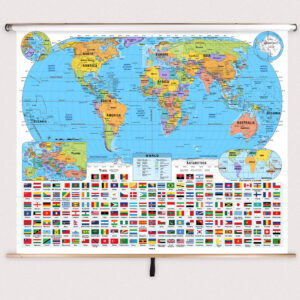
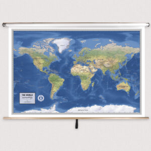
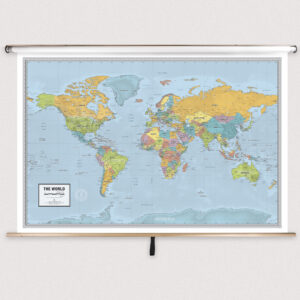
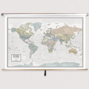
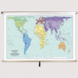
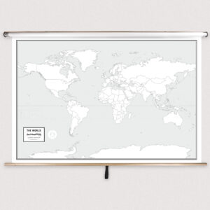
This category includes a variety of world maps suitable for middle school classrooms. Teachers can choose from political maps that focus on countries and borders, physical maps that highlight mountains, rivers, and terrain, or thematic maps that explore topics such as climate, population, or natural resources. Each map is designed to complement middle school geography and social studies lessons.
This category includes a variety of world maps suitable for middle school classrooms. Teachers can choose from political maps that focus on countries and borders, physical maps that highlight mountains, rivers, and terrain, or thematic maps that explore topics such as climate, population, or natural resources. Each map is designed to complement middle school geography and social studies lessons.
What Are the Benefits of Using World Maps in Middle School Classrooms?
World maps help middle school students understand the relationships between continents, countries, and oceans. They provide context for historical events, trade routes, and environmental issues. By using pull-down world maps, teachers can guide interactive lessons that foster spatial reasoning, critical thinking, and a global perspective. The laminated, markable surface allows for hands-on instruction and repeated use.
World maps help middle school students understand the relationships between continents, countries, and oceans. They provide context for historical events, trade routes, and environmental issues. By using pull-down world maps, teachers can guide interactive lessons that foster spatial reasoning, critical thinking, and a global perspective. The laminated, markable surface allows for hands-on instruction and repeated use.
Are Middle School World Maps Good for Classrooms, Offices, and Homes?
Yes. While designed for middle school classrooms, these maps are also suitable for homeschooling environments, educational centers, and offices that require detailed global references. Families use them for teaching children about world geography and planning international travel. The laminated finish ensures durability and easy cleaning for long-term use.
Yes. While designed for middle school classrooms, these maps are also suitable for homeschooling environments, educational centers, and offices that require detailed global references. Families use them for teaching children about world geography and planning international travel. The laminated finish ensures durability and easy cleaning for long-term use.
What Grade Levels Are Middle School World Maps Designed For?
Middle school world maps are intended for grades 6–8 and provide more detailed information than elementary-level maps. These maps help bridge the gap between basic geographic understanding and high school-level analytical studies. They prepare students for advanced courses by introducing more complex political, physical, and thematic details.
Middle school world maps are intended for grades 6–8 and provide more detailed information than elementary-level maps. These maps help bridge the gap between basic geographic understanding and high school-level analytical studies. They prepare students for advanced courses by introducing more complex political, physical, and thematic details.
How Do I Decorate with Middle School World Maps?
Middle school world maps serve as both teaching tools and visual enhancements for classrooms. When retracted, they store neatly above whiteboards or chalkboards, saving wall space. When displayed, they create a colorful focal point that engages students and encourages exploration. At home, these maps can be installed in study areas to support learning while adding educational décor.
Middle school world maps serve as both teaching tools and visual enhancements for classrooms. When retracted, they store neatly above whiteboards or chalkboards, saving wall space. When displayed, they create a colorful focal point that engages students and encourages exploration. At home, these maps can be installed in study areas to support learning while adding educational décor.
Can I Create a Custom Middle School World Map for My Classroom?
Yes. Custom world maps can be designed specifically for middle school classrooms. Options include combining multiple maps on a single roller, adding branded or district-specific features, or customizing thematic details. Each map is produced in-house using high-quality materials to ensure durability and clarity. Learn more about custom solutions at this page.
Yes. Custom world maps can be designed specifically for middle school classrooms. Options include combining multiple maps on a single roller, adding branded or district-specific features, or customizing thematic details. Each map is produced in-house using high-quality materials to ensure durability and clarity. Learn more about custom solutions at this page.
How Do I Install Middle School World Maps?
Installation is simple. These maps are designed to mount above whiteboards or on flat walls, with wall and ceiling mounting options available. Units ordered with backboards come pre-attached and ready to hang. Proper installation ensures secure mounting and smooth roller operation. Instructions can be found at this link.
Installation is simple. These maps are designed to mount above whiteboards or on flat walls, with wall and ceiling mounting options available. Units ordered with backboards come pre-attached and ready to hang. Proper installation ensures secure mounting and smooth roller operation. Instructions can be found at this link.
Do You Sell Mounting Hardware for Middle School World Maps?
Yes. We provide mounting hardware, including brackets, backboards, and accessories specifically for middle school world maps. Each order includes backboards and wall brackets, but screws and anchors must be chosen based on wall type. Browse hardware options at this page.
Yes. We provide mounting hardware, including brackets, backboards, and accessories specifically for middle school world maps. Each order includes backboards and wall brackets, but screws and anchors must be chosen based on wall type. Browse hardware options at this page.
What Materials Are Used for Middle School World Maps?
Each map is printed on heavyweight paper, laminated for a markable, easy-to-clean surface, and mounted on a spring roller for frequent classroom use. The laminated finish supports dry-erase and wet-erase markers, allowing teachers to annotate lessons. Powder-coated steel backboards provide durability and stability for long-term use.
Each map is printed on heavyweight paper, laminated for a markable, easy-to-clean surface, and mounted on a spring roller for frequent classroom use. The laminated finish supports dry-erase and wet-erase markers, allowing teachers to annotate lessons. Powder-coated steel backboards provide durability and stability for long-term use.
What Do Maps Teach Middle School Students?
World maps help middle school students explore the political and physical layout of the globe. Teachers can use these maps to explain international relations, trade, migration, and environmental changes. Interactive pull-down maps support lessons that develop critical thinking and spatial reasoning skills essential for understanding global dynamics.
World maps help middle school students explore the political and physical layout of the globe. Teachers can use these maps to explain international relations, trade, migration, and environmental changes. Interactive pull-down maps support lessons that develop critical thinking and spatial reasoning skills essential for understanding global dynamics.
What Are the Available Sizes of Middle School World Maps?
Middle school world maps are available in various sizes to fit different classroom spaces. Large-format maps are ideal for group instruction, while smaller maps suit compact learning areas. Detailed dimensions for each product can be found on the individual product pages within this category.
Middle school world maps are available in various sizes to fit different classroom spaces. Large-format maps are ideal for group instruction, while smaller maps suit compact learning areas. Detailed dimensions for each product can be found on the individual product pages within this category.
What is BrightWay Educational?
BrightWay Educational is our exclusive line of classroom maps, including middle school world maps. Frequently updated with the latest political and geographic information, BrightWay maps feature accurate cartography, detailed labeling, and vibrant colors tailored to grades 6–8. Learn more about BrightWay Educational maps here.
BrightWay Educational is our exclusive line of classroom maps, including middle school world maps. Frequently updated with the latest political and geographic information, BrightWay maps feature accurate cartography, detailed labeling, and vibrant colors tailored to grades 6–8. Learn more about BrightWay Educational maps here.
Why Choose The Map Shop for Middle School World Maps?
Since 1990, The Map Shop has been a trusted provider of educational maps for schools nationwide. Each middle school world map is hand-finished in our Charlotte, NC facility with premium materials and expert assembly techniques. Our commitment to accuracy and durability ensures that educators receive reliable, long-lasting tools for teaching. Read customer reviews here or learn more about our history here.
Since 1990, The Map Shop has been a trusted provider of educational maps for schools nationwide. Each middle school world map is hand-finished in our Charlotte, NC facility with premium materials and expert assembly techniques. Our commitment to accuracy and durability ensures that educators receive reliable, long-lasting tools for teaching. Read customer reviews here or learn more about our history here.