What Are British Isles and France NGA Charts?
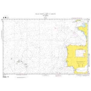
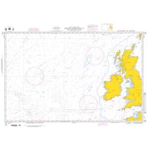
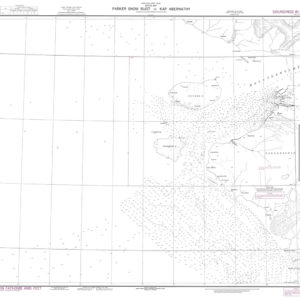
These NGA charts are official maritime maps historically produced by the National Geospatial-Intelligence Agency to document the coastlines, ports, and surrounding waters of the British Isles and France. They provide detailed hydrographic information including depth soundings, channels, harbor layouts, and offshore shipping routes. While no longer updated for navigation, these charts remain valuable for reference, education, and decorative display, capturing the maritime heritage of this region.
These NGA charts are official maritime maps historically produced by the National Geospatial-Intelligence Agency to document the coastlines, ports, and surrounding waters of the British Isles and France. They provide detailed hydrographic information including depth soundings, channels, harbor layouts, and offshore shipping routes. While no longer updated for navigation, these charts remain valuable for reference, education, and decorative display, capturing the maritime heritage of this region.
What Are the Different Types of British Isles and France NGA Charts?
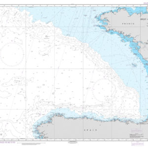
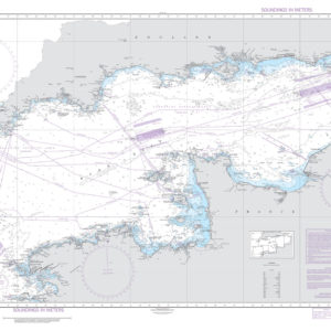
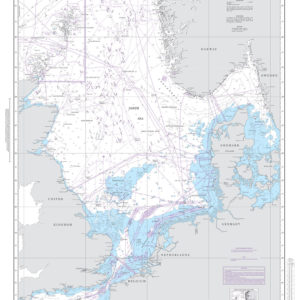
Our collection includes NGA charts covering the entire British Isles, including England, Scotland, Wales, Northern Ireland, and the Republic of Ireland. French charts document the northern coastline along the English Channel, western coasts bordering the Atlantic Ocean, and southern Mediterranean ports. These charts highlight major ferry routes, fishing areas, and international shipping lanes, making them ideal for collectors and maritime décor.
Our collection includes NGA charts covering the entire British Isles, including England, Scotland, Wales, Northern Ireland, and the Republic of Ireland. French charts document the northern coastline along the English Channel, western coasts bordering the Atlantic Ocean, and southern Mediterranean ports. These charts highlight major ferry routes, fishing areas, and international shipping lanes, making them ideal for collectors and maritime décor.
Are British Isles and France NGA Charts Updated?
No. NGA printed charts are no longer updated for modern navigation. They are preserved for their historical and cartographic value. If you need a current chart for this region with a traditional printed appearance, we can create a custom chart using the latest digital maritime data. Create your custom chart here.
No. NGA printed charts are no longer updated for modern navigation. They are preserved for their historical and cartographic value. If you need a current chart for this region with a traditional printed appearance, we can create a custom chart using the latest digital maritime data. Create your custom chart here.
What Areas Do British Isles and France NGA Charts Cover?
These NGA charts cover the waters surrounding the British Isles and France. This includes the North Sea, English Channel, Irish Sea, Celtic Sea, Atlantic coastlines of Brittany and Normandy, and the Mediterranean ports of southern France. Charts also include major river estuaries and shipping routes connecting to continental Europe.
These NGA charts cover the waters surrounding the British Isles and France. This includes the North Sea, English Channel, Irish Sea, Celtic Sea, Atlantic coastlines of Brittany and Normandy, and the Mediterranean ports of southern France. Charts also include major river estuaries and shipping routes connecting to continental Europe.
Can I Order a Custom British Isles or France Chart?
Yes. We can produce custom NGA charts focused on any location within these regions. Specify your preferred port, coastline, or shipping lane, and we will create a chart tailored to your needs. Custom charts can be printed on paper or waterproof synthetic material and finished with mounting or framing for display. Design your custom chart here.
Yes. We can produce custom NGA charts focused on any location within these regions. Specify your preferred port, coastline, or shipping lane, and we will create a chart tailored to your needs. Custom charts can be printed on paper or waterproof synthetic material and finished with mounting or framing for display. Design your custom chart here.
What Finishing Options Are Available?
British Isles and France NGA charts can be printed on standard bond paper or waterproof synthetic material. We offer mounting on foam board and professional framing services to transform these charts into ready-to-hang artwork. Mounted charts are ideal for pin tracking, while framed charts create a polished, decorative look. See finishing options here.
British Isles and France NGA charts can be printed on standard bond paper or waterproof synthetic material. We offer mounting on foam board and professional framing services to transform these charts into ready-to-hang artwork. Mounted charts are ideal for pin tracking, while framed charts create a polished, decorative look. See finishing options here.
Can I Find a Specific NGA Chart by Number?
Yes. Enter the chart number into the search bar at the top-right of our website to quickly locate your desired chart. You can also browse this category to visually explore all British Isles and France NGA charts.
Yes. Enter the chart number into the search bar at the top-right of our website to quickly locate your desired chart. You can also browse this category to visually explore all British Isles and France NGA charts.
What Makes British Isles and France NGA Charts Ideal for Decorative Use?
These charts highlight the historic maritime regions of the British Isles and France, known for their rich nautical traditions and bustling shipping routes. Their detailed cartography makes them perfect for framing and displaying in offices, homes, or yacht clubs. Choosing a chart of a significant port or sailing route creates a personalized, conversation-worthy wall feature.
These charts highlight the historic maritime regions of the British Isles and France, known for their rich nautical traditions and bustling shipping routes. Their detailed cartography makes them perfect for framing and displaying in offices, homes, or yacht clubs. Choosing a chart of a significant port or sailing route creates a personalized, conversation-worthy wall feature.
Why Buy British Isles and France NGA Charts from The Map Shop?
With over 30 years of experience, The Map Shop is a trusted source for maritime charts. We print every NGA chart in-house in Charlotte, NC using premium materials and expert finishing techniques. With thousands of charts available for quick production, mounting, and framing, we ensure quality and fast delivery. Read customer reviews here or learn about our history here.
With over 30 years of experience, The Map Shop is a trusted source for maritime charts. We print every NGA chart in-house in Charlotte, NC using premium materials and expert finishing techniques. With thousands of charts available for quick production, mounting, and framing, we ensure quality and fast delivery. Read customer reviews here or learn about our history here.