What Are Middle School Country Maps?
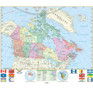
Middle school country maps are educational wall maps mounted on spring rollers that focus on the detailed geography of individual nations. Designed for grades 6–8, these maps display political boundaries, major cities, capitals, and significant physical features such as mountains, rivers, and deserts. Some maps also include thematic details such as climate, population density, or economic activity. These maps help students develop a more focused understanding of each country’s geography and culture.
Middle school country maps are educational wall maps mounted on spring rollers that focus on the detailed geography of individual nations. Designed for grades 6–8, these maps display political boundaries, major cities, capitals, and significant physical features such as mountains, rivers, and deserts. Some maps also include thematic details such as climate, population density, or economic activity. These maps help students develop a more focused understanding of each country’s geography and culture.
What Are the Different Types of Middle School Country Maps?
This category includes maps of various countries specifically designed for middle school education. Teachers can select political maps highlighting borders and capitals, physical maps showing terrain and natural features, or thematic maps focused on climate and population data. Each product is tailored for interactive middle school lessons, providing clarity and detail appropriate for grades 6–8.
This category includes maps of various countries specifically designed for middle school education. Teachers can select political maps highlighting borders and capitals, physical maps showing terrain and natural features, or thematic maps focused on climate and population data. Each product is tailored for interactive middle school lessons, providing clarity and detail appropriate for grades 6–8.
What Are the Benefits of Using Country Maps in Middle School Classrooms?
Country maps allow students to study individual nations in detail, understanding their political divisions, natural landscapes, and cultural regions. Teachers can use these maps to explain historical events, migration patterns, and international relations. The laminated, markable surfaces support hands-on instruction, enabling teachers to highlight key areas during lessons and foster critical thinking about global diversity.
Country maps allow students to study individual nations in detail, understanding their political divisions, natural landscapes, and cultural regions. Teachers can use these maps to explain historical events, migration patterns, and international relations. The laminated, markable surfaces support hands-on instruction, enabling teachers to highlight key areas during lessons and foster critical thinking about global diversity.
Are Middle School Country Maps Good for Classrooms, Offices, and Homes?
Yes. While primarily designed for classroom use, these maps are also suitable for homeschooling environments, educational offices, and family study areas. Parents use them to teach children about specific nations, heritage connections, and travel planning. The durable, laminated construction makes these maps easy to clean and practical for long-term use in active learning spaces.
Yes. While primarily designed for classroom use, these maps are also suitable for homeschooling environments, educational offices, and family study areas. Parents use them to teach children about specific nations, heritage connections, and travel planning. The durable, laminated construction makes these maps easy to clean and practical for long-term use in active learning spaces.
What Grade Levels Are Middle School Country Maps Designed For?
Middle school country maps are specifically designed for grades 6–8, providing more detail than elementary-level maps while remaining accessible to developing learners. High school maps include even more comprehensive political and thematic information for advanced students.
Middle school country maps are specifically designed for grades 6–8, providing more detail than elementary-level maps while remaining accessible to developing learners. High school maps include even more comprehensive political and thematic information for advanced students.
How Do I Decorate with Middle School Country Maps?
Middle school country maps enhance classroom spaces with detailed geographic visuals. When retracted, they store neatly above chalkboards or whiteboards, saving wall space. When displayed, they create an informative focal point that encourages discussion and exploration. At home, these maps can be mounted in study areas to support geography lessons while serving as educational décor.
Middle school country maps enhance classroom spaces with detailed geographic visuals. When retracted, they store neatly above chalkboards or whiteboards, saving wall space. When displayed, they create an informative focal point that encourages discussion and exploration. At home, these maps can be mounted in study areas to support geography lessons while serving as educational décor.
Can I Create a Custom Middle School Country Map for My Classroom?
Yes. We offer custom country maps designed to meet specific curriculum needs. Teachers can request district-specific features, combine multiple country maps on one roller, or create simplified layouts for younger learners. Each custom map is produced in-house with high-quality materials to ensure durability and clarity. Learn more about custom solutions at this page.
Yes. We offer custom country maps designed to meet specific curriculum needs. Teachers can request district-specific features, combine multiple country maps on one roller, or create simplified layouts for younger learners. Each custom map is produced in-house with high-quality materials to ensure durability and clarity. Learn more about custom solutions at this page.
How Do I Install Middle School Country Maps?
Installation is simple. These maps are designed for mounting above whiteboards or on flat walls, with options for wall and ceiling mounting. Units with backboards arrive pre-attached and ready to hang. Proper installation ensures a secure fit and smooth roller operation. Detailed instructions are available at this link.
Installation is simple. These maps are designed for mounting above whiteboards or on flat walls, with options for wall and ceiling mounting. Units with backboards arrive pre-attached and ready to hang. Proper installation ensures a secure fit and smooth roller operation. Detailed instructions are available at this link.
Do You Sell Mounting Hardware for Middle School Country Maps?
Yes. We provide brackets, backboards, and accessories specifically designed for middle school country maps. Each order includes backboards and wall brackets, but screws and anchors must be chosen based on wall type. Browse available hardware options at this page.
Yes. We provide brackets, backboards, and accessories specifically designed for middle school country maps. Each order includes backboards and wall brackets, but screws and anchors must be chosen based on wall type. Browse available hardware options at this page.
What Materials Are Used for Middle School Country Maps?
Each map is printed on heavyweight paper, laminated for durability, and mounted on a spring roller. The laminated surface is compatible with dry-erase and wet-erase markers, allowing teachers to annotate and interact with the maps during lessons. Powder-coated steel backboards provide long-lasting support for daily classroom use.
Each map is printed on heavyweight paper, laminated for durability, and mounted on a spring roller. The laminated surface is compatible with dry-erase and wet-erase markers, allowing teachers to annotate and interact with the maps during lessons. Powder-coated steel backboards provide long-lasting support for daily classroom use.
What Do Maps Teach Middle School Students?
Country maps help students gain in-depth knowledge of individual nations, including their political divisions, physical landscapes, and cultural characteristics. Teachers can use these maps to highlight historical events, analyze geographic challenges, and explore economic and environmental factors, fostering analytical and spatial reasoning skills.
Country maps help students gain in-depth knowledge of individual nations, including their political divisions, physical landscapes, and cultural characteristics. Teachers can use these maps to highlight historical events, analyze geographic challenges, and explore economic and environmental factors, fostering analytical and spatial reasoning skills.
What Are the Available Sizes of Middle School Country Maps?
Middle school country maps are available in various sizes to fit different classroom layouts. Larger maps are ideal for group instruction, while smaller formats suit compact spaces. Exact dimensions for each product are listed on the individual product pages within this category.
Middle school country maps are available in various sizes to fit different classroom layouts. Larger maps are ideal for group instruction, while smaller formats suit compact spaces. Exact dimensions for each product are listed on the individual product pages within this category.
What is BrightWay Educational?
BrightWay Educational is our exclusive line of classroom maps, including middle school country maps. Updated frequently to reflect the latest political and geographic data, BrightWay maps feature detailed cartography, accurate labeling, and vibrant colors tailored for grades 6–8. Learn more about BrightWay Educational maps here.
BrightWay Educational is our exclusive line of classroom maps, including middle school country maps. Updated frequently to reflect the latest political and geographic data, BrightWay maps feature detailed cartography, accurate labeling, and vibrant colors tailored for grades 6–8. Learn more about BrightWay Educational maps here.
Why Choose The Map Shop for Middle School Country Maps?
Since 1990, The Map Shop has supplied schools nationwide with high-quality educational maps. Each middle school country map is hand-finished in our Charlotte, NC facility with premium materials and professional assembly techniques. We prioritize accuracy, durability, and engaging designs that support effective geography instruction. Read customer reviews here or learn more about our story here.
Since 1990, The Map Shop has supplied schools nationwide with high-quality educational maps. Each middle school country map is hand-finished in our Charlotte, NC facility with premium materials and professional assembly techniques. We prioritize accuracy, durability, and engaging designs that support effective geography instruction. Read customer reviews here or learn more about our story here.