

What Are High School and College Classroom Maps?
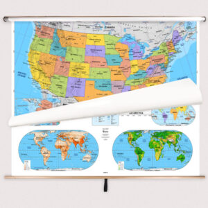
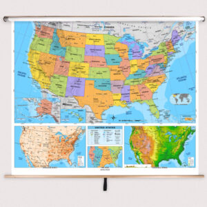
High school and college classroom maps are large-format educational maps mounted on spring rollers, designed for advanced learning environments. These maps include detailed political and physical information, major cities, thematic data, and precise cartographic details to support higher-level instruction in geography, history, political science, and environmental studies. They are built for frequent use in high school and college classrooms, offering a reliable teaching tool for advanced courses.
High school and college classroom maps are large-format educational maps mounted on spring rollers, designed for advanced learning environments. These maps include detailed political and physical information, major cities, thematic data, and precise cartographic details to support higher-level instruction in geography, history, political science, and environmental studies. They are built for frequent use in high school and college classrooms, offering a reliable teaching tool for advanced courses.
What Are the Different Types of High School and College Classroom Maps?
Our High School and College Classroom Maps category includes several subcategories to fit different academic needs. Explore High School and College Combo Maps for multi-map sets, High School and College World Maps for global studies, High School and College Continent Maps for regional instruction, High School and College U.S. Maps for American geography, and High School and College Country Maps for individual nation maps. Each subcategory is designed to support in-depth study and advanced classroom discussions.
Our High School and College Classroom Maps category includes several subcategories to fit different academic needs. Explore High School and College Combo Maps for multi-map sets, High School and College World Maps for global studies, High School and College Continent Maps for regional instruction, High School and College U.S. Maps for American geography, and High School and College Country Maps for individual nation maps. Each subcategory is designed to support in-depth study and advanced classroom discussions.
What Are the Benefits of Using Advanced Maps in Classrooms?
Advanced maps help students develop critical thinking and analytical skills by exploring complex geographic, political, and environmental relationships. Teachers can use these maps to illustrate historical changes, international conflicts, global trade routes, and environmental challenges. The laminated, markable surfaces allow for interactive lessons that support advanced research and discussion.
Advanced maps help students develop critical thinking and analytical skills by exploring complex geographic, political, and environmental relationships. Teachers can use these maps to illustrate historical changes, international conflicts, global trade routes, and environmental challenges. The laminated, markable surfaces allow for interactive lessons that support advanced research and discussion.
Are High School and College Maps Good for Classrooms, Offices, and Homes?
Yes. These maps are ideal for high school and college classrooms but are also suitable for research centers, tutoring environments, and educational offices. Families with older students can use them for advanced studies in geography and history. Laminated for durability and frequent use, these maps offer professional-grade quality for various learning spaces.
Yes. These maps are ideal for high school and college classrooms but are also suitable for research centers, tutoring environments, and educational offices. Families with older students can use them for advanced studies in geography and history. Laminated for durability and frequent use, these maps offer professional-grade quality for various learning spaces.
What Grade Levels Are High School and College Maps Designed For?
High school and college maps are specifically tailored for grades 9–12 and higher education. They feature the most detailed political, physical, and thematic information available for academic instruction. Elementary and middle school maps provide simplified information for younger learners, while these advanced maps are designed to support sophisticated analysis and in-depth study.
High school and college maps are specifically tailored for grades 9–12 and higher education. They feature the most detailed political, physical, and thematic information available for academic instruction. Elementary and middle school maps provide simplified information for younger learners, while these advanced maps are designed to support sophisticated analysis and in-depth study.
How Do I Decorate with High School and College Maps?
These maps add a professional and academic atmosphere to classrooms and study areas. When rolled up, they store neatly above whiteboards or chalkboards. When displayed, they provide an informative and visually impressive teaching resource that supports advanced learning. At home, these maps can be mounted in study rooms or offices to support research and advanced education.
These maps add a professional and academic atmosphere to classrooms and study areas. When rolled up, they store neatly above whiteboards or chalkboards. When displayed, they provide an informative and visually impressive teaching resource that supports advanced learning. At home, these maps can be mounted in study rooms or offices to support research and advanced education.
Can I Create a Custom High School or College Map for My Classroom?
Yes. We specialize in custom maps for high school and college classrooms. Options include combining multiple maps on one roller, creating thematic or branded academic maps, or designing maps for specific research projects. Each custom map is produced in-house with high-quality materials for professional-grade accuracy and durability. Learn more at this page.
Yes. We specialize in custom maps for high school and college classrooms. Options include combining multiple maps on one roller, creating thematic or branded academic maps, or designing maps for specific research projects. Each custom map is produced in-house with high-quality materials for professional-grade accuracy and durability. Learn more at this page.
How Do I Install High School and College Classroom Maps?
Installation is simple and secure. These maps are designed for mounting above whiteboards or on flat walls, with wall and ceiling installation options available. Maps ordered with backboards are pre-attached for easy hanging. Following proper instructions ensures long-lasting and smooth roller operation. Full instructions are provided at this link.
Installation is simple and secure. These maps are designed for mounting above whiteboards or on flat walls, with wall and ceiling installation options available. Maps ordered with backboards are pre-attached for easy hanging. Following proper instructions ensures long-lasting and smooth roller operation. Full instructions are provided at this link.
Do You Sell Mounting Hardware for High School and College Classroom Maps?
Yes. We offer a complete line of mounting hardware, including brackets, backboards, and other accessories designed for high school and college maps. Each order includes backboards and wall brackets, but screws and anchors must be selected based on wall type. Browse mounting hardware options at this page.
Yes. We offer a complete line of mounting hardware, including brackets, backboards, and other accessories designed for high school and college maps. Each order includes backboards and wall brackets, but screws and anchors must be selected based on wall type. Browse mounting hardware options at this page.
What Materials Are Used for High School and College Maps?
Each map is printed on heavyweight paper and laminated for a markable, easy-to-clean surface. The laminated finish works with both dry-erase and wet-erase markers, allowing for interactive lessons and detailed annotations. Powder-coated steel backboards provide stability and ensure long-term durability for daily academic use.
Each map is printed on heavyweight paper and laminated for a markable, easy-to-clean surface. The laminated finish works with both dry-erase and wet-erase markers, allowing for interactive lessons and detailed annotations. Powder-coated steel backboards provide stability and ensure long-term durability for daily academic use.
What Do Maps Teach High School and College Students?
Advanced classroom maps teach students about political boundaries, physical features, and thematic topics such as climate, population, and economics. They are essential tools for analyzing global issues, understanding historical changes, and conducting advanced research in geography, history, and social sciences.
Advanced classroom maps teach students about political boundaries, physical features, and thematic topics such as climate, population, and economics. They are essential tools for analyzing global issues, understanding historical changes, and conducting advanced research in geography, history, and social sciences.
What Are the Available Sizes of High School and College Classroom Maps?
High school and college maps come in various sizes to accommodate different classroom layouts and instructional needs. Large-format maps are ideal for group instruction, while smaller versions suit compact learning spaces. Exact dimensions for each map can be found on the individual product pages within each subcategory.
High school and college maps come in various sizes to accommodate different classroom layouts and instructional needs. Large-format maps are ideal for group instruction, while smaller versions suit compact learning spaces. Exact dimensions for each map can be found on the individual product pages within each subcategory.
What is BrightWay Educational?
BrightWay Educational is our exclusive brand of classroom maps, including high school and college maps. Updated frequently with the latest political and geographic information, BrightWay maps feature highly detailed cartography, professional labeling, and thematic data suited for advanced instruction. Learn more about BrightWay Educational maps here.
BrightWay Educational is our exclusive brand of classroom maps, including high school and college maps. Updated frequently with the latest political and geographic information, BrightWay maps feature highly detailed cartography, professional labeling, and thematic data suited for advanced instruction. Learn more about BrightWay Educational maps here.
Why Choose The Map Shop for High School and College Classroom Maps?
Since 1990, The Map Shop has been a trusted source for high-quality educational maps used by schools and universities nationwide. Each map is hand-finished in our Charlotte, NC facility with premium materials and professional assembly techniques. We focus on accuracy, durability, and instructional value, making our maps a reliable resource for advanced education. Read customer reviews here or learn more about our history here.
Since 1990, The Map Shop has been a trusted source for high-quality educational maps used by schools and universities nationwide. Each map is hand-finished in our Charlotte, NC facility with premium materials and professional assembly techniques. We focus on accuracy, durability, and instructional value, making our maps a reliable resource for advanced education. Read customer reviews here or learn more about our history here.