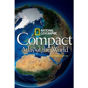
World travel atlases are bound collections of maps that cover global regions, including continents, countries, and key cities. They offer a detailed look at international borders, major transportation routes, and geographic features, making them ideal for global trip planning, education, or reference.
Digital maps are convenient, but they can lack the broader geographic perspective offered by a physical world atlas. A printed atlas provides a comprehensive view of the entire planet, allowing you to visualize large-scale routes, compare regions, and explore remote areas without relying on an internet connection.
We offer world atlases in various formats, including political, physical, and thematic editions. These atlases provide detailed coverage of continents, countries, and cities, along with information on global transportation networks, cultural regions, and natural landmarks.
World atlases provide a global perspective, covering the entire Earth in one volume. Regional or national atlases focus on smaller geographic areas, offering more localized detail. A world atlas is ideal for understanding international connections and planning multi-country or around-the-world trips.
Yes. World atlases are essential for travelers exploring multiple countries or continents. They help you plan routes, understand border crossings, and gain a comprehensive view of your destinations. They are also useful for understanding cultural and geographic relationships between regions.
Most world atlases highlight international airports, major cities, national parks, cultural landmarks, and natural wonders. Many also feature thematic maps showcasing population, climate, and economic data for a deeper understanding of global patterns.
World atlases are available in spiral-bound, hardcover, and paperback formats, making them suitable for travel, classroom use, or display. Some editions feature laminated or coated pages for enhanced durability.
World travel atlases are updated every one to three years to reflect changes in political boundaries, transportation routes, and geographic information. When you purchase from The Map Shop, you’ll receive the most recent edition available for accurate global reference.
The Map Shop has been providing trusted navigation tools and educational resources since 1990. We stock world atlases from leading publishers renowned for their cartographic detail and accuracy. Every atlas is carefully inspected and shipped from our Charlotte, NC facility to ensure you receive a high-quality global reference tool for travel or study.


