What Are Great Lakes NOAA Charts?
Great Lakes NOAA charts are official maritime maps historically produced by the National Oceanic and Atmospheric Administration to chart the interconnected waterways of the Great Lakes region. These charts provide detailed hydrographic information including depth soundings, shoreline features, channels, and harbor layouts. While they are no longer updated for navigation, Great Lakes NOAA charts remain valuable as reference materials and are popular decorative pieces for lakefront properties and maritime-themed interiors.
Great Lakes NOAA charts are official maritime maps historically produced by the National Oceanic and Atmospheric Administration to chart the interconnected waterways of the Great Lakes region. These charts provide detailed hydrographic information including depth soundings, shoreline features, channels, and harbor layouts. While they are no longer updated for navigation, Great Lakes NOAA charts remain valuable as reference materials and are popular decorative pieces for lakefront properties and maritime-themed interiors.
What Are the Different Types of Great Lakes NOAA Charts?
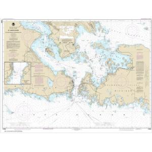
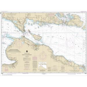
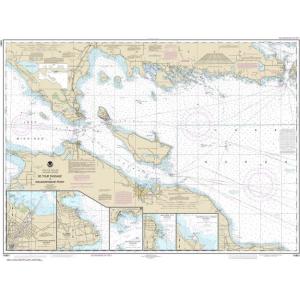
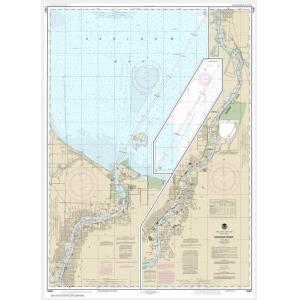
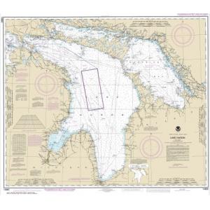
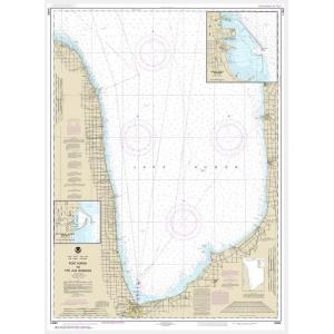
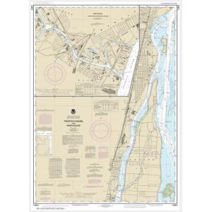
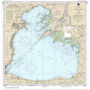
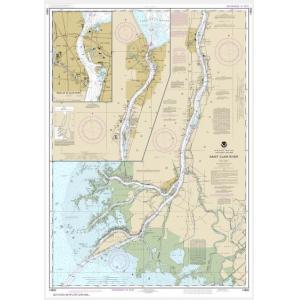
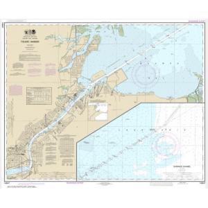
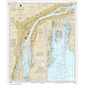
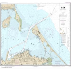
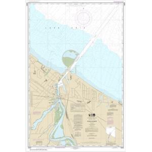
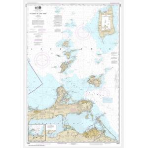
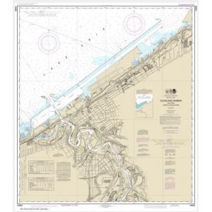
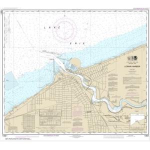
Our Great Lakes NOAA chart collection includes coverage for all five lakes: Lake Superior, Lake Michigan, Lake Huron, Lake Erie, and Lake Ontario. Charts also document the St. Lawrence Seaway, Detroit River, St. Clair River, and other connecting waterways. These charts highlight major ports, marinas, and shipping lanes, providing a detailed view of the entire Great Lakes basin. They are ideal for collectors, educators, and anyone seeking authentic Great Lakes wall décor.
Our Great Lakes NOAA chart collection includes coverage for all five lakes: Lake Superior, Lake Michigan, Lake Huron, Lake Erie, and Lake Ontario. Charts also document the St. Lawrence Seaway, Detroit River, St. Clair River, and other connecting waterways. These charts highlight major ports, marinas, and shipping lanes, providing a detailed view of the entire Great Lakes basin. They are ideal for collectors, educators, and anyone seeking authentic Great Lakes wall décor.
Are Great Lakes NOAA Charts Updated?
No. NOAA has retired its printed chart program, and these charts are no longer updated. They are preserved for historical and cartographic value. For customers seeking current information in a traditional format, we offer custom charts created from the latest digital NOAA data. Design a custom Great Lakes chart here.
No. NOAA has retired its printed chart program, and these charts are no longer updated. They are preserved for historical and cartographic value. For customers seeking current information in a traditional format, we offer custom charts created from the latest digital NOAA data. Design a custom Great Lakes chart here.
What Areas Do Great Lakes NOAA Charts Cover?
Great Lakes NOAA charts cover the entire freshwater system of the United States and Canada, including each of the five lakes, connecting rivers, and major shipping channels. Coverage extends to ports such as Chicago, Milwaukee, Detroit, Toronto, Cleveland, Buffalo, and Duluth, as well as important fishing and recreational boating areas.
Great Lakes NOAA charts cover the entire freshwater system of the United States and Canada, including each of the five lakes, connecting rivers, and major shipping channels. Coverage extends to ports such as Chicago, Milwaukee, Detroit, Toronto, Cleveland, Buffalo, and Duluth, as well as important fishing and recreational boating areas.
Can I Order a Custom Great Lakes Chart?
Yes. We can produce custom Great Lakes charts tailored to your needs. Select a specific lake, region, or port and we will generate a chart using up-to-date digital data. Charts can be printed on standard or waterproof paper and finished with mounting or framing to create professional-quality displays. Create your custom Great Lakes chart here.
Yes. We can produce custom Great Lakes charts tailored to your needs. Select a specific lake, region, or port and we will generate a chart using up-to-date digital data. Charts can be printed on standard or waterproof paper and finished with mounting or framing to create professional-quality displays. Create your custom Great Lakes chart here.
What Finishing Options Are Available?
Great Lakes NOAA charts can be printed on standard paper or waterproof synthetic material. We also offer mounting on foam board for easy display and custom framing for a polished, ready-to-hang piece. These options make Great Lakes charts durable and perfect for showcasing in homes, cottages, and offices. Explore finishing options here.
Great Lakes NOAA charts can be printed on standard paper or waterproof synthetic material. We also offer mounting on foam board for easy display and custom framing for a polished, ready-to-hang piece. These options make Great Lakes charts durable and perfect for showcasing in homes, cottages, and offices. Explore finishing options here.
Can I Find a Specific Great Lakes NOAA Chart by Number?
Yes. If you know the chart number, use the search bar at the top-right corner of our website to locate it quickly. Alternatively, browse this category to visually explore available Great Lakes NOAA charts.
Yes. If you know the chart number, use the search bar at the top-right corner of our website to locate it quickly. Alternatively, browse this category to visually explore available Great Lakes NOAA charts.
What Makes Great Lakes NOAA Charts Ideal for Decorative Use?
Great Lakes NOAA charts capture the unique geography and coastal details of North America’s inland seas. Their detailed cartography and large format make them ideal for framing and displaying in lake houses, offices, or yacht clubs. Selecting a chart of a favorite lake or boating destination turns it into a personalized, conversation-worthy decorative piece.
Great Lakes NOAA charts capture the unique geography and coastal details of North America’s inland seas. Their detailed cartography and large format make them ideal for framing and displaying in lake houses, offices, or yacht clubs. Selecting a chart of a favorite lake or boating destination turns it into a personalized, conversation-worthy decorative piece.
Why Buy Great Lakes NOAA Charts from The Map Shop?
For over 30 years, The Map Shop has been a trusted provider of printed NOAA charts. Every Great Lakes chart is printed in-house in Charlotte, NC using premium materials and professional finishing techniques. With thousands of charts available for quick production, mounting, and framing, we ensure top quality and fast delivery. Read reviews here or learn more about our company history here.
For over 30 years, The Map Shop has been a trusted provider of printed NOAA charts. Every Great Lakes chart is printed in-house in Charlotte, NC using premium materials and professional finishing techniques. With thousands of charts available for quick production, mounting, and framing, we ensure top quality and fast delivery. Read reviews here or learn more about our company history here.