What Types of Navigation Maps Are Available?
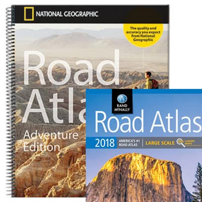
Explore categories designed for wayfinding and planning: Raised Relief Maps for understanding terrain and elevation at a glance, Travel Maps for on-the-go routing and trip planning, Atlases for comprehensive state and regional reference with road networks and points of interest, Nautical Charts for coastal and offshore detail, Classroom Pull Down Maps for large-format, easy-deploy displays, and Maps by State for focused local coverage. Together these navigation maps support route planning, teaching, and real-world exploration across land and sea.
Explore categories designed for wayfinding and planning: Raised Relief Maps for understanding terrain and elevation at a glance, Travel Maps for on-the-go routing and trip planning, Atlases for comprehensive state and regional reference with road networks and points of interest, Nautical Charts for coastal and offshore detail, Classroom Pull Down Maps for large-format, easy-deploy displays, and Maps by State for focused local coverage. Together these navigation maps support route planning, teaching, and real-world exploration across land and sea.
How Accurate Is the Data in These Maps?
Every navigation map we carry comes from a trusted source. NOAA produces our nautical charts, ensuring mariners receive information that meets federal standards for navigation. Our atlases and US travel maps are created by respected publishers such as DeLorme and Rand McNally, both known for precise and regularly updated road data. International travel maps are sourced from reputable cartographers who specialize in global coverage. These are professional-grade resources designed for use in real travel conditions.
Every navigation map we carry comes from a trusted source. NOAA produces our nautical charts, ensuring mariners receive information that meets federal standards for navigation. Our atlases and US travel maps are created by respected publishers such as DeLorme and Rand McNally, both known for precise and regularly updated road data. International travel maps are sourced from reputable cartographers who specialize in global coverage. These are professional-grade resources designed for use in real travel conditions.
Who Uses These Navigation Maps?
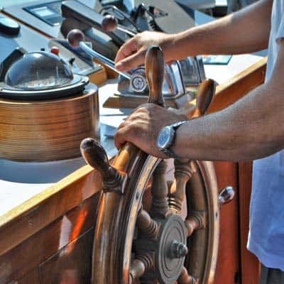
Navigation maps serve a wide audience with practical needs. Sailors use nautical charts to plan safe passages and avoid hazards. Long-distance drivers and truckers keep atlases and US travel maps in their vehicles as a dependable backup to GPS. Travel planners use International travel maps to prepare itineraries and understand foreign transportation routes. Tour companies, delivery services, and expedition leaders also rely on these products for accurate, accessible information that supports safe and efficient travel.
Navigation maps serve a wide audience with practical needs. Sailors use nautical charts to plan safe passages and avoid hazards. Long-distance drivers and truckers keep atlases and US travel maps in their vehicles as a dependable backup to GPS. Travel planners use International travel maps to prepare itineraries and understand foreign transportation routes. Tour companies, delivery services, and expedition leaders also rely on these products for accurate, accessible information that supports safe and efficient travel.
What Scale and Detail Should I Choose?
The best scale for your map depends on how much area you need to cover and the level of detail you require. Nautical charts are available in a range of scales, from broad coastal overviews to highly detailed harbor plans. Atlases provide comprehensive state or regional coverage, often with grid references for easy navigation. US travel maps highlight key routes and connections between cities, while International travel maps balance country-level context with city street detail. Each product description includes scale information and sample images so you can choose confidently.
The best scale for your map depends on how much area you need to cover and the level of detail you require. Nautical charts are available in a range of scales, from broad coastal overviews to highly detailed harbor plans. Atlases provide comprehensive state or regional coverage, often with grid references for easy navigation. US travel maps highlight key routes and connections between cities, while International travel maps balance country-level context with city street detail. Each product description includes scale information and sample images so you can choose confidently.
Are These Maps Useful for Emergency Preparedness?
Yes. Physical maps remain valuable in situations where digital navigation tools fail due to dead batteries, signal loss, or equipment damage. Mariners keep printed nautical charts onboard as a safeguard. Drivers navigating remote areas benefit from having a US travel maps in the glove compartment. International travelers use printed maps as a backup when roaming data is unreliable. In emergencies, having a physical navigation map can be critical for safety and orientation.
Yes. Physical maps remain valuable in situations where digital navigation tools fail due to dead batteries, signal loss, or equipment damage. Mariners keep printed nautical charts onboard as a safeguard. Drivers navigating remote areas benefit from having a US travel maps in the glove compartment. International travelers use printed maps as a backup when roaming data is unreliable. In emergencies, having a physical navigation map can be critical for safety and orientation.
Do You Offer Waterproof or Durable Formats?
Many of our navigation maps are available in waterproof, laminated, or tear-resistant formats. Nautical charts can be printed on water-resistant paper for marine conditions. Atlases may include rugged spiral bindings and coated pages to handle repeated use. Some US travel maps and maps are laminated for durability and compatibility with wet-erase markers. Product listings specify whether a map has enhanced protection for field use.
Many of our navigation maps are available in waterproof, laminated, or tear-resistant formats. Nautical charts can be printed on water-resistant paper for marine conditions. Atlases may include rugged spiral bindings and coated pages to handle repeated use. Some US travel maps and maps are laminated for durability and compatibility with wet-erase markers. Product listings specify whether a map has enhanced protection for field use.
What's the History of Travel Maps?
Navigation maps have guided travelers for centuries, from ancient maritime charts to modern printed and digital mapping systems. Early maps were drawn by hand, serving traders, explorers, and travelers as essential tools for crossing seas and continents. Advances in printing and surveying brought greater accuracy, and later innovations like satellite imagery and GIS data transformed how maps are made and used. Today, high-quality printed navigation maps continue to serve professionals and adventurers alongside digital tools, offering a reliable reference that does not depend on power or internet access.
Navigation maps have guided travelers for centuries, from ancient maritime charts to modern printed and digital mapping systems. Early maps were drawn by hand, serving traders, explorers, and travelers as essential tools for crossing seas and continents. Advances in printing and surveying brought greater accuracy, and later innovations like satellite imagery and GIS data transformed how maps are made and used. Today, high-quality printed navigation maps continue to serve professionals and adventurers alongside digital tools, offering a reliable reference that does not depend on power or internet access.
Why Buy Navigation Maps from The Map Shop?
We have been providing reliable navigation maps since 1990, supplying mariners, drivers, and travelers across the country. Our collection is selected for accuracy, usability, and coverage, and every order ships from our Charlotte, NC facility. We know the importance of having the right map for the job and can help you select the best option for your needs. Want to hear from other customers? Read reviews here. Interested in our history? Learn more about The Map Shop.
We have been providing reliable navigation maps since 1990, supplying mariners, drivers, and travelers across the country. Our collection is selected for accuracy, usability, and coverage, and every order ships from our Charlotte, NC facility. We know the importance of having the right map for the job and can help you select the best option for your needs. Want to hear from other customers? Read reviews here. Interested in our history? Learn more about The Map Shop.


