
What Are U.S. Region, City, County Wall Maps?
U.S. Region, City, County Wall Maps are highly detailed and geographically specific maps designed to highlight smaller-scale areas across the United States. Whether you’re focusing on a congressional district, city layout, or county infrastructure, these maps offer precision and clarity. Ideal for logistics, real estate, government use, or local interest, they help you visualize demographics, boundaries, and key locations. Their accuracy and functionality make them essential tools in offices, planning departments, and classrooms. Discover the wide variety of wall maps we offer—choose from different styles, finishes, and customization options to suit your needs, and buy the perfect map that fits your space and preferences. Want to explore other types of wall maps? Click here to browse our full collection.
U.S. Region, City, County Wall Maps are highly detailed and geographically specific maps designed to highlight smaller-scale areas across the United States. Whether you’re focusing on a congressional district, city layout, or county infrastructure, these maps offer precision and clarity. Ideal for logistics, real estate, government use, or local interest, they help you visualize demographics, boundaries, and key locations. Their accuracy and functionality make them essential tools in offices, planning departments, and classrooms. Discover the wide variety of wall maps we offer—choose from different styles, finishes, and customization options to suit your needs, and buy the perfect map that fits your space and preferences. Want to explore other types of wall maps? Click here to browse our full collection.
What Are the Different Types of U.S. Region, City, County Wall Maps?
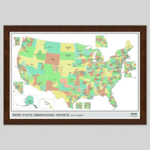
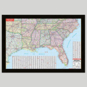
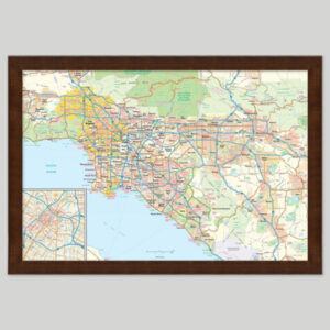
Our U.S. Region, City, County wall maps come in several specialized subcategories to help you narrow down your focus. For legislative planning, explore our Congressional Maps. For broader overviews, view State Maps and U.S. Region Maps. If you’re looking for precise local coverage, our City & County Maps offer detailed views of metropolitan and rural areas. Whether you’re planning routes, analyzing population zones, or managing assets, there’s a map tailored to your exact region. There are a lot of options to choose from, all crafted with high quality materials and available to be finished with lamination, mounting, or framing to suit your needs.
Our U.S. Region, City, County wall maps come in several specialized subcategories to help you narrow down your focus. For legislative planning, explore our Congressional Maps. For broader overviews, view State Maps and U.S. Region Maps. If you’re looking for precise local coverage, our City & County Maps offer detailed views of metropolitan and rural areas. Whether you’re planning routes, analyzing population zones, or managing assets, there’s a map tailored to your exact region. There are a lot of options to choose from, all crafted with high quality materials and available to be finished with lamination, mounting, or framing to suit your needs.
Are the Maps Good for Classrooms, Offices, and Homes?
Yes. U.S. Region, City, County Wall Maps are versatile and useful in a wide range of settings. Teachers use them to reinforce geographic learning. Offices and business environments display them for global strategy, planning, and professional decor. Families and travelers use them to track visits or plan future adventures, including tracking travel each year. A laminated world map is a great addition to family rooms and other shared places, offering educational value in classrooms and learning environments. Whether you’re marking countries visited, teaching global awareness, or decorating a shared space, world maps provide both style and substance. Selecting the right map will ensure it fits your specific needs.
Yes. U.S. Region, City, County Wall Maps are versatile and useful in a wide range of settings. Teachers use them to reinforce geographic learning. Offices and business environments display them for global strategy, planning, and professional decor. Families and travelers use them to track visits or plan future adventures, including tracking travel each year. A laminated world map is a great addition to family rooms and other shared places, offering educational value in classrooms and learning environments. Whether you’re marking countries visited, teaching global awareness, or decorating a shared space, world maps provide both style and substance. Selecting the right map will ensure it fits your specific needs.
How Do I Decorate with U.S. Region, City, County Wall Maps?
U.S. Region, City, County Wall Maps can transform a room. When selecting one, consider the size, color scheme, and design to make sure it fits with your décor. A framed map adds a polished, professional look. These maps can also serve as a unique piece of art, featuring classy colors and elegant finishes that make it a perfect addition to any décor. Laminated maps are durable and easy to clean. Lamination is a popular finishing option for world wall maps, providing extra protection, allowing for dry-erase use, and preserving the map’s vibrant colors for years. Foam-mounted maps are great for pins and visual tracking. The right finish can make the map come alive in your space, enhancing both its visual appeal and functionality. Visit our shop page to find the perfect map for your needs—explore a wide variety of world wall maps, from classic to modern styles, ideal for homes, offices, classrooms, or as a meaningful piece of art. World maps can spark conversation, highlight global awareness, and reflect your interests. Use one to create an inspiring focal point in your home, classroom, or workspace.
U.S. Region, City, County Wall Maps can transform a room. When selecting one, consider the size, color scheme, and design to make sure it fits with your décor. A framed map adds a polished, professional look. These maps can also serve as a unique piece of art, featuring classy colors and elegant finishes that make it a perfect addition to any décor. Laminated maps are durable and easy to clean. Lamination is a popular finishing option for world wall maps, providing extra protection, allowing for dry-erase use, and preserving the map’s vibrant colors for years. Foam-mounted maps are great for pins and visual tracking. The right finish can make the map come alive in your space, enhancing both its visual appeal and functionality. Visit our shop page to find the perfect map for your needs—explore a wide variety of world wall maps, from classic to modern styles, ideal for homes, offices, classrooms, or as a meaningful piece of art. World maps can spark conversation, highlight global awareness, and reflect your interests. Use one to create an inspiring focal point in your home, classroom, or workspace.
What Are the Details on Printing, Paper, and Lamination?
Each U.S. Region, City, County Wall Map is finished by hand in our Charlotte, NC workshop using high-quality materials. We offer paper, laminated, mounted, framed, and spring roller formats. The specific paper type and lamination details depend on the map and finish selected. See individual product pages for specifications. Laminated maps work well with dry or wet-erase markers. While dry-erase is convenient, leaving the ink on too long may cause ghosting. For best long-term results, we recommend wet-erase markers. These markers dry quickly and remove cleanly with a damp cloth, keeping your map looking fresh over time.
Each U.S. Region, City, County Wall Map is finished by hand in our Charlotte, NC workshop using high-quality materials. We offer paper, laminated, mounted, framed, and spring roller formats. The specific paper type and lamination details depend on the map and finish selected. See individual product pages for specifications. Laminated maps work well with dry or wet-erase markers. While dry-erase is convenient, leaving the ink on too long may cause ghosting. For best long-term results, we recommend wet-erase markers. These markers dry quickly and remove cleanly with a damp cloth, keeping your map looking fresh over time.
Can I Get Laminated, Mounted, or Framed Maps?
Yes. All of our maps are finished in-house using professional techniques developed over decades. Choose a laminated map for a markable surface. Select a foam-mounted map for push pins and tacks. Prefer a ready-to-hang option? Go with a framed map or try a mounted map with rails for a sleek look. For schools and offices, we also offer spring roller maps that function like pull-down charts. And if you want a simple, unaltered version, paper maps are always available. No matter your needs, we have a finish that fits. Read more about our finishing options here.
Yes. All of our maps are finished in-house using professional techniques developed over decades. Choose a laminated map for a markable surface. Select a foam-mounted map for push pins and tacks. Prefer a ready-to-hang option? Go with a framed map or try a mounted map with rails for a sleek look. For schools and offices, we also offer spring roller maps that function like pull-down charts. And if you want a simple, unaltered version, paper maps are always available. No matter your needs, we have a finish that fits. Read more about our finishing options here.
What Are the Available Sizes of the Maps?
Our maps come in a range of sizes depending on how the original map was published and its intended use. Some maps are created for large-format classroom displays. Others are scaled for office or home use. There is no universal sizing. To see exact dimensions for each map, check the individual product page for available options.
Our maps come in a range of sizes depending on how the original map was published and its intended use. Some maps are created for large-format classroom displays. Others are scaled for office or home use. There is no universal sizing. To see exact dimensions for each map, check the individual product page for available options.
Why Buy from The Map Shop?
Since 1990, The Map Shop has been committed to publishing and finishing high-quality wall maps. We’ve worked with schools, government agencies, and Fortune 500 companies to produce maps that are accurate, durable, and visually impressive. Each map reflects decades of cartographic knowledge and a passion for quality. Our in-house team hand-finishes every product in Charlotte, NC using premium materials and proven techniques. Want to know what customers are saying? Read reviews here. Curious about our story? Learn more about The Map Shop.
Since 1990, The Map Shop has been committed to publishing and finishing high-quality wall maps. We’ve worked with schools, government agencies, and Fortune 500 companies to produce maps that are accurate, durable, and visually impressive. Each map reflects decades of cartographic knowledge and a passion for quality. Our in-house team hand-finishes every product in Charlotte, NC using premium materials and proven techniques. Want to know what customers are saying? Read reviews here. Curious about our story? Learn more about The Map Shop.