What Are Elementary Classroom Pull Down Maps?
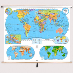
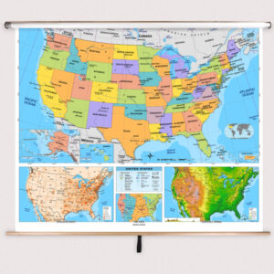
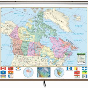
Elementary classroom pull down maps are educational wall maps mounted on spring rollers and designed for early learners in grades K–5. These maps feature simplified labeling, bold colors, and intuitive layouts to make it easy for young students to understand geographic concepts. Mounted above whiteboards or chalkboards, they can be pulled down during lessons and retracted for storage. Built for frequent classroom use, these maps provide visual support for geography, history, and social studies instruction, helping students develop foundational spatial awareness and global understanding.
Elementary classroom pull down maps are educational wall maps mounted on spring rollers and designed for early learners in grades K–5. These maps feature simplified labeling, bold colors, and intuitive layouts to make it easy for young students to understand geographic concepts. Mounted above whiteboards or chalkboards, they can be pulled down during lessons and retracted for storage. Built for frequent classroom use, these maps provide visual support for geography, history, and social studies instruction, helping students develop foundational spatial awareness and global understanding.
What Are the Different Types of Elementary Maps?
We offer a variety of elementary-level maps to meet different teaching needs. Popular subcategories include Elementary Combo Maps that combine multiple maps on one roller, Elementary World Maps for global geography lessons, Elementary Continent Maps that focus on specific regions, Elementary U.S. Maps for American geography, and Elementary Country Maps for individual nations. Each category is designed with simplified labeling, bold colors, and age-appropriate detail to make geography engaging and accessible for young learners.
We offer a variety of elementary-level maps to meet different teaching needs. Popular subcategories include Elementary Combo Maps that combine multiple maps on one roller, Elementary World Maps for global geography lessons, Elementary Continent Maps that focus on specific regions, Elementary U.S. Maps for American geography, and Elementary Country Maps for individual nations. Each category is designed with simplified labeling, bold colors, and age-appropriate detail to make geography engaging and accessible for young learners.
What Are the Benefits of Using Maps in Elementary Classrooms?
Maps provide significant benefits in elementary education by helping young students visualize locations, understand spatial relationships, and make connections between events and places. Using pull down maps encourages curiosity and supports interactive learning, allowing teachers to highlight areas, trace routes, and guide discussions. Early exposure to maps builds geographic literacy, critical thinking, and cultural awareness, which are essential skills for future learning in history and social studies. Elementary pull down maps also make it easier for teachers to manage lessons, transitioning quickly between topics without multiple installations.
Maps provide significant benefits in elementary education by helping young students visualize locations, understand spatial relationships, and make connections between events and places. Using pull down maps encourages curiosity and supports interactive learning, allowing teachers to highlight areas, trace routes, and guide discussions. Early exposure to maps builds geographic literacy, critical thinking, and cultural awareness, which are essential skills for future learning in history and social studies. Elementary pull down maps also make it easier for teachers to manage lessons, transitioning quickly between topics without multiple installations.
Are Elementary Maps Good for Classrooms, Offices, and Homes?
Yes. While specifically designed for elementary classrooms, these maps are also ideal for home education and early learning centers. Families can use them to teach children about countries, states, and continents while tracking family travels. Offices that focus on education or child services also display these maps to create engaging, kid-friendly environments. Laminated for durability, elementary maps are easy to clean and built to withstand frequent handling, making them perfect for any setting where young learners are present.
Yes. While specifically designed for elementary classrooms, these maps are also ideal for home education and early learning centers. Families can use them to teach children about countries, states, and continents while tracking family travels. Offices that focus on education or child services also display these maps to create engaging, kid-friendly environments. Laminated for durability, elementary maps are easy to clean and built to withstand frequent handling, making them perfect for any setting where young learners are present.
What Grade Levels Are Elementary Maps Designed For?
Elementary pull down maps are tailored for grades K–5, with design features that make geographic learning accessible to younger students. These maps simplify political and physical information, using bold colors, larger fonts, and intuitive layouts. For middle and high school classrooms, we offer more detailed maps with advanced data. This ensures that each map aligns with the cognitive level and curriculum standards of the intended age group.
Elementary pull down maps are tailored for grades K–5, with design features that make geographic learning accessible to younger students. These maps simplify political and physical information, using bold colors, larger fonts, and intuitive layouts. For middle and high school classrooms, we offer more detailed maps with advanced data. This ensures that each map aligns with the cognitive level and curriculum standards of the intended age group.
How Do I Decorate with Elementary Maps?
Elementary maps can brighten and enrich a classroom’s appearance. When retracted, they stay neatly stored above the board, preserving wall space. When pulled down, they add vibrant visuals that attract student attention and spark curiosity. At home, these maps can be framed or mounted in playrooms or study areas, serving as both décor and an educational tool. The colorful design makes them a fun and engaging addition to any learning environment.
Elementary maps can brighten and enrich a classroom’s appearance. When retracted, they stay neatly stored above the board, preserving wall space. When pulled down, they add vibrant visuals that attract student attention and spark curiosity. At home, these maps can be framed or mounted in playrooms or study areas, serving as both décor and an educational tool. The colorful design makes them a fun and engaging addition to any learning environment.
Can I Create a Custom Elementary Map for My Classroom?
Yes. We can design custom spring roller maps specifically for elementary classrooms. You can combine different maps—such as U.S., world, and state maps—onto a single roller for comprehensive coverage. Custom options include branded district maps, simplified regional content for younger audiences, and private-label designs. Each custom map is assembled in-house using high-quality materials to ensure durability and clarity. Learn more about custom options at this page.
Yes. We can design custom spring roller maps specifically for elementary classrooms. You can combine different maps—such as U.S., world, and state maps—onto a single roller for comprehensive coverage. Custom options include branded district maps, simplified regional content for younger audiences, and private-label designs. Each custom map is assembled in-house using high-quality materials to ensure durability and clarity. Learn more about custom options at this page.
How Do I Install Elementary Pull Down Maps?
Installation is straightforward. Elementary spring roller maps are designed for mounting above whiteboards or flat walls with options for wall or ceiling installation. Orders with backboards come pre-attached and ready to hang. Following the correct installation steps ensures a secure, long-lasting setup. Full installation instructions are available at this link.
Installation is straightforward. Elementary spring roller maps are designed for mounting above whiteboards or flat walls with options for wall or ceiling installation. Orders with backboards come pre-attached and ready to hang. Following the correct installation steps ensures a secure, long-lasting setup. Full installation instructions are available at this link.
Do You Sell Mounting Hardware for Elementary Maps?
Yes, we offer all the hardware needed to securely install elementary pull down maps. This includes brackets, backboards, and other accessories that ensure stable mounting. Each order includes backboards and wall brackets, but screws and anchors should be selected based on wall material. Browse mounting hardware options at this page.
Yes, we offer all the hardware needed to securely install elementary pull down maps. This includes brackets, backboards, and other accessories that ensure stable mounting. Each order includes backboards and wall brackets, but screws and anchors should be selected based on wall material. Browse mounting hardware options at this page.
What Materials Are Used for Elementary Maps?
Each elementary map is printed on heavyweight paper, laminated for a markable, easy-to-clean surface, and mounted on a durable spring roller. The laminated finish works with both dry-erase and wet-erase markers, allowing teachers to write on and wipe off notes easily. Backboards are made of powder-coated steel for strength and longevity, ensuring these maps can handle frequent classroom use. Multi-map sets are carefully assembled for smooth, reliable operation.
Each elementary map is printed on heavyweight paper, laminated for a markable, easy-to-clean surface, and mounted on a durable spring roller. The laminated finish works with both dry-erase and wet-erase markers, allowing teachers to write on and wipe off notes easily. Backboards are made of powder-coated steel for strength and longevity, ensuring these maps can handle frequent classroom use. Multi-map sets are carefully assembled for smooth, reliable operation.
What Do Maps Teach Elementary Students?
Maps help young students understand the world around them by teaching basic geographic concepts, spatial reasoning, and global awareness. They support lessons on landforms, climates, countries, and regions while helping students grasp ideas like distance and direction. Pull down maps make it easy for teachers to illustrate these concepts visually, reinforcing learning through interactive instruction and engaging discussions.
Maps help young students understand the world around them by teaching basic geographic concepts, spatial reasoning, and global awareness. They support lessons on landforms, climates, countries, and regions while helping students grasp ideas like distance and direction. Pull down maps make it easy for teachers to illustrate these concepts visually, reinforcing learning through interactive instruction and engaging discussions.
What Are the Available Sizes of Elementary Maps?
Elementary map sizes vary depending on the type of map and its intended classroom use. Large-format maps are perfect for group instruction, while smaller sets suit more compact learning spaces. Exact dimensions for each map are listed on individual product pages within the Elementary Classroom Maps category.
Elementary map sizes vary depending on the type of map and its intended classroom use. Large-format maps are perfect for group instruction, while smaller sets suit more compact learning spaces. Exact dimensions for each map are listed on individual product pages within the Elementary Classroom Maps category.
What is BrightWay Educational?
BrightWay Educational is our exclusive line of classroom maps, including elementary-level designs, created for maximum clarity and accuracy. These maps are updated regularly with the latest geographic and political information. Featuring enhanced labeling, vibrant colors, and simplified details suitable for young learners, BrightWay maps are a leading choice for elementary educators. Learn more about BrightWay Educational maps here.
BrightWay Educational is our exclusive line of classroom maps, including elementary-level designs, created for maximum clarity and accuracy. These maps are updated regularly with the latest geographic and political information. Featuring enhanced labeling, vibrant colors, and simplified details suitable for young learners, BrightWay maps are a leading choice for elementary educators. Learn more about BrightWay Educational maps here.
Why Choose The Map Shop for Elementary Maps?
Since 1990, The Map Shop has been a trusted provider of high-quality educational maps to schools across the United States. Each elementary map is hand-finished in our Charlotte, NC facility using premium materials and professional techniques. Our commitment to accuracy and durability ensures that educators receive reliable, long-lasting maps that make a real impact in the classroom. Read customer reviews here or learn more about our history here.
Since 1990, The Map Shop has been a trusted provider of high-quality educational maps to schools across the United States. Each elementary map is hand-finished in our Charlotte, NC facility using premium materials and professional techniques. Our commitment to accuracy and durability ensures that educators receive reliable, long-lasting maps that make a real impact in the classroom. Read customer reviews here or learn more about our history here.


