
What Are Middle School Classroom Maps?
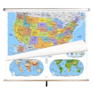
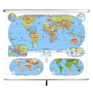
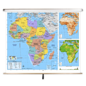
Middle school classroom maps are educational wall maps mounted on spring rollers, tailored for students in grades 6–8. These maps provide more detail than elementary-level maps, featuring political boundaries, physical landforms, and thematic content designed to support middle school geography and social studies curricula. Built for frequent classroom use, these maps help students develop stronger spatial reasoning skills and a deeper understanding of global and national geography.
Middle school classroom maps are educational wall maps mounted on spring rollers, tailored for students in grades 6–8. These maps provide more detail than elementary-level maps, featuring political boundaries, physical landforms, and thematic content designed to support middle school geography and social studies curricula. Built for frequent classroom use, these maps help students develop stronger spatial reasoning skills and a deeper understanding of global and national geography.
What Are the Different Types of Middle School Maps?
Our Middle School Classroom Maps category includes several subcategories to meet different teaching needs. Browse Middle School Combo Maps that combine multiple maps on a single roller, Middle School World Maps for teaching global geography, Middle School Continent Maps for focused regional instruction, Middle School U.S. Maps for American geography, and Middle School Country Maps for detailed views of individual nations. Each subcategory is designed to match middle school learning standards and classroom needs.
Our Middle School Classroom Maps category includes several subcategories to meet different teaching needs. Browse Middle School Combo Maps that combine multiple maps on a single roller, Middle School World Maps for teaching global geography, Middle School Continent Maps for focused regional instruction, Middle School U.S. Maps for American geography, and Middle School Country Maps for detailed views of individual nations. Each subcategory is designed to match middle school learning standards and classroom needs.
What Are the Benefits of Using Maps in Middle School Classrooms?
Maps in middle school classrooms help students understand complex geographic relationships, analyze political and physical features, and connect historical events to locations around the world. Teachers can guide interactive lessons using laminated, markable surfaces to highlight routes, regions, and thematic data. These maps enhance engagement and support critical thinking skills essential for advanced geography and social studies education.
Maps in middle school classrooms help students understand complex geographic relationships, analyze political and physical features, and connect historical events to locations around the world. Teachers can guide interactive lessons using laminated, markable surfaces to highlight routes, regions, and thematic data. These maps enhance engagement and support critical thinking skills essential for advanced geography and social studies education.
Are Middle School Maps Good for Classrooms, Offices, and Homes?
Yes. While these maps are designed for classroom use, they are also suitable for homeschooling environments, tutoring centers, and educational offices. Families and educators can use them to teach students about world and U.S. geography in a visual, hands-on way. Laminated for durability and easy cleaning, these maps are built to withstand regular use in high-traffic learning spaces.
Yes. While these maps are designed for classroom use, they are also suitable for homeschooling environments, tutoring centers, and educational offices. Families and educators can use them to teach students about world and U.S. geography in a visual, hands-on way. Laminated for durability and easy cleaning, these maps are built to withstand regular use in high-traffic learning spaces.
What Grade Levels Are Middle School Maps Designed For?
Middle School Classroom Maps are specifically designed for grades 6–8, offering more detailed geographic information than elementary-level maps. These maps bridge the gap between simplified elementary maps and advanced high school maps, preparing students for higher-level geography, history, and civics courses.
Middle School Classroom Maps are specifically designed for grades 6–8, offering more detailed geographic information than elementary-level maps. These maps bridge the gap between simplified elementary maps and advanced high school maps, preparing students for higher-level geography, history, and civics courses.
How Do I Decorate with Middle School Maps?
Middle school maps can enrich classroom spaces with detailed visuals that support engaging lessons. When stored, they retract neatly above whiteboards or chalkboards, saving space. When displayed, they create an educational focal point that sparks curiosity and discussion. At home, these maps can be mounted in study areas to support at-home learning while adding informative décor.
Middle school maps can enrich classroom spaces with detailed visuals that support engaging lessons. When stored, they retract neatly above whiteboards or chalkboards, saving space. When displayed, they create an educational focal point that sparks curiosity and discussion. At home, these maps can be mounted in study areas to support at-home learning while adding informative décor.
Can I Create a Custom Middle School Map for My Classroom?
Yes. We can design custom spring roller maps for middle school classrooms. You can combine U.S., world, and regional maps on a single roller or create district-specific maps tailored to your curriculum. Each custom map is produced with premium materials to ensure long-lasting classroom use. Learn more about custom solutions at this page.
Yes. We can design custom spring roller maps for middle school classrooms. You can combine U.S., world, and regional maps on a single roller or create district-specific maps tailored to your curriculum. Each custom map is produced with premium materials to ensure long-lasting classroom use. Learn more about custom solutions at this page.
How Do I Install Middle School Maps?
Installing middle school maps is straightforward. They are designed to mount above whiteboards or on flat walls with wall or ceiling installation options available. Orders with backboards come pre-attached for easy setup. Proper installation ensures secure mounting and smooth spring roller operation. Full instructions are provided at this link.
Installing middle school maps is straightforward. They are designed to mount above whiteboards or on flat walls with wall or ceiling installation options available. Orders with backboards come pre-attached for easy setup. Proper installation ensures secure mounting and smooth spring roller operation. Full instructions are provided at this link.
Do You Sell Mounting Hardware for Middle School Maps?
Yes. We offer brackets, backboards, and other hardware needed for installing middle school pull-down maps. Each map order includes backboards and wall brackets, but screws and anchors must be selected based on the wall type. Browse mounting hardware options at this page.
Yes. We offer brackets, backboards, and other hardware needed for installing middle school pull-down maps. Each map order includes backboards and wall brackets, but screws and anchors must be selected based on the wall type. Browse mounting hardware options at this page.
What Materials Are Used for Middle School Maps?
Each middle school map is printed on heavyweight paper and laminated to provide a markable, easy-to-clean surface. The laminated finish is compatible with dry-erase and wet-erase markers for interactive instruction. Powder-coated steel backboards ensure stability and durability, making these maps reliable tools for daily classroom use.
Each middle school map is printed on heavyweight paper and laminated to provide a markable, easy-to-clean surface. The laminated finish is compatible with dry-erase and wet-erase markers for interactive instruction. Powder-coated steel backboards ensure stability and durability, making these maps reliable tools for daily classroom use.
What Do Maps Teach Middle School Students?
Maps help middle school students understand political boundaries, physical geography, and the connections between history, culture, and the environment. Teachers can use these maps to illustrate migration patterns, trade routes, and geopolitical changes, fostering analytical skills and deeper geographic awareness.
Maps help middle school students understand political boundaries, physical geography, and the connections between history, culture, and the environment. Teachers can use these maps to illustrate migration patterns, trade routes, and geopolitical changes, fostering analytical skills and deeper geographic awareness.
What Are the Available Sizes of Middle School Maps?
Middle School Classroom Maps are available in different sizes to suit various classroom layouts. Larger maps are ideal for group instruction, while smaller formats work well for compact classrooms. Exact dimensions are listed on individual product pages within each subcategory.
Middle School Classroom Maps are available in different sizes to suit various classroom layouts. Larger maps are ideal for group instruction, while smaller formats work well for compact classrooms. Exact dimensions are listed on individual product pages within each subcategory.
What is BrightWay Educational?
BrightWay Educational is our exclusive brand of classroom maps, including many middle school-level designs. Updated frequently to reflect the latest geographic and political information, BrightWay maps feature detailed labeling, accurate cartography, and vibrant colors tailored for grades 6–8. Learn more about BrightWay Educational maps here.
BrightWay Educational is our exclusive brand of classroom maps, including many middle school-level designs. Updated frequently to reflect the latest geographic and political information, BrightWay maps feature detailed labeling, accurate cartography, and vibrant colors tailored for grades 6–8. Learn more about BrightWay Educational maps here.
Why Choose The Map Shop for Middle School Maps?
For over 30 years, The Map Shop has been providing high-quality educational maps to schools across the country. Each middle school map is hand-finished in our Charlotte, NC facility using premium materials and expert assembly techniques. Our maps are built for accuracy, durability, and engaging instruction. Read customer reviews here or learn more about our history here.
For over 30 years, The Map Shop has been providing high-quality educational maps to schools across the country. Each middle school map is hand-finished in our Charlotte, NC facility using premium materials and expert assembly techniques. Our maps are built for accuracy, durability, and engaging instruction. Read customer reviews here or learn more about our history here.