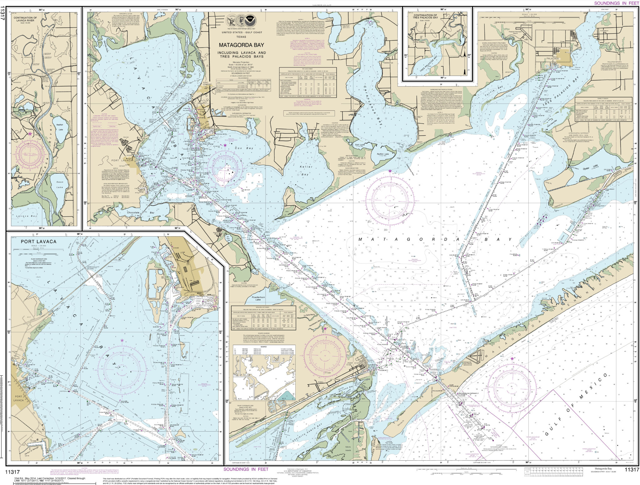
NOAA Chart – Matagorda Bay including Lavaca and Tres Palacios Bays; Port Lavaca; Continuation of Lavaca River; Continuation of Tres Palacios Bay – 11317
$29.99 – $449.99
Final Edition: 2022
Printed By: MapShop
**This chart has been canceled by NOAA and is no longer being updated. This chart is not intended for navigation; for decorative use only**
Print-on-Demand Series
This product is printed on demand using our large format inkjet printers. Print-on-demand maps are always in stock and you can order as many as you need all at once to have them ship together!
Returns
We offer free returns within 30 days for this product*. Contact us within 30 days of receiving your product to receive a return authorization number, which you can write on the box and ship back to us. We will issue your return within three days of receiving the product back.
We do not refund the initial shipping charges and you’re responsible for shipping charges to get the product back to us unless we made a mistake in the order.
*Finishes such as Foam Core with Rails & Framed are also not returnable as they went through production on a by-order basis by our team. If you have any questions on if your order qualifies for a return, please CONTACT US.
Up to Date
All the NOAA Charts are the most up-to-date ones that are currently available through NOAA. Some charts are updated weekly from NOAA so we update our print files as soon as we can to make sure you are getting the most informed chart for your nautical adventure! If the chart has been canceled, we offer the final updated version from NOAA as a decorative option.
Decoration or Practical
Part of being an NOAA Certified printer means that we are able to include an NOAA seal on our charts. This means that we are able to say they are approved and ready to be used on the open waters! However not everyone needs that seal to be included, so we can leave it off if you need. Just click the checkbox above “For Decoration” and we will leave off the NOAA seal and the Mapshop logo from your NOAA Chart.
What Is A Nautical Chart?
A nautical chart is one of the most fundamental tools available to the mariner. It is a map that depicts the configuration of the shoreline and seafloor. It provides water depths, locations of dangers to navigation, locations and characteristics of aids to navigation, anchorages, and other features. The nautical chart is essential for safe navigation. Mariners use charts to plan voyages and navigate ships safely and economically. Federal regulations require most commercial vessels to carry nautical charts while they transit U.S. waters. Since the mid-1830s, the U.S. Coast Survey (a NOAA predecessor agency) has been the nation’s nautical chartmaker. NOAA’s Office of Coast Survey is still responsible for creating and maintaining all charts of U.S. coastal waters, the Great Lakes, and waters surrounding U.S. territories.
Finishing Options
Most wall maps are offered in a variety of finishing options. If you need a map that’s ready to hang on the wall, we can frame or add rails your map to save you time and money. Here are the details, contact us with questions.
PAPER
Paper finishing is the most economical option. Most maps are printed on premium 36lb paper. Waterproof paper is also available for functional maps that may be used outdoors.
LAMINATED
Maps are printed then run through our laminator that secures 1.7mil-thick satin-gloss-finished lamination on the front and back. Use map stickers and wet-erase markers.
MOUNTED
Maps are printed then laminated with 1.7mil-thick satin lamination onto 1/4″-thick foamcore. You can use map pins, stickers, or wet-erase markers with our mounted maps.
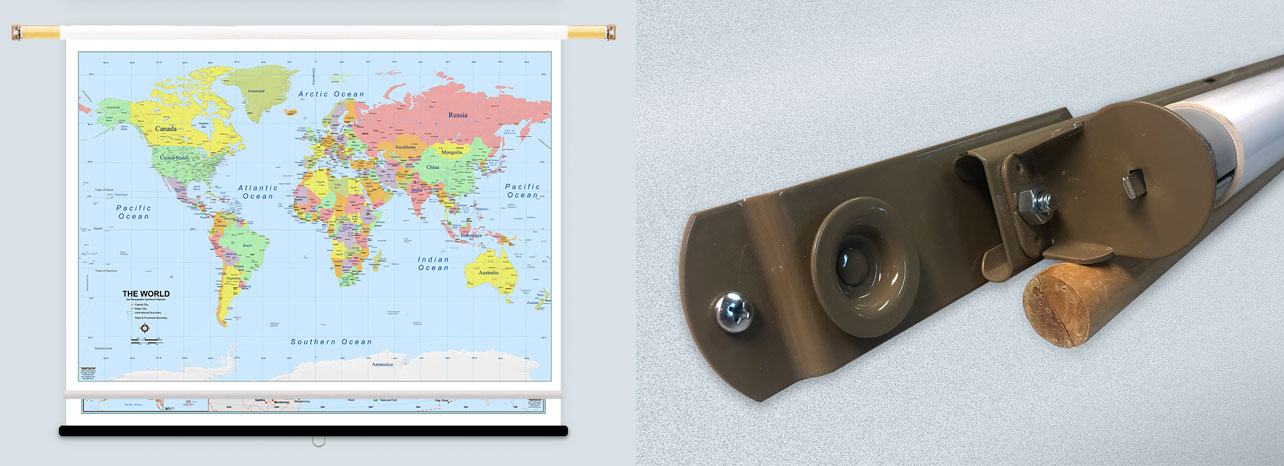
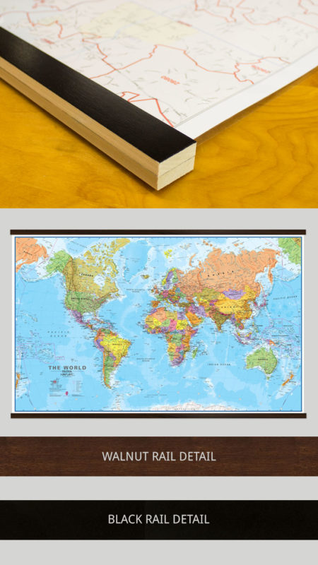
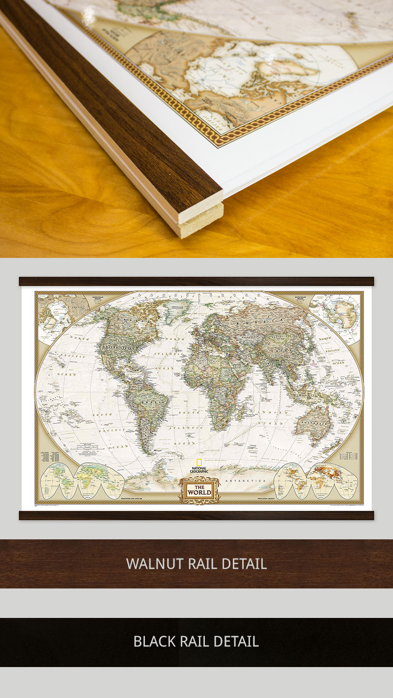
LAMINATED WITH RAILS
First, we laminate the map then we mount wood rails at the top and bottom of the map. The front side of each rail is finished with a black or walnut finish while the sides and back are unfinished wood.
Sawtooth hardware is fixed to the back of the top rail, so it’s ready to hang. Use stickers or wet-erase markers on your map.
MOUNTED WITH RAILS
First, we laminate the map onto foam core then we mount wood rails at the top and bottom of the map. The front side of each rail is finished with a black or walnut finish while the sides and back are unfinished wood.
Sawtooth hardware is fixed to the back of the top rail. Use map pins, stickers, or wet-erase markers on your maps.
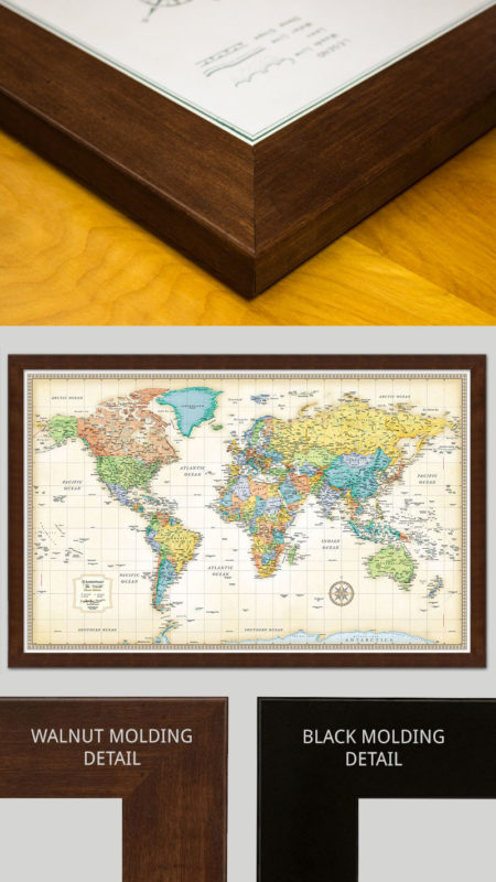
FRAMED
Maps are laminated onto foam core then secured into the frame. The engineered molding is made from recycled wood in either a black or walnut-finish that wraps around the whole frame to the back.
Sawtooth hardware is fixed to the back of the top. You can use map pins, stickers, or wet-erase markers on all our framed maps.